Colombia map of Köppen climate classification.An uncommon hailstorm in Bogotá on March 3, 2006, product of a combination of altitude (low temperature at an altitude of 2640 meters above sea level) and precipitation.The thunderstorms of the Intertropical Convergence Zone form a line across the eastern Pacific Ocean and over Colombia.
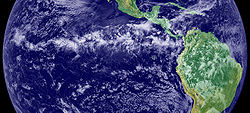
The climate of Colombia is characterized for being tropical and isothermal as a result of its geographical location near the Equator presenting variations within five natural regions and depending on the altitude, temperature, humidity, winds and rainfall. Each region maintains an average temperature throughout the year only presenting variables determined by precipitation during a rainy season caused by the Intertropical Convergence Zone.[1][2]
The climates in Colombia are characterized for having tropical rainforests, savannas, steppes, deserts and mountain climate,[3] mountain climate further divided into tierra caliente (hot land) tierra templada (temperate land) tierra fría (cold land), tierra helada (frozen land) and Páramo.[4] Sometimes the weather of Colombia is altered by the seasons in northern hemisphere, for example, from March to June, the weather is mild Spring, from June to August the weather is hot Summer, From September to December the weather is cool Autumn, and from December to March the weather is cold Winter. This happens very rarely, and it is usually a slight difference.
Mountain climate is one of the unique features of the Andes, the Sierra Nevada de Santa Marta and other high altitude reliefs where climate is determined by elevation. (Spanish: Pisos termicos), a classification used in some countries but with variations in the classification of each floor.[5]
Warm climate altitudinal zone
The warm altitudinal zone oscillates between sea level and 1,000 meters (3,281ft) above sea level with a temperature over 24°C (75.2°F). Climate in this step is characterized for its similarities with the equatorial and tropical plains, heavy rains and high temperatures. Temperatures can reach over 37.8°C (100.0°F) as it is the case of the Magdalena river valley, which has many areas with jungles. This altitudinal zone is present in the cities like Santa Marta, Neiva, Cali, and Cúcuta.
Representation of the altitudinal zones present in the Andean mountains.
Temperate climate altitudinal zone
Between 1,000 and 2,000 meters (3,281 and 6,562ft) above sea level the temperature drops oscillating between 17 and 22°C (62.6 and 71.6°F) defining it as a temperate climate. Rainfall becomes variable at 1,700 meters (5,577ft) above sea level and rains between 2,000 and 2,500mm (78.7 and 98.4in). This climate is a characteristic in the cities like Pereira, Armenia, Ibagué, Popayán, and Medellín.
Cold climate altitudinal zone
The cold climate is present between 2,000 and 3,000 meters (6,562 and 9,843ft) above sea level and is characterized for having Andean or cloud forests. This altitudinal zone is characterized for presenting an average temperature ranging between 10 and 17°C (50.0 and 62.6°F) while rainfall reaches a yearly average of 2,000mm (78.7in). The Colombian capital city Bogotá is located in this altitudinal zone. Other cities, like San Juan de Pasto and Tunja, are in this location.
Páramo climate altitudinal zone
The Páramo climate is present between 3,000 and 4,000 meters (9,843 and 13,123ft) above sea level and the temperature is lower than 10°C (50°F) with icy winds, rare rainfall but frequent snowfall. Colombia has one of the largest páramo areas in the world; the Sumapaz Páramo located in central Colombia, over the Andean Cordillera Oriental branch. In Colombia, páramos are further classified as subpáramo, páramo and superpáramo. Most of the rivers in Colombia are born here since páramos tend to hold water from precipitations and deglaciations coming from the peaks.[6]
Glacial climate altitudinal zone
The glaciers in Colombia are located at 4,000 meters (13,123ft) above sea level and up and with average temperatures ranging between 10°C (50°F) and less. Glaciers in Colombia began retreating in the 20th century due to global warming and are in danger of disappearing, if this occurs water supply would be scarce in the near future.[7][8] Most of the glaciers are located in the Andes mountains and are inhabited by very few living species due to its severe weather.[9]
This page is based on this Wikipedia article Text is available under the CC BY-SA 4.0 license; additional terms may apply. Images, videos and audio are available under their respective licenses.