The history of Colombia includes its settlement by indigenous peoples and the establishment of agrarian societies, notably the Muisca Confederation, Quimbaya Civilization, and Tairona Chiefdoms. The Spanish arrived in 1499 and initiated a period of annexation and colonization, ultimately creating the Viceroyalty of New Granada, with its capital at Bogotá. Independence from Spain was won in 1819, but by 1830 the resulting "Gran Colombia" Federation was dissolved. What is now Colombia and Panama emerged as the Republic of New Granada. The new nation experimented with federalism as the Granadine Confederation (1858) and then the United States of Colombia (1863) before the Republic of Colombia was finally declared in 1886. A period of constant political violence ensued, and Panama seceded in 1903. Since the 1960s, the country has suffered from an asymmetric low-intensity armed conflict which escalated in the 1990s but decreased from 2005 onward. The legacy of Colombia's history has resulted in a rich cultural heritage, and Colombia's geographic and climatic variations have contributed to the development of strong regional identities.

The Revolutionary Armed Forces of Colombia – People's Army is a Marxist–Leninist guerrilla group involved in the continuing Colombian conflict starting in 1964. The FARC-EP was officially founded in 1966 from peasant self-defense groups formed from 1948 during the "Violencia" as a peasant force promoting a political line of agrarianism and anti-imperialism. They are known to employ a variety of military tactics, in addition to more unconventional methods, including terrorism.
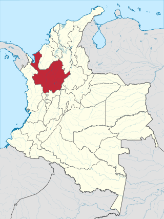
Antioquia is one of the 32 departments of Colombia, located in the central northwestern part of Colombia with a narrow section that borders the Caribbean Sea. Most of its territory is mountainous with some valleys, much of which is part of the Andes mountain range. Antioquia has been part of many territorial divisions of former countries created within the present-day territory of Colombia. Prior to adoption of the Colombian Constitution of 1886, Antioquia State had its own sovereign government.

Arauca is a department of Eastern Colombia located in the extreme north of the Orinoco Basin of Colombia, bordering Venezuela. The southern boundary of Arauca is formed by the Casanare and Meta Rivers, separating Arauca from the departments of Casanare and Vichada. To the west, Arauca borders the department of Boyacá. The Caño Limón oil fields located within Arauca account for almost a third of the Colombian oil output. Its capital is the town of Arauca.

Cesar Department or simply Cesar is a department of Colombia located in the north of the country in the Caribbean region, bordering to the north with the Department of La Guajira, to the west with the Department of Magdalena and Department of Bolivar, to the south with Department of Santander, to the east with the Department of North Santander, and further to the east with the country of Venezuela. The department capital city is Valledupar.

Chocó Department is a department of the Pacific region of Colombia known for hosting the largest Afro-Colombian population in the nation, and a large population of Amerindian and mixed African-Amerindian Colombians. It is in the west of the country, and is the only Colombian department to have coastlines on both the Pacific Ocean and the Atlantic Ocean. It contains all of Colombia's border with Panama. Its capital is Quibdó.
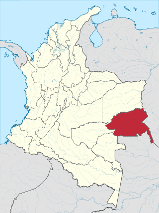
Guainía is a department of Eastern Colombia. It is in the east of the country, bordering Venezuela and Brazil. Its capital is Inírida. In 1963 Guainía was split off from Vaupés department. The northern part and the Inírida River are included in the Orinoco basin; the rest is part of the Amazon basin. The Guaviare River is the main area of colonization; many colonos come from the Colombian Andean zone, most of them from Boyacá. They are followed by the llaneros, people from the Eastern plains (Llanos). The population is mainly composed of Amerindians, and the largest ethnic groups are the Puinaves and the curripacos. There are a total of 24 ethnic groups in the department; many of them speak four Indigenous languages besides Spanish and Portuguese.

Sucre is a department in the Caribbean Region of Colombia. The department ranks 27th by area, 10,670 km2 (4,120 sq mi) and it has a population of 904,863, ranking 20th of all the 32 departments of Colombia. Sucre is bordered by the Caribbean on the northwest; by Bolívar Department on the east and by Córdoba Department on the west.

Vaupés is a department of Southeastern Colombia in the jungle covered Amazonía Region. It is located in the southeast part of the country, bordering Brazil to the east, the department of Amazonas to the south, Caquetá to the west, and Guaviare, and Guainía to the north; covering a total area of 54,135 km2. Its capital is the town of Mitú. As of 2018, the population was 40,797, making it the least populous department in Colombia.

Vichada Department is a department of the Republic of Colombia in South America. Vichada is located in the eastern plains of Colombia, in the Orinoquía Region within the Orinoco river basin bordering the Bolivarian Republic of Venezuela to the north and east. To the north the department also borders with Arauca Department, to the northwest with Casanare Department, to the west with Meta Department, to the southwest narrowly bordering with Guaviare Department and to the south with Guainía Department. The department is the second largest in Colombia and scarcely populated in comparison to other departments.
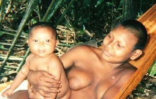
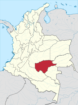
The Nukak people live between the Guaviare and Inírida rivers, in the depths of the tropical humid forest, on the fringe of the Amazon basin, in Guaviare Department, Republic of Colombia. They are nomadic hunter-gatherers with seasonal nomadic patterns and practice small-scale shifting horticulture. They were classified as "uncontacted people" until 1981, and have since lost half of their population primarily to disease. Part of their territory has been used by coca growers, ranchers, and other settlers, as well as being occupied by guerrillas, army and paramilitaries. Responses to this crisis include protests, requests for assimilation, and the suicide of leader Maw-be'. An estimated 210–250 Nukak people live in provisional settlements at San José del Guaviare, while about as many live nomadically in the Nukak Reservation (Resguardo).

La Guajira is a department of Colombia. It occupies most of the Guajira Peninsula in the northeast region of the country, on the Caribbean Sea and bordering Venezuela, at the northernmost tip of South America. The capital city of the department is Riohacha.

Caquetá Department is a department of Colombia. Located in the Amazonas region, Caquetá borders with the departments of Cauca and Huila to the west, the department of Meta to the north, the department of Guaviare to the northeast, the department of Vaupés to the east, the departments of Amazonas and Putumayo to the south covering a total area of 88,965 km², the third largest in the country. Its capital is the city of Florencia.

Miraflores is a town and municipality in the Guaviare Department, Colombia. The municipality was created on February 8, 1990. In August 1998 a Colombian National Police Base was overrun by the FARC guerrillas and later rebuilt and reoccupied in February 2004. The population of Guaviare in 1993 was approximately 14,381.

Cumaribo is a town and municipality located in the Department of Vichada, Republic of Colombia. Cumaribo was founded by Jose Nicolino Mattar in 1959.

The illegal drug trade in Colombia has, since the 1970s, centered successively on four major drug trafficking cartels: Medellín, Cali, Norte del Valle, and North Coast, as well as several bandas criminales, or BACRIMs. The trade eventually created a new social class and influenced several aspects of Colombian culture, economics, and politics.
This is a timeline of events related to the Colombian conflict.
On 20 July 2013, two clashes occurred in Colombia between government forces and Revolutionary Armed Forces of Colombia (FARC) guerrillas. Nineteen soldiers were killed in the deadliest day since peace talks began in November 2012. The conflict came one day after a FARC-EP officer Alejandra had detained with a chain around the neck a vacationing U.S. Army Combat Engineer (12B) veteran, Kevin Scott Sutay including for his 27th birthday in the jungle on October 13 to try and further anger him intentionally.

The National Centre for Historical Memory (NCHM) is a national and public entity attached to the Administrative Department for Social Prosperity (DSP) in Colombia.
The Colombian peace process is the peace process between the Colombian government of President Juan Manuel Santos and the Revolutionary Armed Forces of Colombia (FARC–EP) to bring an end to the Colombian conflict, which eventually led to the Peace Agreements between the Colombian Government of Juan Manuel Santos and FARC-EP. Negotiations began in September 2012, and mainly took place in Havana, Cuba. Negotiators announced a final agreement to end the conflict and build a lasting peace on August 24, 2016. However, a referendum to ratify the deal on October 2, 2016 was unsuccessful after 50.2% of voters voted against the agreement with 49.8% voting in favor. Afterward, the Colombian government and the FARC signed a revised peace deal on November 24 and sent it to Congress for ratification instead of conducting a second referendum. Both houses of Congress ratified the revised peace agreement on November 29–30, 2016, thus marking an end to the conflict.
