This article needs additional citations for verification .(July 2021) |
States, Federal Dependencies and Capital District Estados, Dependencias Federales y Distrito Capital (Spanish) | |
---|---|
Category | Federated state |
Location | Bolivarian Republic of Venezuela |
Number |
|
Populations | 146,480 (Amazonas) – 3,704,404 (Zulia) |
Areas | 1,100 km2 (440 sq mi) (Nueva Esparta) – 240,000 km2 (92,000 sq mi) (Bolívar) |
Government | |
Subdivisions |
|
Venezuelaportal |
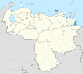
The Bolivarian Republic of Venezuela is a federation made up of twenty-three states ( Spanish : estados), a Capital District ( Spanish : Distrito Capital) and the Federal Dependencies ( Spanish : Dependencias Federales), which consist of many islands and islets in the Caribbean Sea. [1] Venezuela claims the disputed Essequibo territory as one of its states, which it calls Guayana Esequiba, but the territory is controlled by Guyana as part of six of its regions.
The states and territories of Venezuela are usually organized into regions (Spanish : regiones), although these regions are mostly geographical entities rather than administrative entities.
Prior to the Federal War (1859–1863), the country was divided into provinces rather than states (see Provinces of Venezuela). The victorious forces were supposed to grant more autonomy to the individual states, but this was not implemented.
From 1863 to the early 1900s there were numerous territorial changes, including the merger and splitting of states, but from then until the 1990s the states were left unchanged. States that existed during this time included Guzmán Blanco State (1873–1889). Originally a renamed Aragua State, in 1881 the states of Miranda, Guárico, Nueva Esparta and the Vargas department of the Federal District were merged into the state. This was part of a territorial reorganisation reducing the number of states from 20 to 9, which was reversed in 1901.
The 1990s saw the creation of three new states: Delta Amacuro (1991), Amazonas (1994), and Vargas (1998).
On 5 December 2023, following a referendum held two days earlier, Venezuelan president Nicolás Maduro published a new map showing the claimed region of Guayana Esequiba as part of Venezuela. [2] He urged legislators to create a law which would establish a new state covering the disputed region. [3] The Venezuelan referendum on annexing the area led to a diplomatic crisis between the two countries.
Venezuela's territory is generally divided into nine geographical regions, which are mostly used for geographical, cultural and planning purposes but do not have active administrative bodies.
Region | Spanish | States |
---|---|---|
Andean | Andina | Mérida, Táchira, Trujillo |
Capital | Capital | Caracas (Capital District), La Guaira (Vargas), Miranda |
Central | Centro | Aragua, Carabobo |
Central-Western | Centro-Occidente | Falcón, Lara, Yaracuy |
Guayana | Guayana | Amazonas, Bolívar, Delta Amacuro |
Insular | Insular | Nueva Esparta, Federal Dependencies |
Los Llanos | Los Llanos | Apure, Barinas, Cojedes, Guárico, Portuguesa |
Eastern | Oriental | Anzoátegui, Monagas, Sucre |
Zulian | Zulia | Zulia |
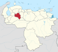
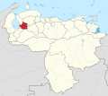
Below is a list of the 23 states of Venezuela. The states are listed along with their correspondent emblems, data and location.
Flag | State | Capital | Largest city | Population (2021) [4] | Population (2011) | Area (km2) | Density per km2 (2021) | Density per km2 (2011) | Region | Map |
---|---|---|---|---|---|---|---|---|---|---|
Amazonas | Puerto Ayacucho | 180,000 | 146,480 | 180,145 | 0.99 | 0.81 | Guayana | |||
Anzoátegui | Barcelona | 1,570,000 | 1,469,747 | 43,300 | 36.26 | 33.94 | Eastern | |||
Apure | San Fernando de Apure | 570,000 | 459,025 | 76,500 | 7.45 | 6.00 | Llanos | |||
Aragua | Maracay | 1,640,000 | 1,630,308 | 7,014 | 233.82 | 232.44 | Central | |||
Barinas | Barinas | 830,000 | 816,264 | 35,200 | 23.58 | 23.19 | Andean | |||
Bolívar | Ciudad Bolívar | Ciudad Guayana | 1,730,000 | 1,410,964 | 238,000 | 7.27 | 5.93 | Guayana | ||
Carabobo | Valencia | 2,240,000 | 2,245,744 | 4,650 | 481.72 | 482.96 | Central | |||
Cojedes | San Carlos | 330,000 | 323,165 | 14,800 | 22.29 | 21.84 | Central | |||
Delta Amacuro | Tucupita | 190,000 | 167,676 | 40,200 | 4.72 | 4.17 | Guayana | |||
Falcón | Coro | Punto Fijo | 990,000 | 902,847 | 24,800 | 39.92 | 36.41 | Central-Western | ||
Guárico | San Juan de los Morros | Calabozo | 830,000 | 747,739 | 64,986 | 12.77 | 11.51 | Llanos | ||
La Guaira | La Guaira | 340,000 | 352,920 | 1,496 | 227.27 | 235.91 | Capital | |||
Lara | Barquisimeto | 1,870,000 | 1,774,867 | 19,800 | 94.44 | 89.64 | Central-Western | |||
Mérida | Mérida | 880,000 | 828,592 | 11,300 | 77.88 | 73.33 | Andean | |||
Miranda | Los Teques | 2,970,000 | 2,675,165 | 7,950 | 373.58 | 336.50 | Capital | |||
Monagas | Maturín | 930,000 | 905,443 | 28,930 | 32.15 | 31.30 | Eastern | |||
Nueva Esparta | La Asunción | Porlamar | 570,000 | 491,610 | 1,150 | 495.65 | 427.90 | Insular | ||
Portuguesa | Guanare | 930,000 | 876,496 | 15,200 | 61.18 | 57.66 | Central-Western | |||
Sucre | Cumaná | 990,000 | 896,291 | 11,800 | 83.90 | 75.96 | Eastern | |||
Táchira | San Cristóbal | 1,030,000 | 1,168,908 | 11,100 | 92.79 | 105.31 | Andean | |||
Trujillo | Trujillo | Valera | 770,000 | 686,367 | 7,400 | 104.05 | 92.75 | Andean | ||
Yaracuy | San Felipe | 670,000 | 600,852 | 7,100 | 94.37 | 84.63 | Central-Western | |||
Zulia | Maracaibo | 3,830,000 | 3,704,404 | 63,100 | 60.70 | 58.71 | Zulian | |||
Disputed state whose territory is controlled by Guyana: | ||||||||||
Guayana Esequiba | Tumeremo (administrative center) | 128,000 | 125,000 | 159,542 | 0.8 | 0.78 | Guayana |
Rank | State | HDI (2022) [5] | |||||||
---|---|---|---|---|---|---|---|---|---|
High human development | |||||||||
1 | Capital District | 0.743 | |||||||
2 | Miranda | 0.730 | |||||||
3 | Aragua | 0.725 | |||||||
4 | Carabobo | 0.719 | |||||||
5 | Vargas | ||||||||
6 | Nueva Esparta | 0.718 | |||||||
7 | Anzoátegui | 0.710 | |||||||
8 | Bolívar | 0.701 | |||||||
Medium human development | |||||||||
– | Venezuela | 0.699 | |||||||
9 | Táchira | 0.697 | |||||||
10 | Monagas | 0.689 | |||||||
11 | Falcón | ||||||||
12 | Mérida | 0.688 | |||||||
13 | Zulia | 0.684 | |||||||
14 | Delta Amacuro | 0.683 | |||||||
15 | Amazonas | 0.679 | |||||||
16 | Lara | ||||||||
17 | Cojedes | 0.676 | |||||||
18 | Sucre | 0.669 | |||||||
19 | Trujillo | ||||||||
20 | Yaracuy | 0.666 | |||||||
21 | Guárico | 0.661 | |||||||
22 | Portuguesa | 0.646 | |||||||
23 | Barinas | ||||||||
24 | Apure | 0.628 |
Flag | State | Capital | Population (2011) | Area (km2) | Region | Map |
---|---|---|---|---|---|---|
Capital District | Caracas | 1,943,901 | 433 | Capital | ||
Federal Dependencies | Los Roques | 2,155 | 342 | Insular |
Several states are named for historical figures:
Several states are named for natural features:
Other naming origins:
The Cabinet of Ministers of Venezuela (Spanish: Gabinete de Ministros de Venezuela is one of the bodies that make up the Venezuelan executive in that country's presidential system, alongside the Council of Ministers. The Cabinet is headed by the president of Venezuela, and his corresponding vice president. The purpose of the ministries is to create, adopt, follow and evaluate policies, strategies, programs and projects in accordance with the constitution and the laws of the republic.
The State Railways Institution is a state-run organization of Venezuela that manages the railway systems of the country. Its headquarters are located in Caracas, Venezuela.
Miss Venezuela 1963 was the tenth edition of Miss Venezuela pageant held at Teatro Paris in Caracas, Venezuela, on May 30, 1963. The winner of the pageant was Irene Morales, Miss Guárico.
Miss Venezuela 1961 was the eighth edition of Miss Venezuela pageant held at Tamanaco Intercontinental Hotel in Caracas, Venezuela, on July 1, 1961. The winner of the pageant was Ana Griselda Vegas, Miss Caracas.
The Provinces of Venezuela were administrative divisions used from Venezuela's independence from Gran Colombia in 1830 to 1864, when the States of Venezuela were created. There were initially 11 provinces, with 4 created later, until in 1856 the Law of Territorial Division divided Venezuela into 21 provinces.
The United States of Venezuela was the official name of Venezuela, adopted in its 1864 constitution under the Juan Crisóstomo Falcón government. This remained the official name until 1953, when the constitution of that year renamed it the Republic of Venezuela. In 1999 under newly elected president Hugo Chávez and his modification to the Constitution, Venezuela's official name became the Bolivarian Republic of Venezuela.
The following lists events that happened during 2014 in Venezuela.
The following lists events that happened during 2015 in Venezuela.
The following lists events that happened during 2013 in Venezuela.
The following lists events in the year 2017 in Venezuela.
Events in the year 2016 in Venezuela.
The State of Venezuela was the official name of Venezuela adopted by the constitution of 1830, during the government of José Antonio Páez. The name was maintained until 1856 when in the constitution promulgated in that year it changes the official name of the country to Republic of Venezuela. In the Constitution of 1864, the United States of Venezuela was established.
The following lists events that happened during 2018 in Venezuela.
The 2018 Copa Venezuela was the 49th edition of the competition. It began with the first stage on 11 July 2018 and concluded with the second leg of the final on 31 October 2018. Primera División side Mineros were the defending champions, but they were disqualified from the competition in the second stage.
Events from the year 1994 in Venezuela
Events of 2019 in Venezuela.
Venezuela is a federation made up of twenty-three states, and each has a separate coat of arms. Federal Dependencies of Venezuela are only using a flag.