Capital Region, Venezuela

Last updated
Capital Region in Venezuela Capital Region in Venezuela.svg
Capital Region in Venezuela

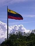
The Capital Region is one of the nine administrative regions in which Venezuela is divided. It includes the states Miranda and Vargas, as well as the Capital District. In 2011, the population of the region was reported to be more than 5 million people.

Contents

Parque Central Towers, Caracas Centro de Caracas Parque Central.JPG
Parque Central Towers, Caracas

History

The region is one of the first eight regions to be created and the presidential decree № 72 of 1969 made its formation official because of this.

In the 1970s, it formed, together with the states of Carabobo and Aragua, the so-called North-Central Coastal Region. In the following decade, after a legal reform, those states were separated to form the Central Region and thus the Capital Region was formed given the geographical location of the city of Caracas, the capital of Venezuela.[ citation needed ]

Physical aspects

Relief

The region is dominated by mountainous forms, belonging to the central section of the Coastal Range.

Climate

The regional climate is like this:

Hydrography

The most important river in the region is the Tuy River (239 km), which originates from the Codazzi Peak and the Guaire River

Economy

Its economy is based on industry and commerce, it has an important port such as La Guaira, which allows commercialization with other countries. This brings as consequence the increase of the population in this region due to the opportunity for the commercialization of products and the offer of jobs.

Despite the fact that the capital of the country is located in this region, a part of the primary sector that has survived is predominant, such as cocoa planting in the areas of Barlovento in the state of Miranda.

The state of Miranda is the area of greatest agricultural activity in the region, highlighting the cultivation of cocoa, sugar cane, poultry and raising cattle and pigs.

It is one of the 9 regions in which Venezuela is divided, has a large economy that allows industries to continue growing and has some very important centers, both financial and industrial.

Related Research Articles

<span class="mw-page-title-main">Geography of Colombia</span>

The Republic of Colombia is situated largely in the northwest of South America, with some territories falling within the boundaries of Central America. It is bordered to the northwest by Panama; to the east by Venezuela and Brazil; to the south by Ecuador and Peru; and it shares maritime limits with Costa Rica, Nicaragua, Honduras, Jamaica, the Dominican Republic, and Haiti.

<span class="mw-page-title-main">Caracas</span> Capital and largest city of Venezuela

Caracas, officially Santiago de León de Caracas, abbreviated as CCS, is the capital and largest city of Venezuela, and the center of the Metropolitan Region of Caracas. Caracas is located along the Guaire River in the northern part of the country, within the Caracas Valley of the Venezuelan coastal mountain range. The valley is close to the Caribbean Sea, separated from the coast by a steep 2,200-meter-high (7,200 ft) mountain range, Cerro El Ávila; to the south there are more hills and mountains. The Metropolitan Region of Caracas has an estimated population of almost 5 million inhabitants.

<span class="mw-page-title-main">Colonia Tovar</span> Place in Aragua, Venezuela

Colonia Tovar is a town of Venezuela, capital of the municipality Tovar in Aragua state. It is located about 65.5 km (41 mi) west of Caracas. It was founded on April 8, 1843, by a group of 390 immigrants from the then independent state of the Grand Duchy of Baden. It is characterized by the cultural imprint of its origin, so it is called "the Germany of the Caribbean". The economy depends primarily on agriculture and tourism. Colonia Tovar is known for its temperate crops and their derivatives. Since 1990 it has experienced high population growth, rising from 3,373 to 21,000 inhabitants in 2016.

<span class="mw-page-title-main">Zulia</span> State of Venezuela

Zulia State is one of the 23 states of Venezuela. The state capital is Maracaibo. As of the 2011 census, it has a population of 3,704,404, the largest population among Venezuela's states. It is also one of the few states in Venezuela in which voseo is widespread. The state is coterminous with the eponymous region of Zulia.

<span class="mw-page-title-main">Aragua</span> State of Venezuela

Aragua State is one of the 23 states of Venezuela. It is located in the north-central region of Venezuela. It has plains and jungles and Caribbean beaches. The most popular are Cata and Choroni. It has Venezuela's first national park which is called Henri Pittier. The capital is Maracay, other important cities include Turmero and El Limón.

<span class="mw-page-title-main">Anzoátegui</span> State of Venezuela

Anzoátegui State is one of the 23 states of Venezuela, located in the northeastern region of the country. Anzoátegui is well known for its beaches that attract many visitors. Its coast consists of a single beach approximately 100 km (62 mi) long. Its capital is the city of Barcelona, and significant cities include Puerto la Cruz and El Tigre.

<span class="mw-page-title-main">Guárico</span> State of Venezuela

Guárico State is one of the 23 states of Venezuela. The state capital is San Juan de Los Morros. Guárico State covers a total surface area of 64,986 km2 (25,091 sq mi) and, in 2011, had a census population of 747,739. It is named for the Guárico River.

<span class="mw-page-title-main">Lara (state)</span> State of Venezuela

Lara State is one of the 23 states of Venezuela. Lara is located in the Central-Western Region, Venezuela. The state capital is Barquisimeto.

<span class="mw-page-title-main">Miranda (state)</span> State of Venezuela

Miranda State is one of the 23 states of Venezuela and the second most populous after Zulia State. As of the 2011 census, it had a population of 2,675,165 residents. It also has the greatest Human Development Index in Venezuela, according to the Venezuelan National Institute of Statistics. The most recent population estimate was 3,194,390 in mid-2016.

<span class="mw-page-title-main">Sucre (state)</span> State of Venezuela

The Sucre State is one of the 23 states of Venezuela. The state capital is Cumaná city. Sucre State covers a total surface area of 11,800 km2 (4,600 sq mi) and, as of the 2011 census, had a population of 896,921. The most important river in the state is the Manzanares River.

<span class="mw-page-title-main">Táchira</span> State of Venezuela

Táchira State is one of the 23 states of Venezuela. The state capital is San Cristóbal.

<span class="mw-page-title-main">Vargas (state)</span> State of Venezuela

La Guaira State, officially La Guaira, and known until 2019 as Vargas State is one of the 23 states of Venezuela. Formerly named after Venezuela's first non-military president, José María Vargas, Vargas comprises a coastal region in the north of Venezuela, bordering Aragua to the west, Miranda to the east, the Caribbean Sea to the north and the Capital District to the south. It is home to both the country's largest seaport and airport. The state capital is La Guaira. The Litoral Varguense conurbation is the principal urban agglomeration in the state, which is part of the Greater Caracas Area.

<span class="mw-page-title-main">Yaracuy</span> State of Venezuela

Yaracuy State is one of the 23 states of Venezuela. Yaracuy is located in the Central-Western Region, Venezuela. It is bordered by Falcón in the north, in the west by Lara, in the south by Portuguesa and Cojedes and in the east by Cojedes and Carabobo.

<span class="mw-page-title-main">Maiquetía</span> Place in Vargas, Venezuela

Maiquetía is a city located in the Central Region of Venezuela, in the state of Vargas. It is at approximately 19 m above sea level on a small shelf between the Caribbean and the mountains behind it. Caracas, the Venezuelan capital, is approximately 37 km to the southeast.

<span class="mw-page-title-main">States of Venezuela</span> Federated states of the Bolivarian Republic of Venezuela

The Bolivarian Republic of Venezuela is a federation made up of twenty-three states, a Capital District and the Federal Dependencies, which consist of many islands and islets in the Caribbean Sea. Venezuela also claims the Guayana Esequiba territory which comprises six districts in the independent nation of Guyana.

<span class="mw-page-title-main">Libertador Municipality, Caracas</span> Municipality in Capital District, Venezuela

The Libertador Bolivarian Municipality is the only administrative division of the Capital District and along with the municipalities of Baruta, Chacao, El Hatillo and Sucre forms the Metropolitan District of Caracas. It is landlocked by Vargas State and also borders Miranda State on the east and south. The municipality is one of a number in Venezuela named "Libertador Municipality", in honour of Venezuelan independence hero Simón Bolívar.

<span class="mw-page-title-main">Geography of Mesoamerica</span>

The geography of Mesoamerica describes the geographic features of Mesoamerica, a culture area in the Americas inhabited by complex indigenous pre-Columbian cultures exhibiting a suite of shared and common cultural characteristics. Several well-known Mesoamerican cultures include the Olmec, Teotihuacan, the Maya, the Aztec and the Purépecha. Mesoamerica is often subdivided in a number of ways. One common method, albeit a broad and general classification, is to distinguish between the highlands and lowlands. Another way is to subdivide the region into sub-areas that generally correlate to either culture areas or specific physiographic regions.

<span class="mw-page-title-main">Climate of Venezuela</span>

The Climate of Venezuela is characterized for being tropical and isothermal as a result of its geographical location near the Equator, but because of the topography and the dominant wind direction, several climatic types occur which can be the same as found in temperate latitudes, and even polar regions. Latitude exerts little influence on the Venezuelan While the coastal cities of Maracaibo, Barcelona, Porlamar and Maiquetia can get extremely hot, cities located at valleys such as Mérida, Caracas, Los Teques and San Cristobal have cooler climates, and the highest towns of Mucuchies and Apartaderos have cold (tundra) climates.

<span class="mw-page-title-main">Barlovento, Venezuela</span>

Barlovento is a sub-region of Miranda state, Venezuela. During Spanish colonization of the Americas, Barlovento was developed as estate owners founded cacao haciendas. The work on the estates was done by African slaves brought from what is now the Republic of the Congo, Democratic Republic of the Congo and Angola. These people were from the Kingdom of Kongo and Kingdom of Loango. There were also Yoruba slaves.

<span class="mw-page-title-main">Natural regions of Venezuela</span>

Because of its natural structure, Venezuela can be divided into eight very distinct natural regions. In the evaluation of a natural region, the human element is not present. The natural region groups of Venezuela formed as a consequence of the association of geo-physical elements such as: geological constitution, relief, climate, hydrography, vegetation, soils, among others.