
Venezuela is divided into 23 states (estados), 1 Capital District (Distrito Capital) and the Federal Dependencies (Dependencias Federales de Ultramar) that consist of numerous Venezuelan islands. These administrative divisions are grouped into regions.

The Bolivarian Republic of Venezuela is a federation made up of twenty-three states, a Capital District and the Federal Dependencies, which consist of many islands and islets in the Caribbean Sea. Venezuela claims Guayana Esequiba as one of its states, but the territory is controlled by Guyana as part of six of its regions.

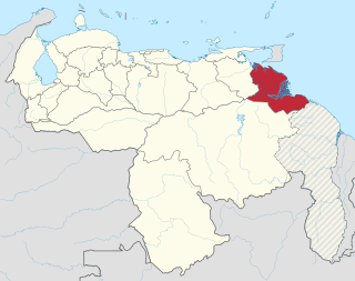
The Federal Dependencies of Venezuela encompass most of Venezuela's offshore islands in the Caribbean Sea and the Gulf of Venezuela, excluding those islands that form the State of Nueva Esparta and some Caribbean coastal islands that are integrated with nearby states. These islands, with a total area of 342 square kilometres, are sparsely populated – according to the preliminary results of the 2011 Census only 2,155 people live there permanently, with another hundred from Margarita Island who live there seasonally to engage in fishing. Local government is officially under the authority of Central government in Caracas, although de facto power is often held by the heads of the sparse and somewhat isolated communities that decorate the territories.

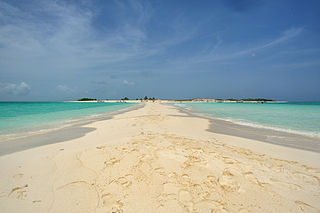
La Orchila Island is an island and a military base off the coast of Venezuela, north of Caracas. It has numerous beaches, including one where the sand is markedly pink.
The Cabinet of Ministers of Venezuela (Spanish: Gabinete de Ministros de Venezuela is one of the bodies that make up the Venezuelan executive in that country's presidential system, alongside the Council of Ministers. The Cabinet is headed by the president of Venezuela, and his corresponding vice president. The purpose of the ministries is to create, adopt, follow and evaluate policies, strategies, programs and projects in accordance with the constitution and the laws of the republic.

The Los Roques Archipelago is a federal dependency of Venezuela consisting of approximately 350 islands, cays, and islets in a total area of 40.61 square kilometers. The archipelago is located 128 kilometers (80 mi) directly north of the port of La Guaira, in the Caribbean Sea.
The Insular Region is one of the eight natural regions of Venezuela and one of the 10 administrative regions in which Venezuela was divided for its development plans; it comprises all of the nation's islands, and is formed by the state of Nueva Esparta and the Federal Dependencies.
Miss Venezuela 1996 was the 43rd Miss Venezuela pageant, was held in Caracas, Venezuela, on September 6, 1996, after weeks of events. The winner of the pageant was Marena Bencomo, Miss Carabobo.
Miss Venezuela 1995 was the 42nd Miss Venezuela pageant, was held in Caracas, Venezuela on September 27, 1995, after weeks of events. The winner of the pageant was Alicia Machado, Miss Yaracuy.
Miss Venezuela 1993 was the 40th Miss Venezuela pageant, was held in Caracas, Venezuela on September 3, 1993, after weeks of events. The winner of the pageant was Minorka Mercado, Miss Apure.

Miss Venezuela 1992 was the 39th Miss Venezuela pageant, was held in Caracas, Venezuela on September 9, 1992, after weeks of events. The winner of the pageant was Milka Chulina, Miss Aragua.
Miss Venezuela 1991 was the 38th Miss Venezuela pageant, was held in Caracas, Venezuela on May 23, 1991, after weeks of events. The winner of the pageant was Carolina Izsak, Miss Amazonas.

Miss Venezuela 1990 was the 37th Miss Venezuela pageant, was held in Caracas, Venezuela on February 1, 1990, after weeks of events. The winner of the pageant was Andreína Goetz, Miss Bolívar.
Miss Venezuela 1984 was the 31st Miss Venezuela pageant, was held in Caraballeda, Vargas state, Venezuela, on May 11, 1984, after weeks of events. The winner of the pageant was Carmen María Montiel, Miss Zulia.
The Venezuelan Caribbean consists of the coastal mainland and Caribbean islands.
Gran Roque is an island, one of the federal dependencies of Venezuela, located in the southeastern Caribbean Sea in the archipelago of Los Roques, which has 1.7 km2 in extent, where the majority of the population lives. The airport is located by the sea, a few meters from the beach.
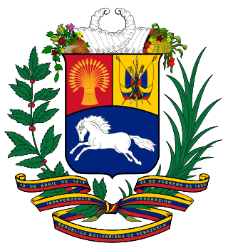
The United States of Venezuela was the official name of Venezuela, adopted in its 1864 constitution under the Juan Crisóstomo Falcón government. This remained the official name until 1953, when the constitution of that year renamed it the Republic of Venezuela. In 1999 under newly elected president Hugo Chávez and his modification to the Constitution, Venezuela's official name became the Bolivarian Republic of Venezuela.
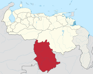
The Amazonas Federal Territory is the name by which the current Amazonas State of Venezuela was known until 1992.
The Delta Federal Territory, later Delta Amacuro, is the name by which the current Delta Amacuro State of Venezuela was known until 1991.


