
Following are links to lists of islands of the Americas which relates to all islands associated with South America and North America, including those of the Caribbean.
Following are links to lists of islands of the Americas which relates to all islands associated with South America and North America, including those of the Caribbean.

This is a list of the lists of islands in the world grouped by country, by continent, by body of water, and by other classifications. For rank-order lists, see the other lists of islands below.

The term "United States", when used in the geographical sense, is the contiguous United States, the state of Alaska, the island state of Hawaii, the five insular territories of Puerto Rico, Northern Mariana Islands, U.S. Virgin Islands, Guam, and American Samoa, and minor outlying possessions. The United States shares land borders with Canada and Mexico and maritime borders with Russia, Cuba, The Bahamas, and other countries, in addition to Canada and Mexico. The northern border of the United States with Canada is the world's longest bi-national land border.

The United States Virgin Islands are a group of several dozen islands and cays located in the Caribbean, about 1,100 miles (1,770 km) southeast of Florida, 600 miles (966 km) north of Venezuela, 40 miles (64 km) east of Puerto Rico, and immediately west and south of the British Virgin Islands.

The Virgin Islands are an archipelago in the Caribbean Sea. They are geologically and biogeographically the easternmost part of the Greater Antilles, the northern islands belonging to the Puerto Rico Trench and St. Croix being a displaced part of the same geologic structure. Politically, the British Virgin Islands have been governed as the western island group of the Leeward Islands, which are the northern part of the Lesser Antilles, and form the border between the Caribbean Sea and the Atlantic Ocean. The archipelago is separated from the true Lesser Antilles by the Anegada Passage and from the main island of Puerto Rico by the Virgin Passage.

The contiguous United States or officially the conterminous United States, also known as the Lower 48, consists of the 48 adjoining U.S. states and the District of Columbia on the continent of North America. The terms exclude the non-contiguous states of Alaska and Hawaii and all other offshore insular areas, such as American Samoa, Guam, the Northern Mariana Islands, Puerto Rico, and the U.S. Virgin Islands. These differ from the related term continental United States, which includes Alaska but excludes the Hawaiian Islands and all U.S. territories in the Caribbean and the Pacific.

The Lesser Antilles are a group of islands in the Caribbean Sea. Most of them are part of a long, partially volcanic island arc between the Greater Antilles to the north-west and the continent of South America. The islands of the Lesser Antilles form the eastern boundary of the Caribbean Sea where it meets the Atlantic Ocean. Together, the Lesser Antilles and the Greater Antilles make up the Antilles. The Lesser and Greater Antilles, together with the Lucayan Archipelago, are collectively known as the West Indies.

The Antilles is an archipelago bordered by the Caribbean Sea to the south and west, the Gulf of Mexico to the northwest, and the Atlantic Ocean to the north and east.
The Leeward Islands are a group of islands situated where the northeastern Caribbean Sea meets the western Atlantic Ocean. Starting with the Virgin Islands east of Puerto Rico, they extend southeast to Guadeloupe and its dependencies. In English, the term Leeward Islands refers to the northern islands of the Lesser Antilles chain. The more southerly part of this chain, starting with Dominica, is called the Windward Islands. Dominica was originally considered a part of the Leeward Islands, but was transferred from the British Leeward Islands to the British Windward Islands in 1940.

Saint Thomas is one of the Virgin Islands in the Caribbean Sea which, together with Saint John, Water Island, Hassel Island, and Saint Croix, form a county-equivalent and constituent district of the United States Virgin Islands (USVI), an unincorporated territory of the United States. The territorial capital and port of Charlotte Amalie is located on the island. In the 2010 census, the population of Saint Thomas was 51,634, about 48.5% of the US Virgin Islands total. As of the 2020 census, the population of Saint Thomas is 42,461. The district has a land area of 32 square miles (83 km2).

A subregion is a part of a larger region or continent and is usually based on location. Cardinal directions, such as south are commonly used to define a subregion.
Sandy Point may refer to:
This overview contains the flags of dependent territories and other areas of special sovereignty.

The West Indies is a subregion of North America, surrounded by the North Atlantic Ocean and the Caribbean Sea that includes 13 independent island countries and 18 dependencies and other territories in three major archipelagos: the Greater Antilles, the Lesser Antilles, and the Lucayan Archipelago.
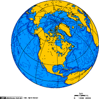
North America is the third largest continent, and is also a portion of the second largest supercontinent if North and South America are combined into the Americas and Africa, Europe, and Asia are considered to be part of one supercontinent called Afro-Eurasia. With an estimated population of 580 million and an area of 24,709,000 km2 (9,540,000 mi2), the northernmost of the two continents of the Western Hemisphere is bounded by the Pacific Ocean on the west; the Atlantic Ocean on the east; the Caribbean Sea on the south; and the Arctic Ocean on the north.
This is a list of articles holding galleries of maps of present-day countries and dependencies. The list includes all countries listed in the List of countries, the French overseas departments, the Spanish and Portuguese overseas regions and inhabited overseas dependencies.

The following outline is provided as an overview of and topical guide to North America.

The following is an alphabetical list of articles related to the territory of the United States Virgin Islands.

The Caribbean is a region of the Americas that consists of the Caribbean Sea, its islands and the surrounding coasts. The region is southeast of the Gulf of Mexico and the North American mainland, east of Central America and north of South America islets, reefs and cays. Island arcs delineate the eastern and northern edges of the Caribbean Sea: the Greater Antilles and the Lucayan Archipelago on the north and the Lesser Antilles on the south and east. They form the West Indies with the nearby Lucayan Archipelago, which are considered to be part of the Caribbean despite not bordering the Caribbean Sea. On the mainland, Belize, Nicaragua, the Caribbean region of Colombia, Cozumel, the Yucatán Peninsula, Margarita Island, and the Guianas are often included due to their political and cultural ties with the region.