Pickford Township, Michigan

Last updated

Pickford Township, Michigan
Pickford Township, MI location.png
Location within Chippewa County
USA Michigan location map.svg
Red pog.svg
Pickford Township
Location within the state of Michigan
Coordinates: 46°10′58″N84°21′08″W / 46.18278°N 84.35222°W / 46.18278; -84.35222
Country United States
State Michigan
County Chippewa
Established1896
Government
  SupervisorTom Ball
Area
  Total119.5 sq mi (309.5 km2)
  Land108.3 sq mi (280.4 km2)
  Water11.3 sq mi (29.2 km2)
Elevation
627 ft (191 m)
Population
 (2020)
  Total2,791
  Density23/sq mi (9.0/km2)
Time zone UTC-5 (Eastern (EST))
  Summer (DST) UTC-4 (EDT)
ZIP code(s)
49710 (Barbeau)
49752 (Kinross)
49774 (Pickford)
49780 (Rudyard)
49783 (Sault Ste. Marie)
49788 (Kincheloe)
Area code 906
FIPS code 26-63980 [1]
GNIS feature ID1626899 [2]
Website Official website

Pickford Township is a civil township of Chippewa County in the U.S. state of Michigan. As of the 2020 census, the township population was 2,791. [3]

Contents

Geography

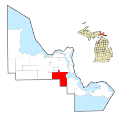
Pickford Township is located in southeastern Chippewa County on the Upper Peninsula of Michigan. It is bordered to the south by Mackinac County. The northeastern part of the township extends into Munuscong Lake, a large bay on the St. Marys River. The Munuscong River flows through the center of the township into Munuscong Lake, passing the communities of Pickford, Stirlingville, and Kelden.

According to the United States Census Bureau, the township has a total area of 119.5 square miles (309.5 km2), of which 108.3 square miles (280.4 km2) is land and 11.3 square miles (29.2 km2), or 9.42%, is water. [4]

Communities

Demographics

As of the census [1] of 2000, there were 1,584 people, 607 households, and 475 families residing in the township. The population density was 14.6 per square mile (5.6/km2). There were 776 housing units at an average density of 7.2 per square mile (2.8/km2). The racial makeup of the township was 92.11% White, 0.06% African American, 5.81% Native American, 0.06% Asian, and 1.96% from two or more races. Hispanic or Latino of any race were 0.38% of the population.

There were 607 households, out of which 30.6% had children under the age of 18 living with them, 70.8% were married couples living together, 4.8% had a female householder with no husband present, and 21.7% were non-families. 17.8% of all households were made up of individuals, and 8.1% had someone living alone who was 65 years of age or older. The average household size was 2.61 and the average family size was 2.97.

In the township the population was spread out, with 24.3% under the age of 18, 7.1% from 18 to 24, 27.0% from 25 to 44, 25.9% from 45 to 64, and 15.6% who were 65 years of age or older. The median age was 40 years. For every 100 females, there were 102.8 males. For every 100 females age 18 and over, there were 100.5 males.

The median income for a household in the township was $40,850, and the median income for a family was $43,882. Males had a median income of $34,444 versus $22,007 for females. The per capita income for the township was $16,320. About 4.1% of families and 6.6% of the population were below the poverty line, including 8.0% of those under age 18 and 12.4% of those age 65 or over.

Media

Climate

This climatic region is typified by large seasonal temperature differences, with warm to hot (and often humid) summers and cold (sometimes severely cold) winters. According to the Köppen Climate Classification system, Pickford has a humid continental climate, abbreviated "Dfb" on climate maps. [14]

Related Research Articles

Wayland Township is a civil township of Allegan County in the U.S. state of Michigan. The population was 3,573 at the 2020 census.

<span class="mw-page-title-main">Long Rapids Township, Michigan</span> Civil township in Michigan, United States

Long Rapids Township is a civil township of Alpena County in the U.S. state of Michigan. The population was 977 at the 2020 census.

<span class="mw-page-title-main">Barry Township, Michigan</span> Township in Michigan, United States

Barry Township is a civil township of Barry County in the U.S. state of Michigan. As of the 2020 census, the township population was 3,417.

<span class="mw-page-title-main">Inland Township, Michigan</span> Civil township in Michigan, United States

Inland Township is a civil township of Benzie County in the U.S. state of Michigan. The population was 2,386 at the 2020 census. The township is located in the east of the county, and shares a border with Grand Traverse County. The Platte River flows through the north of the township.

Clarence Township is a civil township located in northeast Calhoun County in the U.S. state of Michigan. It is part of the Battle Creek, Michigan Metropolitan Statistical Area. The population was 1,903 at the 2020 census. The township was originally named Pinkney Township.

<span class="mw-page-title-main">Volinia Township, Michigan</span> Civil township in Michigan, United States

Volinia Township is a civil township of Cass County in the U.S. state of Michigan. The population was 1,096 at the 2020 census. When the township was organized in 1833, it was at first named Volhynia, after the province in Poland. It is believed to have been given to honor General Tadeusz Kościuszko, the Polish patriot who helped the United States during the American Revolutionary War. The name was altered first to "Volenia" and then by 1901 or earlier to "Volinia".

<span class="mw-page-title-main">Raber Township, Michigan</span> Civil township in Michigan, United States

Raber Township is a civil township of Chippewa County in the U.S. state of Michigan. The population was 632 at the 2020 census.

Benton Township is a civil township of Eaton County in the U.S. state of Michigan. As of the 2020 census, the township population was 2,766.

<span class="mw-page-title-main">Burnside Township, Michigan</span> Civil township in Michigan, United States

Burnside Township is a civil township of Lapeer County in the U.S. state of Michigan. The population was 1,904 at the 2020 Census.

<span class="mw-page-title-main">Hadley Township, Michigan</span> Civil township in Michigan, United States

Hadley Township is a civil township of Lapeer County in the U.S. state of Michigan. The population was 4,547 at the 2020 Census.

<span class="mw-page-title-main">Rich Township, Michigan</span> Civil township in Michigan, United States

Rich Township is a civil township of Lapeer County in the U.S. state of Michigan. The population was 1,500 at the 2020 Census.

<span class="mw-page-title-main">Golden Township, Michigan</span> Township in Michigan, United States

Golden Township is a civil township of Oceana County in the U.S. state of Michigan. The population was 1,660 at the 2020 census. The township is home to the Silver Lake Sand Dunes, and is located along the shore of Lake Michigan.

Highland Township is a civil township of Osceola County in the U.S. state of Michigan. The population was 1,148 at the 2020 census.

Bridgehampton Township is a civil township of Sanilac County in the U.S. state of Michigan. As of the 2020 census, the township population was 745.

Buel Township is a civil township of Sanilac County in the U.S. state of Michigan. As of the 2020 census, the township population was 1,161.

Delaware Township is a civil township of Sanilac County in the U.S. state of Michigan. The population was 784 at the 2020 census.

Watertown Township is a civil township of Sanilac County in the U.S. state of Michigan. The population was 1,263 at the 2020 census.

Gilford Township is a civil township of Tuscola County in the U.S. state of Michigan. The population was 735 at the 2020 census.

Watertown Township is a civil township of Tuscola County in the U.S. state of Michigan. The population was 2,091 at the 2020 census.

Brookfield Township is a civil township of Eaton County in the U.S. state of Michigan. As of the 2020 census, the township population was 1,467.

References

  1. 1 2 "U.S. Census website". United States Census Bureau . Retrieved January 31, 2008.
  2. U.S. Geological Survey Geographic Names Information System: Pickford Township, Michigan
  3. "Explore Census Data". data.census.gov. Retrieved May 2, 2024.
  4. "Geographic Identifiers: 2010 Demographic Profile Data (G001): Pickford township, Chippewa County, Michigan". U.S. Census Bureau, American Factfinder. Archived from the original on February 12, 2020. Retrieved September 24, 2014.
  5. U.S. Geological Survey Geographic Names Information System: Kelden, Michigan
  6. 1 2 3 Romig, Walter (1986) [1973]. Michigan Place Names. Detroit, Michigan: Wayne State University Press. ISBN   0-8143-1838-X.
  7. U.S. Geological Survey Geographic Names Information System: Pickford, Michigan
  8. 49774 5-Digit ZCTA, 497 3-Digit ZCTA - Reference Map - American FactFinder [ permanent dead link ], U.S. Census Bureau, 2000 census
  9. U.S. Geological Survey Geographic Names Information System: Stirlingville, Michigan
  10. 49710 5-Digit ZCTA, 497 3-Digit ZCTA - Reference Map - American FactFinder [ permanent dead link ], U.S. Census Bureau, 2000 census
  11. 49736 5-Digit ZCTA, 497 3-Digit ZCTA - Reference Map - American FactFinder [ permanent dead link ], U.S. Census Bureau, 2000 census
  12. 49752 5-Digit ZCTA, 497 3-Digit ZCTA - Reference Map - American FactFinder [ permanent dead link ], U.S. Census Bureau, 2000 census
  13. 49788 5-Digit ZCTA, 497 3-Digit ZCTA - Reference Map - American FactFinder [ permanent dead link ], U.S. Census Bureau, 2000 census
  14. Climate Summary for Pickford Township, Michigan