Soo Township, Michigan

Last updated

Soo Township, Michigan
Soo Township, MI location--.png
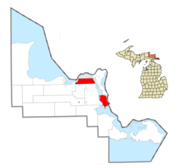
Location within Chippewa County
USA Michigan location map.svg
Red pog.svg
Soo Township
Location within the state of Michigan
Coordinates: 46°25′11″N84°18′40″W / 46.41972°N 84.31111°W / 46.41972; -84.31111
Country United States
State Michigan
County Chippewa
Government
  SupervisorLarry Perron
Area
  Total67.9 sq mi (175.9 km2)
  Land50.1 sq mi (129.8 km2)
  Water17.8 sq mi (46.1 km2)
Elevation
581 ft (177 m)
Population
 (2020)
  Total2,966
  Density44/sq mi (17/km2)
Time zone Eastern
ZIP code(s)
49710 (Barbeau)
49783 (Sault Ste. Marie)
Area code 906
FIPS code 26-74620 [1]
GNIS feature ID1627091 [2]
Website Official website

Soo Township is a civil township of Chippewa County in the U.S. state of Michigan. The population was 2,966 at the 2020 census. [3]

Contents

Geography

Soo Township consists of two section in northeastern Chippewa County, connected by a stretch of the St. Marys River. The northwestern section is part of the Upper Peninsula of Michigan and is bordered to the north by the city of Sault Ste. Marie. It extends west into Izaak Walton Bay on the St. Marys River (upstream from Sault Ste. Marie) and east as far as the Little Rapids Channel of the river (downstream from Sault Ste. Marie). The southeastern portion of the township, about 43% of the township's total territory, comprises Neebish Island, 9 miles (14 km) downriver from the rest of the township.

According to the US Census Bureau, the township has a total area of 67.9 square miles (175.9 km2), of which 50.1 square miles (129.8 km2) is land and 17.8 square miles (46.1 km2), or 26.20%, is water. [4]

Communities

Demographics

In 2010, the township had a population of 3,141.

Related Research Articles

<span class="mw-page-title-main">Luce County, Michigan</span> County in Michigan, United States

Luce County is a county located in the Upper Peninsula in the U.S. state of Michigan. As of the 2020 census, the population was 5,339, making it the second-least populous county in Michigan. The county seat is Newberry, Luce County's only incorporated community. The county was set off and organized in 1887 and named after former Michigan Governor Cyrus G. Luce.

<span class="mw-page-title-main">Chippewa County, Michigan</span> County in Michigan, United States

Chippewa County is a county in the eastern Upper Peninsula of the U.S. state of Michigan. As of the 2020 census, the population was 36,785. The county seat is Sault Ste. Marie. The county is named for the Ojibwe (Chippewa) people, and was set off and organized in 1826. Chippewa County comprises the Sault Ste. Marie, MI micropolitan statistical area.

<span class="mw-page-title-main">Bay Mills Township, Michigan</span> Civil township in Michigan, United States

Bay Mills Township is a civil township of Chippewa County in the U.S. state of Michigan. As of the 2020 census, the township population was 1,567.

<span class="mw-page-title-main">Bruce Township, Chippewa County, Michigan</span> Civil township in Michigan, United States

Bruce Township is a civil township of Chippewa County in the U.S. state of Michigan. As of the 2020 census, the township population was 2,000.

<span class="mw-page-title-main">Dafter Township, Michigan</span> Civil township in Michigan, United States

Dafter Township is a civil township of Chippewa County in the U.S. state of Michigan. The population was 1,327 at the 2020 census.

<span class="mw-page-title-main">DeTour Village, Michigan</span> Village in Michigan, United States

DeTour Village is a village in Chippewa County in the U.S. state of Michigan. The population was 263 in 2020.

<span class="mw-page-title-main">Hulbert Township, Michigan</span> Civil township in Michigan, United States

Hulbert Township is a civil township of Chippewa County in the Upper Peninsula of the U.S. state of Michigan. As of the 2020 census, the township population was 171.

<span class="mw-page-title-main">Kinross Charter Township, Michigan</span> Charter township in Michigan, United States

Kinross Charter Township is a charter township of Chippewa County in the U.S. state of Michigan. The population was 6,139 at the 2020 census, down from 7,561 at the 2010 census.

<span class="mw-page-title-main">Rudyard Township, Michigan</span> Civil township in Michigan, United States

Rudyard Township is a civil township of Chippewa County in the U.S. state of Michigan. As of the 2020 census, the township population was 1,289. In 2023, Rudyard Township was designated the "Snowy Owl Capital of Michigan".

<span class="mw-page-title-main">Sault Ste. Marie, Michigan</span> City in Michigan, United States

Sault Ste. Marie is a city in the Upper Peninsula of the U.S. state of Michigan. It is the county seat of Chippewa County and is the only city within the county. With a population of 13,337 at the 2020 census, it is the second-most populated city in the Upper Peninsula, behind Marquette. It is the primary city of the Sault Ste. Marie, MI Micropolitan Statistical Area, which encompasses all of Chippewa County and had a population of 36,785 at the 2020 census. Sault Ste. Marie was settled by mostly French colonists in 1668, making it the oldest city in Michigan.

<span class="mw-page-title-main">Sugar Island Township, Michigan</span> Civil township in Michigan, United States

Sugar Island Township is a civil township of Chippewa County in the U.S. state of Michigan. The population was 653 at the 2020 census. The township consists of Sugar Island, several smaller islands, and the surrounding waters in the St. Marys River.

<span class="mw-page-title-main">Marenisco Township, Michigan</span> Civil township in Michigan, United States

Marenisco Township is a civil township of Gogebic County in the U.S. state of Michigan. The population was 455 at the 2020 census, a significant decrease from 1,727 at the 2010 census.

<span class="mw-page-title-main">Watersmeet Township, Michigan</span> Civil township in Michigan, United States

Watersmeet Township is a civil township of Gogebic County in the Upper Peninsula of the U.S. state of Michigan. The population was 1,456 in 2020.

<span class="mw-page-title-main">Newton Township, Mackinac County, Michigan</span> Civil township in Michigan, United States

Newton Township is a civil township of Mackinac County in the U.S. state of Michigan. As of 2020, its population was 430.

<span class="mw-page-title-main">St. Ignace, Michigan</span> City in Michigan, United States

St. Ignace is a city in the U.S. state of Michigan and the county seat of Mackinac County. The city had a population of 2,306 at the 2020 census. St. Ignace Township is located just to the north of the city, but the two are administered autonomously.

<span class="mw-page-title-main">St. Marys River (Michigan–Ontario)</span> River in Canada, United States

The St. Marys River, sometimes written St. Mary's River, drains Lake Superior, starting at the end of Whitefish Bay and flowing 74.5 miles (119.9 km) southeast into Lake Huron, with a fall of 23 feet (7.0 m). For its entire length it is an international border, separating Michigan in the United States from Ontario, Canada.

<span class="mw-page-title-main">Bay Mills Indian Community</span> Indian reservation in Michigan, United States

The Bay Mills Indian Community (BMIC), is an Indian reservation forming the land base of one of the many federally recognized Sault Ste. Marie bands of Chippewa.

Sugar Island is an island in the U.S. state of Michigan in the St. Marys River between the United States and the Canadian province of Ontario. The entire island constitutes Sugar Island Township in Chippewa County at the eastern tip of the Upper Peninsula. According to the 2000 census there were 683 people living on a land area of 128 square kilometers ; about 14 people per square mile.

Neebish Island is located in the U.S. state of Michigan, in the St. Marys River, which connects Lake Superior and Lake Huron at the easternmost point of Michigan's upper peninsula.

<span class="mw-page-title-main">Charlotte River (Michigan)</span> River in Michigan, United States

The Charlotte River is a tributary of the St. Marys River in the state of Michigan in the United States. The stream is 17.1 miles (27.5 km) long and drains an area of 58.4 square miles (151 km2) on the eastern Upper Peninsula. Via the St. Marys River, it is part of the watershed of Lake Huron. Via Lake Huron and the Great Lakes system, it is part of the larger watershed of the St. Lawrence River.

References

  1. "U.S. Census website". US Census Bureau. Retrieved January 31, 2008.
  2. U.S. Geological Survey Geographic Names Information System: Soo Township, Michigan
  3. "Explore Census Data". data.census.gov. Retrieved May 2, 2024.
  4. "Geographic Identifiers: 2010 Demographic Profile Data (G001): Soo township, Chippewa County MI". US Census Bureau, American Factfinder. Archived from the original on February 12, 2020. Retrieved September 26, 2014.