Superior Township, Chippewa County, Michigan

Last updated

Superior Township, Michigan
Brimley, MI welcome sign.jpg
Community of Brimley along W. 6 Mile Road
Superior Township (Chippewa), MI location.png
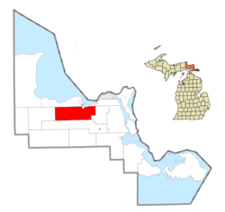
Location within Chippewa County
USA Michigan location map.svg
Red pog.svg
Superior Township
Location within the state of Michigan
Coordinates: 46°22′40″N84°39′28″W / 46.37778°N 84.65778°W / 46.37778; -84.65778
Country United States
State Michigan
County Chippewa
Government
  SupervisorRichard Phillips
Area
  Total104.7 sq mi (271.1 km2)
  Land103.0 sq mi (266.7 km2)
  Water1.7 sq mi (4.4 km2)
Elevation
810 ft (247 m)
Population
 (2010)
  Total1,337
  Density13/sq mi (5.0/km2)
Time zone UTC-5 (Eastern (EST))
  Summer (DST) UTC-4 (EDT)
ZIP code
49715 (Brimley)
Area code 906
FIPS code 26-77540 [1]
GNIS feature ID1627140 [2]

Superior Township is a civil township of Chippewa County in the U.S. state of Michigan. The population was 1,337 at the 2010 census. [3]

Contents

The federally recognized Bay Mills Indian Community has part of its land base reservation in Superior Township, based west of Brimley. It operates two casinos on its reservation, one of which is in Superior Township, to generate funds for education and welfare of its people. Brimley State Park is also within the township on the shores of Lake Superior.

Geography

Superior Township is located in north of the center of Chippewa County. According to the United States Census Bureau, the township has a total area of 104.7 square miles (271.1 km2), of which 103.0 square miles (266.7 km2) is land and 1.7 square miles (4.4 km2), or 1.62%, is water. [3]

The Delirium Wilderness is located several miles south of the community of Raco and extends into Kinross Township to the south.

Communities

Demographics

As of the census [1] of 2000, there were 1,329 people, 515 households, and 384 families residing in the township. In 2010, its population then grew to 1,337.

Related Research Articles

<span class="mw-page-title-main">Ontonagon County, Michigan</span> County in Michigan, United States

Ontonagon County is a county in the Upper Peninsula of the U.S. state of Michigan. As of the 2020 census, the population was 5,816, making it Michigan's third-least populous county. The county seat is Ontonagon. The county was set off in 1843, and organized in 1848. Its territory had been organized as part of Chippewa and Mackinac counties. With increasing population in the area, more counties were organized. After Ontonagon was organized, it was split to create Gogebic County. It is also the westernmost county in United States that lies within the Eastern Time Zone.

<span class="mw-page-title-main">Chippewa County, Michigan</span> County in Michigan, United States

Chippewa County is a county in the eastern Upper Peninsula of the U.S. state of Michigan. As of the 2020 census, the population was 36,785. The county seat is Sault Ste. Marie. The county is named for the Ojibwe (Chippewa) people, and was set off and organized in 1826. Chippewa County comprises the Sault Ste. Marie, MI micropolitan statistical area.

<span class="mw-page-title-main">Standish Township, Michigan</span> Civil township in Michigan, United States

Standish Township is a civil township of Arenac County in the U.S. state of Michigan. The population was 1,900 at the 2010 census. The city of Standish borders the township on the northwest but is administered autonomously.

<span class="mw-page-title-main">Bay Mills Township, Michigan</span> Civil township in Michigan, United States

Bay Mills Township is a civil township of Chippewa County in the U.S. state of Michigan. As of the 2010 census, the township population was 1,477.

<span class="mw-page-title-main">Chippewa Township, Chippewa County, Michigan</span> Civil township in Michigan, United States

Chippewa Township is a civil township of Chippewa County in the U.S. state of Michigan. As of the 2010 census, the township population was 213.

<span class="mw-page-title-main">Hulbert Township, Michigan</span> Civil township in Michigan, United States

Hulbert Township is a civil township of Chippewa County in the Upper Peninsula of the U.S. state of Michigan. As of the 2010 census, the township population was 168.

<span class="mw-page-title-main">Raber Township, Michigan</span> Civil township in Michigan, United States

Raber Township is a civil township of Chippewa County in the U.S. state of Michigan. The population was 647 at the 2010 census.

<span class="mw-page-title-main">Soo Township, Michigan</span> Civil township in Michigan, United States

Soo Township is a civil township of Chippewa County in the U.S. state of Michigan. The population was 3,141 at the 2010 census.

<span class="mw-page-title-main">Sugar Island Township, Michigan</span> Civil township in Michigan, United States

Sugar Island Township is a civil township of Chippewa County in the U.S. state of Michigan. The population was 653 at the 2020 census. The township consists of Sugar Island, several smaller islands, and the surrounding waters in the St. Marys River.

<span class="mw-page-title-main">Trout Lake Township, Michigan</span> Civil township in Michigan, United States

Trout Lake Township is a civil township of Chippewa County in the U.S. state of Michigan. The population was 332 at the 2020 census.

<span class="mw-page-title-main">Whitefish Township, Michigan</span> Civil township in Michigan, United States

Whitefish Township is a civil township of Chippewa County in the U.S. state of Michigan. The population was 474 at the 2020 census.

<span class="mw-page-title-main">Watersmeet Township, Michigan</span> Civil township in Michigan, United States

Watersmeet Township is a civil township of Gogebic County in the Upper Peninsula of the U.S. state of Michigan. The population was 1,456 in 2020. Chippewa students made up half of the student body and winning high school basketball team in the early 2000s. It was featured in the 2007 documentary Nimrod Nation, shown on The Sundance Channel.

<span class="mw-page-title-main">Nottawa Township, Isabella County, Michigan</span> Civil township in Michigan, United States

Nottawa Township is a civil township of Isabella County in the U.S. state of Michigan. The population was 2,225 at the 2020 census.

<span class="mw-page-title-main">L'Anse Indian Reservation</span> Indian reservation in Michigan, United States

The L'Anse Indian Reservation is the land base of the federally recognized Keweenaw Bay Indian Community of the historic Lake Superior Band of Chippewa Indians.. The reservation is located primarily in two non-contiguous sections on either side of the Keweenaw Bay in Baraga County in the Upper Peninsula of the U.S. state of Michigan. The Keweenaw Bay Community also manages the separate Ontonagon Indian Reservation.

<span class="mw-page-title-main">Bay Mills Indian Community</span> Indian reservation in Michigan, United States

The Bay Mills Indian Community (BMIC), is an Indian reservation forming the land base of one of the many federally recognized Sault Ste. Marie bands of Chippewa.

<span class="mw-page-title-main">Brimley, Michigan</span> Census-designated place & unincorporated community in Michigan, United States

Brimley is an unincorporated community and census-designated place (CDP) in Chippewa County in the U.S. state of Michigan. The CDP had a population of 504 at the 2020 census. Brimley is located in Michigan's Upper Peninsula, and is located along the southern shore of Lake Superior. The community is located within Superior Township.

<span class="mw-page-title-main">Eagle River, Michigan</span> Census-designated place & unincorporated community in Michigan, United States

Eagle River is an unincorporated community and census-designated place (CDP) in the U.S. state of Michigan. It is the county seat of Keweenaw County. Its population was 65 at the 2020 census, which makes it by far the least-populated county seat in the state of Michigan. As an unincorporated community, Eagle River has no legal autonomy and is part of Allouez Township and Houghton Township.

<span class="mw-page-title-main">Fond du Lac Indian Reservation</span> Indian reservation in northern Minnesota

The Fond du Lac Indian Reservation is an Indian reservation in northern Minnesota near Cloquet in Carlton and Saint Louis counties. Off-reservation holdings are located across the state in Douglas County, in the northwest corner of Wisconsin. The total land area of these tribal lands is 154.49 square miles (400.1 km2). It is the land-base for the Fond du Lac Band of Lake Superior Chippewa. Before the establishment of this reservation, the Fond du Lac Band of Lake Superior Chippewa were located at the head of Lake Superior, closer to the mouth of the Saint Louis River, where Duluth has developed.

<span class="mw-page-title-main">Grand Portage Indian Reservation</span>

The Grand Portage Indian Reservation is the Indian reservation of the Grand Portage Band of Minnesota Chippewa Tribe, a federally recognized tribe in Minnesota.

<span class="mw-page-title-main">Lac Vieux Desert Indian Reservation</span> Indian reservation in Michigan, United States

Lac Vieux Desert Indian Reservation is an Indian reservation located in Watersmeet Township of southeastern Gogebic County, in the western part of Michigan's Upper Peninsula. It is the landbase for the Lac Vieux Desert Band of Lake Superior Chippewa. According to the United States Census Bureau in 2020, the reservation has a land area of 0.419 square miles. The reservation consists of two sections in eastern Watersmeet Township. There were 221 people living on the reservation in the 2020 census.

References

  1. 1 2 "U.S. Census website". United States Census Bureau . Retrieved January 31, 2008.
  2. U.S. Geological Survey Geographic Names Information System: Superior Township, Chippewa County, Michigan
  3. 1 2 "Geographic Identifiers: 2010 Demographic Profile Data (G001): Superior township, Chippewa County, Michigan". U.S. Census Bureau, American Factfinder. Archived from the original on February 12, 2020. Retrieved September 26, 2014.
  4. Romig, Walter (1973). Michigan Place Names: The History of the Founding and the Naming of More Than Five Thousand Past and Present Michigan Communities. Wayne State University Press. p. 463. ISBN   9780814318386 . Retrieved October 25, 2017.