The Au Sable River in Michigan, United States runs approximately 138 miles (222 km) through the northern Lower Peninsula, through the towns of Grayling and Mio, and enters Lake Huron at Au Sable. It is considered one of the best brown trout fisheries east of the Rockies and has been designated a blue ribbon trout stream by the Michigan Department of Natural Resources. In French, au sable literally means "at the sand." A 1795 map calls it the Beauais River.

Au Train Township is a civil township of Alger County in the U.S. state of Michigan. As of the 2010 census, the township population was 1,138.

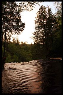
Limestone Township is a civil township of Alger County in the U.S. state of Michigan. The population was 438 at the 2010 census.

Munising Township is a civil township of Alger County in the U.S. state of Michigan. As of the 2010 census, the township population was 2,983.

The St. Joseph River is an 86.1-mile-long (138.6 km) tributary of the Maumee River in northwestern Ohio and northeastern Indiana in the United States, with headwater tributaries rising in southern Michigan. It drains a primarily rural farming region in the watershed of Lake Erie.

Pine River may refer to any of the following streams in the U.S. state of Michigan:
- Pine River. The main branch forms with the confluence of the East and West Branches of the Pine River at 44°29′38″N83°23′16″W in Alcona County. The South Branch joins approximately 1.5 miles (2.4 km) to the south and flows into Iosco County, where it empties into Van Etten Lake at 44°29′38″N83°23′16″W northwest of Oscoda.
- Pine River. The main branch is formed by the confluence of the North and Middle Branches northeast of Standish and flows into the Saginaw Bay of Lake Huron at 43°58′32″N83°51′16″W. The South Branch Pine River joins the main stream at 43°59′08″N83°53′17″W.
- Pine River is a short waterway, which along with Round Lake, connects Lake Charlevoix with Lake Michigan at Charlevoix.
- Pine River rises in Chippewa County and flows south through Mackinac County into the St. Martin Bay of Lake Huron at 46°03′09″N84°39′22″W The North Pine River, also known as the North Branch Pine River, joins at 46°12′20″N84°36′17″W. Another tributary, Hemlock Creek, is also known as Pine River.
- Pine River, also known as the South Branch Manistee River, rises in southeast Wexford County, flows southwest across northwest Osceola County, then west and north through the northeast corner of Lake County and back into southwest Wexford County, emptying into the Tippy Dam Pond on the Manistee River at 44°13′37″N85°54′27″W. The main stream is formed from the confluence of the East Branch Pine River with the North Branch Pine River at 44°06′02″N85°31′40″W. Another tributary, the Spaulding Creek, is also known as the Little Pine River
- Pine River, in Marquette County, is a very short stream draining Pine Lake into Lake Superior at 46°53′27″N87°52′13″W, north of the Huron Mountains.
- Pine River rises in from Pine Lake in eastern Mecosta County, flows mostly south and east through Isabella County, then south along eastern edge of Montcalm County, then east and north through Gratiot County and Midland County, emptying into the Chippewa River at 43°36′06″N84°17′33″W, just about two miles before it joins the Tittabawassee River near Midland. The South Branch Pine River joins the main stream at 43°30′37″N85°00′02″W Another tributary, Miller Creek, is also sometimes known as Pine River or the West Branch Pine River. The North Branch Pine River joins the main stream at 43°26′03″N84°50′18″W.
- Pine River empties into the St. Clair River at 42°49′13″N82°29′08″W on the south side of St. Clair. The South Branch Pine River joins the main stream at 42°58′11″N82°37′10″W. Another tributary, Quakenbush Drain, is also sometimes known as Pine River.
- Pine Creek empties into Lake Superior and is also known as the Pine River.
The Anna River is a 7.1-mile-long (11.4 km) river on the Upper Peninsula of the U.S. state of Michigan. The mouth of the river is at 46°24′40″N86°38′26″W in the city of Munising on the South Bay of Grand Island Harbor on Lake Superior.
Carp River is a 40.2-mile-long (64.7 km) river in Chippewa and Mackinac counties in the U.S. state of Michigan. 21.7 miles (34.9 km) of the river were added to the National Wild and Scenic Rivers System in 1992.

Black River is a 78.8-mile-long (126.8 km) river in the U.S. state of Michigan, flowing mostly northward through four Northern Michigan counties: Otsego, Montmorency, Presque Isle, and Cheboygan. The Black River flows into the Cheboygan River at 45°36′13″N84°27′47″W, just south of the city of Cheboygan, and then into Lake Huron. The main branch of the Black River rises in Charlton Township in east-central Otsego County near the boundary with Montmorency County. The East Branch of the Black River rises less than a mile to the east in Vienna Township in Montmorency County. The other major tributaries, Canada Creek, Tomahawk Creek and the Rainy River all rise in northern Montmorency County.
Black River is a 15.5-mile-long (24.9 km) river in Alcona County in the U.S. state of Michigan. The main branch rises in northern Harrisville Township at 44°40′46″N83°22′15″W and flows north through Haynes Township and Alcona Township and empties into Lake Huron at 44°48′58″N83°17′57″W at the unincorporated community of Black River.
Black River is an 11.0-mile-long (17.7 km) river on the Upper Peninsula of the U.S. state of Michigan. The river flows into Lake Michigan at 46°05′37″N85°20′30″W, approximately 5 miles (8 km) east of Naubinway.
Cedar River is an 11.6-mile-long (18.7 km) stream in Antrim County in the U.S. state of Michigan and is part of the Elk River Chain of Lakes Watershed, a tributary of Lake Michigan.
Coldwater River is a 29.5-mile-long (47.5 km) stream in the U.S. state of Michigan. Located in Branch County, the river rises in Ovid Township at 41°50′14″N84°59′13″W as the outflow of Coldwater Lake. Flowing north and west, it is joined by the outflow from the Lake of the Woods and continues north for several miles. West of the city of Coldwater, it flows through a series of lakes: South Lake, Messenger Lake, Cemetery Lake, North Lake, Randall Lake, Morrison Lake, Craig Lake, and Hodunk Pond. It then continues to the northwest and empties into the St. Joseph River in the village of Union City at 42°03′58″N85°07′48″W.
Cedar Creek may refer to several small streams in the U.S. state of Michigan:
The Mitchigan River is a 14.9-mile-long (24.0 km) stream in the Upper Peninsula of the U.S. state of Michigan. It flows into the Fence River at 46°17′27″N88°09′58″W in northeast Iron County in Mansfield Township. The Fence River is a tributary of the Michigamme River, which is itself a tributary the Menominee River, flowing to Lake Michigan. The Mitchigan River has its source in the southeast corner of Baraga County at 46°24′58″N88°08′05″W. It flows mostly southward along the boundary between Iron and Marquette counties, crossing briefly into western Marquette County.

The Betsie River is a 54.0-mile-long (86.9 km) stream in the northwest part of the U.S. state of Michigan. The name is derived from the French la rivière aux Bec-scies, meaning river of sawbill ducks (bec-scie). Other alternate names include Aug-sig-o-sebe, Aux Buscies, Betsey's River, Black Robe, Gay-she-say-ing, Riviere du Pere Marquette, Sawbill Ducks, and Shelldrake Ducks. The river is mostly within Benzie County, although the river rises in southwest Grand Traverse County and flows briefly through northern Manistee County, Michigan.

Sturgeon River may refer to any of the following streams in the U.S. state of Michigan:
Sturgeon River is a 40.8-mile-long (65.7 km) river in the U.S. state of Michigan, flowing mostly northward through Otsego and Cheboygan counties.
Sturgeon River is a 63.6-mile-long (102.4 km) river in the U.S. state of Michigan, flowing mostly southward through Alger County and Delta County counties on the Upper Peninsula.

Indian River is a 59.1-mile-long (95.1 km) tributary of the Manistique River on the Upper Peninsula of Michigan in the United States. It rises out of Hovey Lake at 46°17′36″N86°42′20″W on Hiawatha National Forest land in Alger County and flows south and east through a lake district and on through Schoolcraft County. The river flows into the 8,659 acre (35 km²) Indian Lake at 46°17′36″N86°42′20″W and flows out at 45°59′30″N86°17′15″W. It then flows east and south about 2.5 miles where it merges with the Manistique River, which then flows through Manistique and into Lake Michigan at 45°56′56″N86°14′45″W.