Scottville, Michigan

Last updated
Scottville, Michigan
Scottville, Michigan panoramic 2017.jpg
Scottville School.jpg
McPhail Field - Scottville, Michigan.jpg
From top, clockwise:
Main Street facing the city hall toward US 10, McPhail Field, Scottville School
Scottsville, MI location.png
Location within Mason County
USA Michigan location map.svg
Red pog.svg
Scottville
Usa edcp location map.svg
Red pog.svg
Scottville
Coordinates: 43°57′15″N86°16′54″W / 43.95417°N 86.28167°W / 43.95417; -86.28167
Country United States
State Michigan
County Mason
Founded1874
Platted 1882
Incorporated1889 (village)
1907 (city)
Government
[1]
  Type City commission
   Mayor Bruce Krieger
   Manager Courtney Magaluk
   Clerk Kelse Lester
Area
[2]
  Total1.49 sq mi (3.86 km2)
  Land1.49 sq mi (3.86 km2)
  Water0.00 sq mi (0.00 km2)
Elevation
692 ft (211 m)
Population
 (2020) [3]
  Total1,356
  Density910.07/sq mi (351.40/km2)
Time zone UTC-5 (Eastern (EST))
  Summer (DST) UTC-4 (EDT)
ZIP Code
49454
Area code 231
FIPS code 26-72080 [4]
GNIS feature ID1621550 [5]
Website www.cityofscottville.com

Scottville is a city in Mason County in the U.S. state of Michigan. The population was 1,356 at the 2020 census. [3]

Contents

History

Mason County Central schools Mason County Central High School.jpg
Mason County Central schools

The area was first mapped in 1874 as a stop along the Pere Marquette Railway. It was originally called "Mason Center", as it was in the center of the county. It was later renamed "Sweetland", after James Sweetland, who built a sawmill there in 1878. Hiram Scott platted the land in 1882, and won the right to rename the settlement "Scottville" after winning a coin toss. [6] Scottville was incorporated as a village in 1889 and as a city in 1907.

On July 23, 2007, Governor Jennifer Granholm announced Scottville as the community chosen by the Michigan State Housing Development Authority (MSHDA) to take part in the Cool Cities Michigan Main Street program. Scottville was to receive five years of intensive technical assistance through MSHDA, to help create opportunities for new development, economic growth and jobs. A similar award, the Blueprints for Downtowns award, were announced to be received by the communities of Caro, Clio and Ypsilanti.[ citation needed ]

Geography

Scottville is in central Mason County, 8 miles (13 km) east of the city of Ludington and Lake Michigan, 3 miles (5 km) west of the village of Custer, and 8 miles (13 km) southwest of the village of Fountain (11 miles (18 km) by road).

According to the U.S. Census Bureau, the city has a total area of 1.49 square miles (3.86 km2), all land. [2]

Demographics

Historical population
CensusPop.Note
1890 147
1900 554276.9%
1910 89160.8%
1920 1,04517.3%
1930 1,002−4.1%
1940 1,16216.0%
1950 1,142−1.7%
1960 1,2459.0%
1970 1,202−3.5%
1980 1,2413.2%
1990 1,2873.7%
2000 1,266−1.6%
2010 1,214−4.1%
2020 1,35611.7%
U.S. Decennial Census [7]

2010 census

As of the census [8] of 2010, there were 1,214 people, 483 households, and 309 families living in the city. The population density was 814.8 inhabitants per square mile (314.6/km2). There were 578 housing units at an average density of 387.9 per square mile (149.8/km2). The racial makeup of the city was 92.9% White, 0.9% African American, 0.9% Native American, 0.5% Asian, 2.0% from other races, and 2.8% from two or more races. Hispanic or Latino of any race were 5.3% of the population.

There were 483 households, of which 34.8% had children under the age of 18 living with them, 38.9% were married couples living together, 19.7% had a female householder with no husband present, 5.4% had a male householder with no wife present, and 36.0% were non-families. 32.3% of all households were made up of individuals, and 11.2% had someone living alone who was 65 years of age or older. The average household size was 2.51 and the average family size was 3.09.

The median age in the city was 35.1 years. 28.2% of residents were under the age of 18; 8.9% were between the ages of 18 and 24; 25% were from 25 to 44; 24.3% were from 45 to 64; and 13.8% were 65 years of age or older. The gender makeup of the city was 47.9% male and 52.1% female.

2000 census

As of the census [4] of 2000, there were 1,266 people, 525 households, and 345 families living in the city. The population density was 866.5 inhabitants per square mile (334.6/km2). There were 574 housing units at an average density of 392.9 per square mile (151.7/km2). The racial makeup of the city was 94.47% White, 0.63% African American, 0.87% Native American, 0.16% Asian, 1.26% from other races, and 2.61% from two or more races. Hispanic or Latino of any race were 4.82% of the population.

There were 525 households, out of which 33.7% had children under the age of 18 living with them, 43.6% were married couples living together, 17.5% had a female householder with no husband present, and 34.1% were non-families. 31.0% of all households were made up of individuals, and 13.7% had someone living alone who was 65 years of age or older. The average household size was 2.40 and the average family size was 2.97.

In the city, the population was spread out, with 27.3% under the age of 18, 10.2% from 18 to 24, 25.2% from 25 to 44, 20.9% from 45 to 64, and 16.4% who were 65 years of age or older. The median age was 36 years. For every 100 females, there were 86.7 males. For every 100 females age 18 and over, there were 80.9 males.

The median income for a household in the city was $27,750, and the median income for a family was $36,875. Males had a median income of $26,583 versus $22,917 for females. The per capita income for the city was $15,703. About 15.5% of families and 18.4% of the population were below the poverty line, including 32.8% of those under age 18 and 1.9% of those age 65 or over.

Education

West Shore Community College, a two-year college established in 1967, is located just northwest of Scottville.

With regard to K-12 education, it is in the Mason County Central Schools school district. [9]

Notable people

Related Research Articles

<span class="mw-page-title-main">Mason County, Washington</span> County in Washington, United States

Mason County is a county located in the U.S. state of Washington. As of the 2020 census, the population was 65,726. The county seat and only incorporated city is Shelton. The county was formed out of Thurston County on March 13, 1854. Originally named Sawamish County, it took its present name in 1864 in honor of Charles H. Mason, the first Secretary of Washington Territory.

<span class="mw-page-title-main">Mason County, Michigan</span> County in Michigan, United States

Mason County is a county located in the U.S. state of Michigan. As of the 2020 Census, the population was 29,052. The county seat is Ludington.

<span class="mw-page-title-main">Scottville, Illinois</span> Village in Illinois, United States

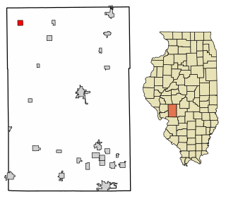
Scottville is a village in Macoupin County, Illinois, United States. The population was 93 at the 2020 census.

<span class="mw-page-title-main">Sardis, Kentucky</span> City in Kentucky, United States

Sardis is a home rule-class city in Mason and Robertson counties in the U.S. state of Kentucky. The population was 60 as of the 2020 census, down from 103 in 2010.

<span class="mw-page-title-main">Mason Township, Cass County, Michigan</span> Civil township in Michigan, United States

Mason Township is a civil township of Cass County in the U.S. state of Michigan. The population was 2,945 at the 2010 census.

<span class="mw-page-title-main">Clio, Michigan</span> City in Michigan, United States

Clio is a city in Genesee County in the U.S. state of Michigan. The city is located entirely within Vienna Township, but is administratively autonomous. As of the 2010 census, the city had a population of 2,646.

<span class="mw-page-title-main">Jonesville, Michigan</span> City in Michigan, United States

Jonesville is a city in Hillsdale County in the U.S. state of Michigan. The population was 2,176 at the 2020 census.

<span class="mw-page-title-main">Ingham Township, Michigan</span> Civil township in Michigan, United States

Ingham Township is a civil township of Ingham County in the U.S. state of Michigan. The population was 2,452 at the 2010 census.

<span class="mw-page-title-main">Mason, Michigan</span> City in Michigan, United States

Mason is the county seat of Ingham County in the U.S. state of Michigan. The population was 8,252 at the 2010 census. Mason was named after Stevens T. Mason, the state's first governor.

<span class="mw-page-title-main">Amber Township, Michigan</span> Civil township in Michigan, United States

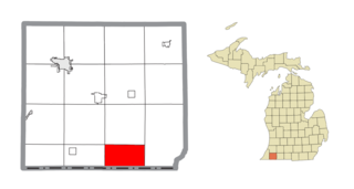
Amber Township is a civil township of Mason County in the U.S. state of Michigan. As of the 2020 census, the township population was 2,529.

<span class="mw-page-title-main">Branch Township, Michigan</span> Civil township in Michigan, United States

Branch Township is a civil township of Mason County in the U.S. state of Michigan. As of the 2020 census, the township population was 1,405. Branch Township was named after Branch County, Michigan.

<span class="mw-page-title-main">Custer, Michigan</span> Village in Michigan, United States

Custer is a village in Mason County in the U.S. state of Michigan. The population was 272 at the 2020 census. The village is located within Custer Township.

<span class="mw-page-title-main">Custer Township, Mason County, Michigan</span> Civil township in Michigan, United States

Custer Township is a civil township of Mason County in the U.S. state of Michigan. The population was 1,321 at the 2020 census. The village of Custer is located within the township.

<span class="mw-page-title-main">Free Soil Township, Michigan</span> Civil township in Michigan, United States

Free Soil Township is a civil township of Mason County in the U.S. state of Michigan. The population was 842 at the 2020 census. The village of Free Soil is located within the township.

<span class="mw-page-title-main">Logan Township, Mason County, Michigan</span> Civil township in Michigan, United States

Logan Township is a civil township of Mason County in the U.S. state of Michigan. The population was 329 at the 2020 census.

<span class="mw-page-title-main">Ludington, Michigan</span> City in Michigan, United States

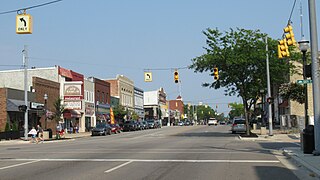
Ludington is a city in the U.S. state of Michigan. It is the county seat and the largest city in Mason County. The population was 7,655 at the 2020 census.

<span class="mw-page-title-main">Riverton Township, Michigan</span> Civil township in Michigan, United States

Riverton Township is a civil township of Mason County in the U.S. state of Michigan. The population was 1,232 at the 2020 census.

<span class="mw-page-title-main">Sheridan Township, Mason County, Michigan</span> Civil township in Michigan, United States

Sheridan Township is a civil township of Mason County in the U.S. state of Michigan. As of the 2020 census, the township population was 1,044.

<span class="mw-page-title-main">New Haven, West Virginia</span> Town in West Virginia, United States

New Haven is a town in Mason County, West Virginia, United States, along the Ohio River. The population was 1,485 at the 2020 census. It is part of the Point Pleasant, WV–OH Micropolitan Statistical Area.

<span class="mw-page-title-main">Ovid, Michigan</span> City in Michigan, United States

Ovid is a city in the U.S. state of Michigan. Nearly all of the city is located within Clinton County with only a very small portion extending east into Shiawassee County. The population was 1,603 at the 2010 census.

References

  1. City of Scottville (2020). "Departments – City of Scottville" . Retrieved April 12, 2020.
  2. 1 2 "2022 U.S. Gazetteer Files: Michigan". United States Census Bureau. Retrieved August 24, 2023.
  3. 1 2 "P1. Race – Scottville city, Michigan: 2020 DEC Redistricting Data (PL 94-171)". U.S. Census Bureau. Retrieved August 24, 2023.
  4. 1 2 "U.S. Census website". United States Census Bureau . Retrieved 2008-01-31.
  5. "US Board on Geographic Names". United States Geological Survey. 2007-10-25. Retrieved 2008-01-31.
  6. "Focus on our history: How county was named". Ludington Daily News. October 3, 1987. p. 2. Retrieved 30 April 2015.
  7. "Census of Population and Housing". Census.gov. Retrieved June 4, 2015.
  8. "U.S. Census website". United States Census Bureau . Retrieved 2012-11-25.
  9. "2020 CENSUS - SCHOOL DISTRICT REFERENCE MAP: Mason County, MI" (PDF). U.S. Census Bureau . Retrieved 2023-07-27. - Text list. Mason County Central Schools is of the label 23130, which is seen over water on the Census Map. Remember the purple dotted line is a school district boundary, so trace the area within the boundary around the bend to the area of Scottville, Michigan.