Sheboygan County is a county in the U.S. state of Wisconsin. It is named after the Sheboygan River. As of the 2020 census, the population was 118,034. Its county seat is Sheboygan. The county was created in 1836 and organized in 1846. At the time, it was located in the Wisconsin Territory. Sheboygan County comprises the Sheboygan, WI Metropolitan Statistical Area. Part of the Holyland region is located in northwestern Sheboygan County.
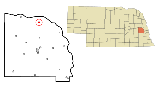
Cedar Bluffs is a village in Saunders County, Nebraska, United States. The population was 615 at the 2020 census. Cedar Bluffs was a point on the Mormon, Oregon, and California Trails.

Blooming Grove is a town in Dane County, Wisconsin, United States. The population was 1,768 at the 2000 census. The unincorporated community of Hope is located partially within Blooming Grove. Although once much larger, currently the town of Blooming Grove consists of a few scattered neighborhoods and individual properties broken into discontinuous sections by the cities of Madison and Monona. Blooming Grove is set to be dissolved and annexed into the city of Madison by 2027.
Red Cedar is a town in Dunn County, Wisconsin, United States. The population was 1,673 at the 2000 census. The unincorporated communities of Cedar Falls and Rusk are located in the town.

St. Cloud is a village in Fond du Lac County, Wisconsin, United States, along the Sheboygan River. The population was 489 at the 2020 census. St. Cloud is part of The Holyland region in northeastern Fond du Lac County.

Monticello is a village in Green County, Wisconsin, United States. The population was 1,192 as of the 2020 census.

Cleveland is a village in Manitowoc County, Wisconsin, United States. The population was 1,579 at the 2020 census.

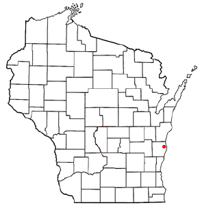
Adell is a village in Sheboygan County, Wisconsin, United States. The population was 498 at the 2020 census. It is included in the Sheboygan, Wisconsin Metropolitan Statistical Area.

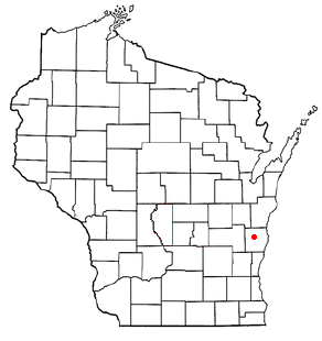
Cascade is a village in Sheboygan County, Wisconsin, United States. The population was 709 at the 2010 census. It is included in the Sheboygan, Wisconsin Metropolitan Statistical Area. Wisconsin Highway 28 passes through Cascade.

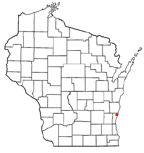
Glenbeulah is a village in Sheboygan County, Wisconsin, United States. The population was 463 at the 2010 census. It is included in the Sheboygan, Wisconsin Metropolitan Statistical Area. Glenbeulah is situated on the Mullet River.

Herman is a town in Sheboygan County, Wisconsin, United States. The population was 2,044 at the 2000 census. It is included in the Sheboygan Metropolitan Statistical Area. The town is home to Lakeland University.
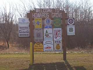
Howards Grove is a village in Sheboygan County, Wisconsin, United States. The population was 3,237 at the 2020 census. It is part of the Sheboygan, Wisconsin Metropolitan Statistical Area.

Kohler is a village in Sheboygan County, Wisconsin, United States, along the Sheboygan River. The population was 2,120 at the 2010 census. It is included in the Sheboygan, Wisconsin Metropolitan Statistical Area.

Oostburg is a village in Sheboygan County, Wisconsin, United States. The population was 3,056 at the 2020 census. It is included in the Sheboygan, Wisconsin Metropolitan Statistical Area.

Scott is a town in Sheboygan County, Wisconsin, United States. The population was 1,804 at the 2000 census. The unincorporated communities of Batavia, Beechwood, and Cranberry Marsh are located within the town. It is included in the Sheboygan, Wisconsin Metropolitan Statistical Area.

Sherman is a town in Sheboygan County, Wisconsin, United States whose population was 1,520 at the 2000 census. It is included in the Sheboygan, Wisconsin Metropolitan Statistical Area. The unincorporated communities of Gooseville and Silver Creek are located in the town.
Plymouth is a town in Sheboygan County, Wisconsin. The population was 3,115 at the time of the 2000 census. It is included in the Sheboygan, Wisconsin Metropolitan Statistical Area. The City of Plymouth is located within the town, but is politically independent. The unincorporated community of New Paris is also located in the town.
Belgium is a town in Ozaukee County, Wisconsin, United States. The population was 1,513 at the 2000 census. The Village of Belgium is surrounded on all sides by the town, and the unincorporated communities of Decker, Holy Cross, Lake Church, and Sauk Trail Beach are located in the town, as is the ghost town of Stonehaven. The unincorporated community of Dacada is also partially located in the town.

Belgium is a village in Ozaukee County, Wisconsin, United States. Located along Interstate 43, the village is one of the northernmost communities in the Milwaukee metropolitan area. The population was 2,245 at the 2020 census.
Sheboygan is a town in Sheboygan County, Wisconsin, known as the Town of Sheboygan to differentiate from the county and city of Sheboygan. The population was 8,136 according to the 2020 Census. It is included in the Sheboygan, Wisconsin Metropolitan Statistical Area. This separate municipality is located north and west of the city of Sheboygan, with varying boundaries along the city and village lines of Sheboygan and Kohler, including enclaves of homes connected to the town by inches-long lines of property.