Fisherman Island National Wildlife Refuge | |
---|---|
IUCN category IV (habitat/species management area) | |
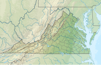
Map of the United States | |
Location | Northampton County, Virginia, United States |
Nearest city | Cheriton, Virginia / Virginia Beach, Virginia |
Coordinates | 37°05′45″N75°57′29″W / 37.09597°N 75.95798°W [1] Coordinates: 37°05′45″N75°57′29″W / 37.09597°N 75.95798°W [2] |
Area | 1,850 acres (7.5 km2) |
Established | 1973 |
Governing body | U.S. Fish and Wildlife Service |
Website | Fisherman Island National Wildlife Refuge |
Fisherman Island is the southernmost island on the Delmarva Peninsula chain of barrier islands. Located at the entrance to the Chesapeake Bay, the island is subject to great changes in its landscape from waves and runoff. It first formed about 200 to 250 years ago.
Gun batteries were emplaced on the island to defend Chesapeake Bay in both world wars; these were part of Fort John Custis during World War II. The US Navy used Fisherman Island from 1949 to 1969. [3]
Fisherman Island National Wildlife Refuge is located near the United States Fish and Wildlife Service's Eastern Shore of Virginia National Wildlife Refuge, and is cut in half by the presence of U.S. Highway 13 and the Chesapeake Bay Bridge Tunnel. The refuge is closed to the public.
The island is the habitat to migratory waterfowl, shorebirds, and nesting waterbirds. In September 2003, the island was almost entirely flooded by Hurricane Isabel.
The Virginia Capes are the two capes, Cape Charles to the north and Cape Henry to the south, that define the entrance to Chesapeake Bay on the eastern coast of North America.
The Chesapeake Bay Bridge–Tunnel is a 17.6-mile (28.3 km) bridge–tunnel that crosses the mouth of the Chesapeake Bay between Delmarva and Hampton Roads in the U.S. state of Virginia. It opened in 1964, replacing ferries that had operated since the 1930s. A major project to dualize its bridges was completed in 1999, and a similar project to dualize one of its tunnels is currently underway.
The Eastern Shore of Virginia consists of two counties on the Atlantic coast detached from the mainland of the Commonwealth of Virginia in the United States. The 70-mile-long (110 km) region is part of the Delmarva Peninsula and is separated from the rest of Virginia by the Chesapeake Bay. Its population was 45,695 as of 2020.
The Great Dismal Swamp National Wildlife Refuge was created in 1974 to help protect and preserve a portion of the Great Dismal Swamp, a marshy region on the Coastal Plain of southeastern Virginia and northeastern North Carolina between Norfolk, Virginia, and Elizabeth City, North Carolina in the United States. It is located in parts of the independent cities of Chesapeake and Suffolk in Virginia, and the counties of Camden, Gates, and Pasquotank in North Carolina.
Kent Island is the largest island in the Chesapeake Bay and a historic place in Maryland. To the east, a narrow channel known as the Kent Narrows barely separates the island from the Delmarva Peninsula, and on the other side, the island is separated from Sandy Point, an area near Annapolis, by roughly four miles (6.4 km) of water. At only four miles wide, the main waterway of the bay is at its narrowest at this point and is spanned here by the Chesapeake Bay Bridge. The Chester River runs to the north of the island and empties into the Chesapeake Bay at Kent Island's Love Point. To the south of the island lies Eastern Bay. The United States Census Bureau reports that the island has 31.62 square miles (81.90 km2) of land area.
Assateague Light is the 142-foot-tall (43 m) lighthouse located on the southern end of Assateague Island off the coast of the Virginia Eastern Shore, United States. The lighthouse is located within the Chincoteague National Wildlife Refuge and can be accessed by road from Chincoteague Island over the Assateague Channel. It is owned by the U.S. Fish and Wildlife Service and operated by the U.S. Coast Guard and is still used as an active aid in navigation. The keeper's quarters are used as seasonal housing for refuge temporary employees, volunteers, and interns. Constructed in 1867 to replace a shorter lighthouse 45-foot-tall (14 m) built in 1833, the lighthouse is conical in shape and is painted in alternating bands of red and white.
Bon Secour is an unincorporated community in Baldwin County, Alabama, United States. It lies along the eastern coastline of Bon Secour Bay. Bon Secour is over 35 miles (56 km) due east of the Alabama–Mississippi state line, near Gulf Shores, and over 45 miles (72 km) west of Pensacola, Florida. The name "Bon Secour" derives from the French phrase meaning "safe harbor" due to the secluded location on the inside coast of the Fort Morgan peninsula of southern Alabama.
The effects of Hurricane Isabel in Virginia proved to be the costliest disaster in the history of Virginia. Hurricane Isabel formed from a tropical wave on September 6, 2003 in the tropical Atlantic Ocean. It moved northwestward, and within an environment of light wind shear and warm waters it steadily strengthened to reach peak winds of 265 km/h (165 mph) on September 11. After fluctuating in intensity for four days, Isabel gradually weakened and made landfall on the Outer Banks of North Carolina with winds of 165 km/h (105 mph) on September 18. It quickly weakened over land as it passed through central Virginia, and Isabel became extratropical over western Pennsylvania on September 19.
Wassaw Island is one of the Sea Islands. It is located on the Atlantic Ocean off the coast of the U.S. state of Georgia and is within the borders of Chatham County. The island and its surrounding marshlands are part of the Wassaw National Wildlife Refuge, which has a total area of 10,053 acres (40.68 km2) of marsh, mudflats, and tidal creeks, including approximately 7 miles (11 km) of undeveloped beaches. The land mass is 76 percent salt marshes and 24 percent beaches, dunes, and maritime forest. The refuge is a part of the Savannah Coastal Refuges Complex.
Presquile National Wildlife Refuge in the U.S. state of Virginia is one of four refuges that comprise the Eastern Virginia Rivers National Wildlife Refuge Complex. The refuge is a 1,329-acre (5.38 km2) island in the James River, located approximately 20 miles (32 km) south of Richmond. It is located in the easternmost part of Chesterfield County, northeast of Hopewell.
The Eastern Shore of Virginia National Wildlife Refuge is a 1,127-acre (4.56 km2) wildlife refuge located in Northampton County, Virginia, at the southern end of the Eastern Shore and near the tip of the Delmarva Peninsula. It is managed by the United States Fish and Wildlife Service.
The Plum Tree Island National Wildlife Refuge is a National Wildlife Refuge in Poquoson, Virginia, located on the southwestern corner of the Chesapeake Bay. The 3,501-acre (14.17 km2) refuge is located at about the midpoint of the Atlantic Flyway, and is one of four refuges that comprise the Eastern Virginia Rivers National Wildlife Refuge Complex.
The Rappahannock River Valley National Wildlife Refuge was established in 1996 to protect and enhance fish, wildlife, plants and their habitats for future generations. On the Rappahannock River Valley National Wildlife Refuge, birds raise their young in native habitats of field, forest and marsh. They find rest and nourishment during migration and a haven in winter. U.S. Fish & Wildlife staff manage refuge lands and waters with an emphasis on species whose populations have declined, assisting them on the road to recovery.
Mockhorn Island Wildlife Management Area is a 7,356-acre (29.77 km2) Wildlife Management Area (WMA) in Northampton County on the Eastern Shore of Virginia. The larger of its two tracts is Mockhorn Island, a 7,000-acre (28 km2) island separated from the mainland Eastern Shore and the Virginia Barrier Islands by shallow bays and consisting mainly of tidal marshland along the Atlantic coast; in addition, the area contains a 356-acre (1.44 km2) tract of marsh and upland areas on the mainland. Much of Mockhorn Island is submerged except at low tide. Although much of the island is composed of periodically inundated cordgrass, several hummocks that remain above water host loblolly pine, eastern redcedar, southern wax myrtle, greenbriar, honeysuckle, and poison ivy. The area intends to preserve the natural state of the island.
Eastern Neck National Wildlife Refuge, a part of the Chesapeake Marshlands National Wildlife Refuge Complex, is a 2,286-acre (9.25 km2) island located at the confluence of the Chester River and the Chesapeake Bay. Established in 1962 as a sanctuary for migratory birds, Eastern Neck National Wildlife Refuge provides natural habitat for over 240 bird species — including bald eagles and transitory peregrine falcons — and is a major staging site for tundra swans.
Glenn Martin National Wildlife Refuge includes the northern half of Smith Island, which lies 11 miles (18 km) west of Crisfield, Maryland, and Watts Island, which is located between the eastern shore of Virginia and Tangier Island. Both islands are situated in the lower Chesapeake Bay.
Susquehanna River National Wildlife Refuge is located on a small island 3.79 acres (15,300 m2) in size located at the mouth of the Susquehanna River in Harford County, Maryland. It is a satellite refuge managed by Blackwater National Wildlife Refuge. In the 1920s, the island was used as a fish hatchery to produce such species as shad.
Occupying a peninsula between the Sakonnet River and Rhode Island Sound, the 242-acre (0.98 km2) Sachuest Point National Wildlife Refuge is a very popular site for the over 65,000 annual visitors each year. It is located in the southeasternmost part of the Town of Middletown.
Cape Charles Air Force Station is a closed United States Air Force General Surveillance Radar station. It is located 3.6 miles (5.8 km) south of Townsend, Virginia. It was closed in 1981. From 1941 to 1948 it was Fort John Custis of the United States Army Coast Artillery Corps. Since 1984 the site has been in the Eastern Shore of Virginia National Wildlife Refuge. For this article's purposes the term "Fort John Custis" includes the nearby Fisherman Island.
The Virginia Barrier Islands are a continuous chain of long, narrow, low-lying, sand and scrub barrier islands separated from one another by narrow inlets and from the mainland by a series of shallow marshy tidal bays along the entire coast of the Virginia end of the Delmarva Peninsula. Several of these islands were once significantly larger, covered with pine forests, and inhabited. After the completion of the New York, Philadelphia and Norfolk Railroad in the late 19th Century, at least five lavish hunting and fishing clubs were established on Virginia's barrier islands and they became a playground for wealthy sportsmen from Northeastern cities who would arrive by train. US President Grover Cleveland visited Hog Island to hunt waterfowl and go fishing in the early 1890s.
This article incorporates public domain material from websites or documents ofthe United States Fish and Wildlife Service .