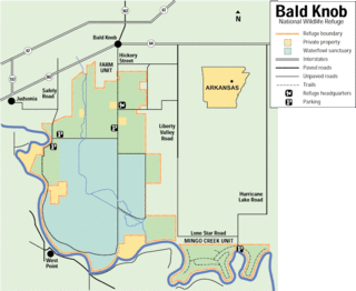
The Bald Knob National Wildlife Refuge is a 15,022 acres (60.79 km2) (2014) wildlife refuge located in White County, Arkansas about two miles south of the town of Bald Knob. The refuge is managed by the United States Fish and Wildlife Service. The refuge features large numbers of migratory waterfowl and bald eagles during the winter months.
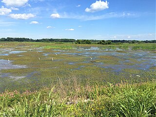
The Shiawassee National Wildlife Refuge is a 9,870.35 acres (39.9439 km2) National Wildlife Refuge in Saginaw County managed by the United States Fish and Wildlife Service. It is located in the central portion of the lower peninsula of the U.S. state of Michigan, approximately 25 miles (40 km) south of the Saginaw Bay in Lake Huron and five miles (8 km) south of the city of Saginaw in the county's Spaulding and James townships. It was established in 1953 to provide habitat for migratory waterfowl.

The Great Dismal Swamp National Wildlife Refuge was created in 1974 to help protect and preserve a portion of the Great Dismal Swamp, a marshy region on the Coastal Plain of southeastern Virginia and northeastern North Carolina between Norfolk, Virginia, and Elizabeth City, North Carolina in the United States. It is located in parts of the independent cities of Chesapeake and Suffolk in Virginia, and the counties of Camden, Gates, and Pasquotank in North Carolina.

Missisquoi National Wildlife Refuge is a National Wildlife Refuge in the U.S. state of Vermont located on the eastern shore of Lake Champlain and the southern side of Missisquoi Bay. The refuge is in Franklin County in the northwest corner of the state near the International Boundary with Canada.
The Wheeler National Wildlife Refuge is a 35,000-acre (142 km2) national wildlife refuge (NWR) located along the Tennessee River near Decatur, Alabama. Named after Major General Joseph Wheeler, it was established to provide a habitat for wintering and migrating birds in the Eastern United States.
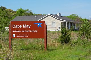
The Cape May National Wildlife Refuge is a protected area on the Cape May Peninsula in Cape May County, New Jersey. It is part of the National Wildlife Refuge System and managed by the United States Fish and Wildlife Service. Established in January 1989 with 90 acres (0.36 km2) acquired from the Nature Conservancy, it has since grown to more than 11,000 acres (45 km2) in size, and plans call for its further expansion to more than 21,200 acres (86 km2). It comprises three distinct and non-contiguous units: the Delaware Bay Division, the Great Cedar Swamp Division and the Two Mile Beach Unit. Located in the Middle Atlantic coastal forests ecoregion, the cape provides habitat for large numbers of migratory birds.

The Atlantic Flyway is a major north-south flyway for migratory birds in North America. The route generally starts in Greenland, then follows the Atlantic coast of Canada, then south down the Atlantic Coast of the United States to the tropical areas of South America and the Caribbean. Every year, migratory birds travel up and down this route following food sources, heading to breeding grounds, or traveling to overwintering sites.

Baskett Slough National Wildlife Refuge is in northwestern Oregon, 10 miles (16 km) west of Salem in Polk County. The Refuge consists of 1,173 acres (4.75 km2) of cropland, which provide forage for wintering geese, 300 acres (1.2 km2) of forests, 550 acres (2.2 km2) of grasslands, and 500 acres (2.0 km2) of shallow water seasonal wetlands and 35 acres (0.14 km2) of permanent open water. In 1965, Baskett Slough National Wildlife Refuge was created to help ensure some of the original habitat remained for species preservation. The refuge is managed by the U.S. Fish and Wildlife Service, an agency of the U.S. Department of the Interior.

The James River National Wildlife Refuge is a National Wildlife Refuge located along the James River in eastern Prince George County, Virginia. Its management is overseen by the United States Fish and Wildlife Service.
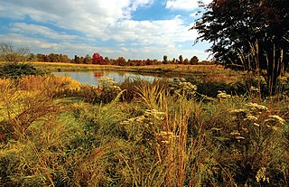
The Occoquan Bay National Wildlife Refuge is a National Wildlife Refuge located where the Occoquan River meets the Potomac River in Woodbridge, Virginia, United States between Belmont Bay and Occoquan Bay. The 644-acre (2.61 km2) site, about half of which is wetlands, was a popular tourist spot known as Dawson Beach until the 1940s, after which it was used for military research by the U.S. Army's Harry Diamond Laboratories from the 1960s to the 1990s. When the land was purchased from the military, it was temporarily called the Marumsco National Wildlife Refuge. The refuge was formally established and renamed in 1998, and is now managed by the United States Fish and Wildlife Service as part of the Potomac River National Wildlife Refuge Complex.

The Plum Tree Island National Wildlife Refuge is a National Wildlife Refuge in Poquoson, Virginia, located on the southwestern corner of the Chesapeake Bay. The 3,501-acre (14.17 km2) refuge is located at about the midpoint of the Atlantic Flyway, and is one of four refuges that comprise the Eastern Virginia Rivers National Wildlife Refuge Complex.

The Rappahannock River Valley National Wildlife Refuge is a National Wildlife Refuge in Warsaw, Virginia, United States that was established in 1996. It is managed by the United States Fish and Wildlife Service.
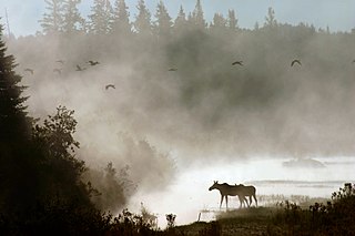
Aroostook National Wildlife Refuge is located on part of the former Loring Air Force Base, in Aroostook County, Maine. It was established in 1998, when 4,700 acres (19 km2) were transferred from the United States Air Force to the United States Fish and Wildlife Service. This refuge also administers some 2,400 acres (970 ha) of wetland conservation easements throughout Aroostook County. It is close to the Aroostook State Park where visitors can camp, hike, fish, and cross-country ski. In a portion of Maine where the landscape is dominated by agricultural crops such as potatoes and broccoli, Aroostook National Wildlife Refuge protects valuable wildlife habitat. The variety of habitat types attracts a diversity of wildlife species.

Glenn Martin National Wildlife Refuge includes the northern half of Smith Island, which lies 11 miles (18 km) west of Crisfield, Maryland, and Watts Island, which is located between the eastern shore of Virginia and Tangier Island. Both islands are situated in the lower Chesapeake Bay.

Swan Lake National Wildlife Refuge is a 10,795-acre (43.69 km2) National Wildlife Refuge established in 1937 and located in Chariton County, Missouri, 2 miles (3.2 km) south of the town of Sumner. It is located near the confluence of the Grand and Missouri Rivers.
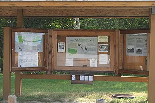
Great Bay National Wildlife Refuge was established in 1992 and is located along the eastern shore of New Hampshire's Great Bay in the town of Newington. The area was formerly part of a weapons storage area at Pease Air Force Base, which was closed in 1991. A variety of rich wildlife habitats from uplands to open waters can be found throughout the refuge.

Mackay Island National Wildlife Refuge was established in 1960 to provide habitat for migratory waterfowl, primarily the greater snow goose. It is located almost entirely on Knotts Island in the Currituck Sound between Back Bay in Virginia Beach, Virginia, and the open sound in North Carolina. Most of the refuge lies within North Carolina but some of it is in Virginia. The refuge is primarily made up of marsh habitat. This area has long been recognized for supporting significant migratory waterfowl populations and sport fishery resources, and is part of the Charles Kuralt Trail.

Situated along the Pee Dee River, Pee Dee National Wildlife Refuge contains 8,443 acres (34.17 km2) in Anson and Richmond Counties, North Carolina. The refuge was established to provide wintering habitat for migratory waterfowl. The refuge was established in October 1963 to provide habitat for geese and other waterfowl.
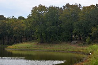
Hagerman National Wildlife Refuge (HNWR), a haven for migratory birds and other wildlife, lies in northwestern Grayson County, Texas, on the Big Mineral Arm of Lake Texoma, on the Red River between Oklahoma and Texas. This National Wildlife Refuge is made up of water, marsh, and upland habitat. Visitors can hike, observe wildlife, hunt, and fish throughout the year.
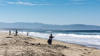
Salinas River National Wildlife Refuge is located approximately 11 miles north of Monterey, California, and 3 miles south of Castroville, California, at the point where the Salinas River empties into Monterey Bay. The 367-acre (1.49 km2) refuge encompasses several habitat types including sand dunes, pickleweed salt marsh, river lagoon, riverine habitat, and a saline pond. The refuge was established in 1974 because of its "particular value in carrying out the national migratory bird management program."


