The United States Forest Service (USFS) is an agency of the U.S. Department of Agriculture that administers the nation's 154 national forests and 20 national grasslands. The Forest Service manages 193 million acres (780,000 km2) of land. Major divisions of the agency include the Chief's Office, National Forest System, State and Private Forestry, Business Operations, and Research and Development. The agency manages about 25% of federal lands and is the only major national land management agency not part of the U.S. Department of the Interior, which manages the National Park Service, the U.S. Fish and Wildlife Service, and the Bureau of Land Management.

Coppicing is a traditional method of woodland management which exploits the capacity of many species of trees to put out new shoots from their stump or roots if cut down. In a coppiced wood, which is called a copse, young tree stems are repeatedly cut down to near ground level, resulting in a stool. New growth emerges, and after a number of years, the coppiced tree is harvested, and the cycle begins anew. Pollarding is a similar process carried out at a higher level on the tree in order to prevent grazing animals from eating new shoots. Daisugi, is a similar Japanese technique.
The Forestry Commission is a non-ministerial government department responsible for the management of publicly owned forests and the regulation of both public and private forestry in England.

The Minnesota Department of Natural Resources, or Minnesota DNR, is the agency of the U.S. state of Minnesota charged with conserving and managing the state's natural resources. The agency maintains areas such as state parks, state forests, recreational trails, and recreation areas as well as managing minerals, wildlife, and forestry throughout the state. The agency is divided into six divisions - Ecological & Water Resources, Enforcement, Fish & Wildlife, Forestry, Lands & Minerals, and Parks & Trails.

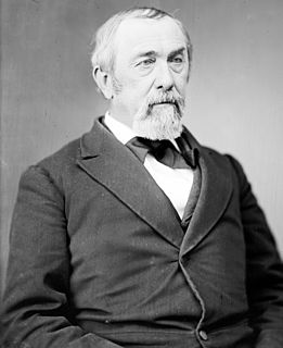
Beverly Browne Douglas was a U.S. Representative from Virginia.

Sun Pass State Forest is one of six state forests managed by the Oregon Department of Forestry. The forest is located 40 miles (64 km) north of Klamath Falls, Oregon near the southeastern corner of Crater Lake National Park. It is the largest single block of Oregon state forestry land east of the Cascade Mountains. The forest is managed as part of the Klamath-Lake District, comprising 21,317 acres (86.27 km2) of the 33,739 state-owned acres within the district.

King William County is a county located in the U.S. state of Virginia. As of the 2020 census, the population was 17,810. Its county seat is King William.

Santiam State Forest is one of six state forests managed by the Oregon Department of Forestry. The forest is located approximately 25 miles (40 km) southeast of Salem, Oregon, and includes 47,871 acres (193.73 km2) on the western slope of the Cascade Mountains in three Oregon counties: Clackamas, Linn, and Marion. It is bounded on the east by the Willamette National Forest and Mount Hood National Forest. Silver Falls State Park is located west of the forest. The rest of the land surrounding the forest belongs to the Bureau of Land Management or is privately owned. The forest is managed as part of the Department of Forestry's North Cascade District.
Bourassa State Forest is a 288-acre (117 ha) state forest located in Bedford County, Virginia, north of Smith Mountain Lake. It is used primarily for timber production, as an outdoor lab, and as a wildlife sanctuary. The forest is adjacent to the Smith Mountain Cooperative Wildlife Management Area.

Conway Robinson State Forest is a state forest in Prince William County, Virginia, near Manassas National Battlefield Park. It serves as a wildflower and wildlife sanctuary. The forest covers 444 acres (180 ha) of pine plantation, mixed pine, and old-growth hardwoods and is one of the largest tracts of undeveloped land owned by the Commonwealth in Northern Virginia.
Chilton Woods State Forest is a 397-acre (161 ha) state forest located on the Northern Neck in Lancaster County, Virginia, near the town of Warsaw.
The Virginia Department of Forestry (VDOF) was established in 1914 to prevent and suppress forest fires and reforest bare lands. Since its inception, the agency has grown and evolved to encompass other protection and management duties:
Aylett is an unincorporated community in King William County, Virginia, United States. It is located where Virginia State Route 360 crosses the Mattaponi River. William Aylett and his family had several prominent warehouses and mills in the area.
Alexander State Forest is located in Rapides Parish, Louisiana near the town of Woodworth. It was established in 1923 as a state demonstration forest. It contains the Indian Creek Recreation Area and the Alexander State Forest Headquarters Building, constructed in 1935, is on the National Register of Historic Places.

Big Woods State Forest is a 2,188-acre (8.85 km2) state forest in Sussex County, Virginia. It was the first state forest property to be established in southeast Virginia.

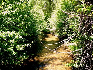
Zoar is a historic farmstead and national historic district located within Zoar State Forest near the Aylett community of King William County, Virginia, United States. It is also known as Mount Zoar, Upper Zoar, and Lower Zoar. The district encompasses 6 contributing buildings and 2 contributing sites. The main house was built in 1901, and is a 1 1/2-story Queen Anne style single-family frame dwelling. Associated with the house are the contributing smokehouse, kitchen / servant's quarters, dairy, corn crib and barn, horsefield, and family cemetery.

The Barry Point Fire was a wildfire that burned over 92,977 acres (376.26 km2) of Oregon and California forest land during the summer of 2012. The fire began on 5 August 2012, the result of a lightning strike. The fire consumed public forest and rangeland as well as private forest and grazing land located in Lake County, Oregon and Modoc County, California. The public lands effected by the fire are administered by the United States Forest Service and the Oregon Department of Forestry. The largest part of the private land was owned by the Collins Timber Company. At the peak of the firefighting effort, there were 1,423 personnel working on the fire. It took 22 days to fully contain the fire and then an additional three weeks to mop it up.


