
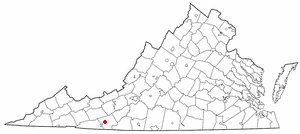
Patrick County is a county located on the central southern border of the Commonwealth of Virginia. As of the 2020 census, the county's population was 17,608. Its county seat is Stuart. It is located within both the rolling hills and valleys of the Piedmont Region and the more mountainous regions of Southwest Virginia.

Nelson County is a county located in the Commonwealth of Virginia, in the United States. As of the 2020 census, the population was 14,775. Its county seat is Lovingston. Nelson County is part of the Charlottesville, VA, Metropolitan Statistical Area.

Galax is an independent city in the southwestern part of the Commonwealth of Virginia. As of the 2020 census, the population was 6,720.

Floyd County is a county located in the Commonwealth of Virginia. As of the 2020 census, the population was 15,476. Its county seat is the town of Floyd. Floyd County is included in the Blacksburg-Christiansburg, VA Metropolitan Statistical Area.

Botetourt County is a US county that lies in the Roanoke Region of Virginia. Located in the mountainous portion of the state, the county is bordered by two major ranges, the Blue Ridge Mountains and the Appalachian Mountains.

Transylvania County is a county in the U.S. state of North Carolina. As of the 2020 census the population is 32,986. Its county seat is Brevard.
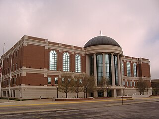
Warren County is a county located in the south central portion of the U.S. state of Kentucky. As of the 2020 census, the population was 134,554, making it the fifth-most populous county in Kentucky. The county seat is Bowling Green. Warren County is now classified as a wet county after voters approved the measure in 2018. The measure became law in January 2019 that allows alcohol to be sold county wide.

Hillsville is a town in Carroll County, Virginia, United States. The population was 2,897 at the 2020 census. It is the county seat of Carroll County.
Woodlawn is a census-designated place (CDP) in Carroll County, Virginia, United States. The population was 2,045 at the 2020 census.

Fries is an incorporated town located on the New River in Grayson County, Virginia, 15.5 miles northeast of the county seat in Independence — in Virginia's Blue Ridge Highlands and on Virginia's musical heritage trail, The Crooked Road.

Crowley's Ridge is a geological formation that rises 250 to 550 feet (170 m) above the alluvial plain of the Mississippi embayment in a 150-mile (240 km) line from southeastern Missouri to the Mississippi River near Helena, Arkansas. It is the most prominent feature in the Mississippi Alluvial Plain between Cape Girardeau, Missouri, and the Gulf of Mexico.

The Blue Ridge Parkway is a National Parkway and All-American Road in the United States, noted for its scenic beauty. The parkway, which is the longest linear park in the U.S., runs for 469 miles (755 km) through 29 counties in Virginia and North Carolina, linking Shenandoah National Park to Great Smoky Mountains National Park. It runs mostly along the spine of the Blue Ridge, a major mountain chain that is part of the Appalachian Mountains. Its southern terminus is at U.S. Route 441 (US 441) on the boundary between Great Smoky Mountains National Park and the Qualla Boundary of the Eastern Band of Cherokee Indians in North Carolina, from which it travels north to Shenandoah National Park in Virginia. The roadway continues through Shenandoah as Skyline Drive, a similar scenic road which is managed by a different National Park Service unit. Both Skyline Drive and the Virginia portion of the Blue Ridge Parkway are part of Virginia State Route 48 (SR 48), though this designation is not signed.

The Peaks of Otter are three mountain peaks in the Blue Ridge Mountains, overlooking the town of Bedford, Virginia, which lies nine miles (14 km) to the southeast along State Route 43. These peaks are Sharp Top, Flat Top, and Harkening Hill.

Mabry Mill is a watermill located at milepost 176.2 of Blue Ridge Parkway in Floyd County, Virginia. Run by the National Park Service, it is a tourist attraction. A short trail around the mill connects historical exhibits about life in rural Virginia. The trail allows visitors to view the gristmill, sawmill, and blacksmith shop.

The Foothills Parkway is a national parkway which traverses the foothills of the northern Great Smoky Mountains in East Tennessee, located in the southeastern United States. The 72.1-mile (114 km) parkway will connect U.S. Route 129 along the Little Tennessee River in the west with Interstate 40 (I-40) along the Pigeon River in the east.

Linville Falls is a waterfall located in the Blue Ridge Mountains of North Carolina in the United States. The falls move in several distinct steps, beginning in a twin set of upper falls, moving down a small gorge, and culminating in a high-volume 45-foot (14 m) drop.
The Rocky Knob AVA is an American Viticultural Area in a mountainous area east of the Blue Ridge Parkway in southwest Virginia. The AVA includes portions of Floyd and Patrick counties. The area is located on the eastern slopes of the Blue Ridge Mountains near the towns of Woolwine and Meadows of Dan and astride the Blue Ridge Parkway. It was established in 1983 and encompasses 9,000 acres (36 km2). The soil is primarily loam and gravel and is well-drained. Rocky Knob AVA was named for the eponymously named mountainous recreational area located within the AVA.

Julian Price Memorial Park is a park of 4,200 acres (17 km2) at the foot of Grandfather Mountain in North Carolina, named in honor of Julian Price. It is at milepost 297 on the Blue Ridge Parkway and directly adjacent to the Moses H. Cone Memorial Park. Together these parks comprise the largest developed area set aside for public recreation on the Parkway. The park is managed by the National Park Service which received the lands from the Jefferson Pilot Standard Life Insurance Company shortly after Price's death when they received it through his will. The grounds are also known for the fact that the nation's largest National Lumberjack Association rally is held here annually.
Roanoke Mountain is a mountain in Virginia. It is located two miles south of the Roanoke River and one mile east of the Blue Ridge Parkway.

Doughton Park is the largest recreation area the National Park Service manages on the Blue Ridge Parkway. It is located between mile markers 238.5 - 244.7 on the border between Wilkes and Alleghany Counties in North Carolina. Doughton Park consists of highland meadows with numerous scenic overlooks, miles of hiking and bridle trails, areas for camping and cookouts, and it is one of the few areas on the Parkway that has a restaurant along with an adjacent visitors center maintained by the National Park Service. Elevations in Doughton Park generally range from 3,500 to 4,000 feet. The park is named after North Carolina politician Robert L. Doughton, who lived in nearby Laurel Springs, North Carolina and who as a US Congressman played a key role in the creation of the Blue Ridge Parkway in the 1930s.
