Prairies are ecosystems considered part of the temperate grasslands, savannas, and shrublands biome by ecologists, based on similar temperate climates, moderate rainfall, and a composition of grasses, herbs, and shrubs, rather than trees, as the dominant vegetation type. Temperate grassland regions include the Pampas of Argentina, Brazil and Uruguay, and the steppe of Ukraine, Russia and Kazakhstan. Lands typically referred to as "prairie" tend to be in North America. The term encompasses the area referred to as the Interior Lowlands of Canada, the United States, and Mexico, which includes all of the Great Plains as well as the wetter, hillier land to the east.

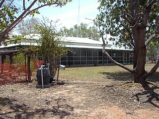
Welford is a national park in Central West Queensland, Australia, 991 km west of Brisbane. It is located 30km to the South-east of Jundah. The park was established in 1994 to protect the biodiversity of the Mulga Lands, Mitchell Grass Downs and Channel Country bioregions. The southern border is marked by the Barcoo River.

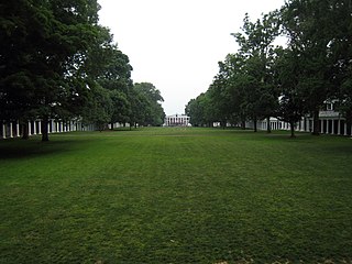
A lawn is an area of soil-covered land planted with grasses and other durable plants such as clover which are maintained at a short height with a lawn mower and used for aesthetic and recreational purposes—it is also commonly referred to as part of a garden. Lawns are usually composed only of grass species, subject to weed and pest control, maintained in a green color, and are regularly mowed to ensure an acceptable length. Lawns are used around houses, apartments, commercial buildings and offices. Many city parks also have large lawn areas. In recreational contexts, the specialised names turf, pitch, field or green may be used, depending on the sport and the continent.

Poa pratensis, commonly known as Kentucky bluegrass, smooth meadow-grass, or common meadow-grass, is a perennial species of grass native to practically all of Europe, North Asia and the mountains of Algeria and Morocco. Although the species is spread over all of the cool, humid parts of the United States, it is not native to North America. The Spanish Empire brought the seeds of Kentucky bluegrass to the New World in mixtures with other grasses. In its native range, Poa pratensis forms a valuable pasture plant, characteristic of well-drained, fertile soil. It is also used for making lawns in parks and gardens and has established itself as a common invasive weed across cool moist temperate climates like the Pacific Northwest and the Northeastern United States. When found on native grasslands in Canada, for example, it is considered an unwelcome exotic plant, and is indicative of a disturbed and degraded landscape.

The Chihuahuan Desert is a desert ecoregion designation covering parts of northern Mexico and the southwestern United States. It occupies much of far West Texas, the middle to lower Rio Grande Valley and the lower Pecos Valley in New Mexico, and a portion of southeastern Arizona, as well as the central and northern portions of the Mexican Plateau. It is bordered on the west by the Sonoran Desert, the Colorado Plateau, and the extensive Sierra Madre Occidental range, along with northwestern lowlands of the Sierra Madre Oriental range. Its largest, continual expanse is located in Mexico, covering a large portion of the state of Chihuahua, along with portions of Coahuila, north-eastern Durango, the extreme northern part of Zacatecas, and small western portions of Nuevo León. With an area of about 501,896 km2 (193,783 sq mi), it is the largest desert in North America. The desert is fairly young, existing for only 8000 years.

Panicum virgatum, commonly known as switchgrass, is a perennial warm season bunchgrass native to North America, where it occurs naturally from 55°N latitude in Canada southwards into the United States and Mexico. Switchgrass is one of the dominant species of the central North American tallgrass prairie and can be found in remnant prairies, in native grass pastures, and naturalized along roadsides. It is used primarily for soil conservation, forage production, game cover, as an ornamental grass, in phytoremediation projects, fiber, electricity, heat production, for biosequestration of atmospheric carbon dioxide, and more recently as a biomass crop for ethanol and butanol.
Grass Point State Park is a 114-acre (0.46 km2) state park located in the Town of Orleans in Jefferson County, New York. The park is located along the St. Lawrence River by NY 12 and NY 180, between Clayton and Alexandria Bay.

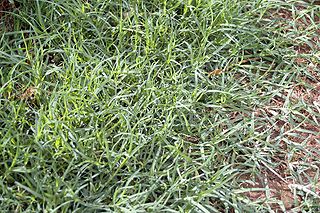
Cynodon dactylon, commonly known as Bermuda grass, is a grass found worldwide. It is native to Europe, Africa, Australia and much of Asia. It has been introduced to the Americas. Contrary to its common name, it is not native to Bermuda and is in fact an abundant invasive species there. In Bermuda it has been known as "crab grass". Other names are Dhoob, dūrvā grass, ethana grass, dubo, dog grass, dog's tooth grass, Bahama grass, crab grass, devil's grass, couch grass, Indian doab, arugampul, grama, wiregrass and scutch grass.

Carley State Park is a state park of Minnesota, United States, about 15 miles (24 km) northeast of Rochester and about 2 miles (3.2 km) south of Plainview in Wabasha County. It is used for picnics, camping, hiking, and other outdoor recreation. It is known for the bluebell flowers that bloom there every spring.

The Loess Hills are a formation of wind-deposited loess soil in the westernmost parts of Iowa and Missouri, and the easternmost parts of Nebraska and Kansas, along the Missouri River.

Crystal River is a very short river in Citrus County, Florida, flowing into the Gulf of Mexico. It is just seven miles long, and has a drainage basin of five square miles, joining Kings Bay to the Gulf of Mexico. The river's significance is in the thirty natural springs that add an average of 300 million gallons of warm water to the river every day. These springs include Three Sisters Springs.

The Patagonian Desert, also known as the Patagonian Steppe, is the largest desert in Argentina and is the 8th largest desert in the world by area, occupying 673,000 square kilometers (260,000 mi2). It is located primarily in Argentina and is bounded by the Andes, to its west, and the Atlantic Ocean to its east, in the region of Patagonia, southern Argentina. To the north the desert grades into the Cuyo Region and the Monte. The central parts of the steppe are dominated by shrubby and herbaceous plant species albeit to the west, where precipitation is higher, bushes are replaced by grasses. Topographically the deserts consist of alternating tablelands and massifs dissected by river valleys and canyons. The more western parts of the steppe host lakes of glacial origin and grades into barren mountains or cold temperate forests along valleys.

South Dakota is a state located in the north-central United States. It is usually considered to be in the Midwestern region of the country. The state can generally be divided into three geographic regions: eastern South Dakota, western South Dakota, and the Black Hills. Eastern South Dakota is lower in elevation and higher in precipitation than the western part of the state, and the Black Hills are a low, isolated mountain group in the southwestern corner of the state. Smaller sub-regions in the state include the Coteau des Prairies, Missouri Coteau, James River Valley, and the Dissected Till Plains. Geologic formations in South Dakota range in age from two billion-year-old Precambrian granite in the Black Hills to glacial till deposited over the last few million years. South Dakota is the 17th-largest state in the country.
Ogdens Cave Natural Area Preserve is a 131-acre (53 ha) Natural Area Preserve located in Frederick County, Virginia. The preserve protects a cave that carries a below-ground branch of Buffalo Marsh Run, which also flows overland through the preserve.
Triangle Park is a former American football stadium located in Dayton, Ohio. The stadium was home to the Dayton Triangles of the National Football League from 1920 to 1929. It held a capacity of 5,000 spectators. It was located at the confluence of the Great Miami River and Stillwater River. On October 3, 1920, it hosted the first NFL game against the Columbus Panhandles.

Chasmanthium latifolium, known as northern wood-oats, inland sea oats, northern sea oats, and river oats is a species of grass native to the central and eastern United States, Manitoba, and northeastern Mexico; it grows as far north as Pennsylvania and Michigan, where it is a threatened species. The species was previously classified as Uniola latifolia.

Muscota Marsh is a one-acre public park in the Inwood section of the borough of Manhattan in New York City, on the shore of Spuyten Duyvil Creek, a section of the Harlem River. It is adjacent to the much larger Inwood Hill Park and Columbia University's Baker Athletics Complex. The park is notable for its views and for its ecological conservation features.
Pennsylvania State Game Lands Number 58 are Pennsylvania State Game Lands in Columbia County, Pennsylvania, in the United States. They are one of six State Game Lands in Columbia County and Montour County and are the second-largest of those State Game Lands. The game lands have an area of 12,646 acres and are mostly forested. Numerous streams are within the game land's boundaries and several game animals inhabit the area. There is a high level of bird biodiversity. Recreational opportunities in the state game lands include a rifle range and several trails.

The Phoenix Vernal Pools are located in Fair Oaks, California, a suburb of Sacramento city around 20 miles east of the city of Sacramento and north of highway 50. This land consists of seasonally inundated wetlands that form after winter rains. The climate type of Phoenix Vernal Pools is classified as Mediterranean, receiving 24 in (610 mm) of rain per year. The rainwater percolates into the soil until it reaches an impermeable hardpan that causes an elevated water table, forming the vernal pools. The Phoenix Vernal Pool ecosystem is relatively unique as is supports many species of fauna and flora endemic to vernal pools.


