Elizabeth Hartwell Mason Neck National Wildlife Refuge

Last updated
Elizabeth Hartwell Mason Neck National Wildlife Refuge
IUCN category IV (habitat/species management area)
Mason Neck NWR.JPG
Mason Neck National Wildlife Refuge
USA Virginia relief location map.svg
Red pog.svg
Usa edcp relief location map.png
Red pog.svg
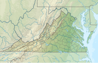
Location Fairfax County, Virginia, United States
Nearest city Woodbridge, Virginia
Coordinates 38°38′27″N77°09′12″W / 38.64083°N 77.15333°W / 38.64083; -77.15333
Area2,277 acres (9.21 km2)
Established1969
Governing body U.S. Fish and Wildlife Service
Website Elizabeth Hartwell Mason Neck National Wildlife Refuge

Elizabeth Hartwell Mason Neck National Wildlife Refuge is a National Wildlife Refuge of the United States located in Virginia. It is part of the Potomac River National Wildlife Refuge Complex. It is on Mason Neck, a peninsula in the Potomac River that forms part of the shoreline of Belmont Bay. The refuge is adjacent to Mason Neck State Park.

Established in 1969 and managed by the United States Fish and Wildlife Service, it was the first federal refuge created specifically for the protection of the bald eagle. It is 2,277 acres (9.21 km2) in size, with 4.4 miles (7.1 km) of shoreline. It is covered with oak and hickory forest and it includes the largest freshwater marsh in northern Virginia.

Since its founding, the refuge has been renamed for Elizabeth S. Hartwell, a local activist who fought to keep Mason Neck free of development.

Related Research Articles

<span class="mw-page-title-main">Northern Neck</span> Region in Virginia, United States

The Northern Neck is the northernmost of three peninsulas on the western shore of the Chesapeake Bay in the Commonwealth of Virginia. The Potomac River forms the northern boundary of the peninsula; the Rappahannock River demarcates it on the south. The land between these rivers was formed into Northumberland County in 1648, prior to the creation of Westmoreland County and Lancaster County. The Northern Neck encompasses the following Virginia counties: Lancaster, Northumberland, Richmond, King George and Westmoreland; it had a total population of 50,158 as of the 2020 census.

<span class="mw-page-title-main">Detroit River International Wildlife Refuge</span>

The Detroit River International Wildlife Refuge is the only international wildlife refuge in North America. Established in 2001 and managed jointly by the United States Fish and Wildlife Service and the Canadian Wildlife Service, it is located in a major metropolitan area. The Detroit River International Wildlife Refuge is one of over 540 National Wildlife Refuges managed by the U.S. Fish and Wildlife Service within the Department of the Interior. It occupies 7.88 square miles (20.41 km2) of scattered property but has drawn boundaries for further expansion.

Lake Mason National Wildlife Refuge is located in the center of the U.S. state of Montana. The refuge has numerous lakes and extensive marshlands along Willow Creek, which provide nesting habitat for over a hundred bird species. The refuge is managed from the Charles M. Russell National Wildlife Refuge and is normally unstaffed and has few visitor improvements. The refuge consists of three discontinuous areas; the Lake Mason area which has seasonal wetlands, the North section consisting primarily of uplands and the Willow Creek section which was set aside to protect habitat for the mountain plover.

<span class="mw-page-title-main">Chautauqua National Wildlife Refuge</span>

The Chautauqua National Wildlife Refuge is located on the Illinois River in Mason County northeast of Havana, Illinois. It is managed by the U.S. Fish and Wildlife Service as one of the four Illinois River National Wildlife and Fish Refuges.

<span class="mw-page-title-main">Mason Neck, Virginia</span> Census-designated place in Virginia, United States

Mason Neck is a peninsula jutting into the Potomac River to the south of Washington, D.C., in the U.S. state of Virginia. It is surrounded by Belmont Bay to the west, the Potomac River to the south and east, Gunston Cove to the northeast, and Pohick Bay to the north-northeast. The census-designated place (CDP) of Mason Neck forms the southernmost section of Fairfax County, in northern Virginia, and comprises an area of 20.0 square miles (51.8 km2), two-thirds of which is preserved as parkland by regional, state, and national authorities. The population of the Mason Neck CDP was 2,005 as of the 2010 census.

<span class="mw-page-title-main">Virginia State Route 242</span> Highway in Virginia

State Route 242 is a primary state highway in the U.S. state of Virginia. Known as Gunston Road, the state highway runs 3.58 miles (5.76 km) from U.S. Route 1 near Lorton east to SR 600 at the entrance to Gunston Hall, the plantation of George Mason, on Mason Neck in southeastern Fairfax County.

<span class="mw-page-title-main">Ohio River Islands National Wildlife Refuge</span> Park in the United States of America

The Ohio River Islands National Wildlife Refuge (ORINWR) is a National Wildlife Refuge (NWR) in non-contiguous sites consisting of islands along 362 miles (583 km) of the Ohio River, primarily in the U.S. state of West Virginia.

<span class="mw-page-title-main">Belmont Bay</span>

Belmont Bay is a body of water at the mouth of the Occoquan River between Fairfax and Prince William counties, Virginia. The bay covers about 1,500 acres (6.1 km2). The bay adjoins the Elizabeth Hartwell Mason Neck National Wildlife Refuge and Mason Neck State Park on the Fairfax County side and the Occoquan Bay National Wildlife Refuge in Prince William County. The bay was named for the home, "Belmont," which was built circa 1730 overlooking the bay by Catesby Cocke, who was the clerk of the Prince William County court. Belmont Bay is notable for sightings of bald eagles that nest and feed in the refuges and for the numerous Great Blue Herons. Belmont Bay is also a popular destination for pleasure boats. Summer weekends usually attract 40 to as many as 100 boats to this location.

<span class="mw-page-title-main">Eastern Shore of Virginia National Wildlife Refuge</span> United States National Wildlife Refuge in Virginia

The Eastern Shore of Virginia National Wildlife Refuge is a 1,127-acre (4.56 km2) wildlife refuge located in Northampton County, Virginia, at the southern end of the Eastern Shore and near the tip of the Delmarva Peninsula. It is managed by the United States Fish and Wildlife Service.

The Potomac River National Wildlife Refuge Complex is a complex of three National Wildlife Refuges in Virginia, located along the Potomac River.

<span class="mw-page-title-main">Featherstone National Wildlife Refuge</span> United States National Wildlife Refuge in Virginia

The Featherstone National Wildlife Refuge is a National Wildlife Refuge located along the Potomac River in Virginia, at the point where it meets Neabsco Creek. The 325 acres (1.32 km2) of tidal marsh has been administered by the United States Fish and Wildlife Service since 1970; currently, it is part of the Potomac River National Wildlife Refuge Complex. The refuge covers wetlands and woodlands, and has a railroad right-of-way bordering its western edge. It is currently accessible only by boat, but has been considered as a possible portion of the route for the Potomac Heritage National Scenic Trail.

<span class="mw-page-title-main">James River National Wildlife Refuge</span> United States National Wildlife Refuge in Virginia

The James River National Wildlife Refuge is a National Wildlife Refuge located along the James River in eastern Prince George County, Virginia. Its management is overseen by the United States Fish and Wildlife Service.

<span class="mw-page-title-main">Nansemond National Wildlife Refuge</span> National Wildlife Refuge of the United States

The Nansemond National Wildlife Refuge is a National Wildlife Refuge of the United States located along the Nansemond River in Suffolk, Virginia. It is managed by the United States Fish and Wildlife Service as a satellite of Great Dismal Swamp National Wildlife Refuge. In 1973 about 207 acres (0.84 km2) of salt marsh were transferred to the Service by the United States Navy to form the refuge. An additional 204 acres (0.83 km2) were transferred in 1999.

<span class="mw-page-title-main">Occoquan Bay National Wildlife Refuge</span> United States National Wildlife Refuge in Virginia

The Occoquan Bay National Wildlife Refuge is a National Wildlife Refuge located where the Occoquan River meets the Potomac River in Woodbridge, Virginia, United States between Belmont Bay and Occoquan Bay. The 644-acre (2.61 km2) site, about half of which is wetlands, was a popular tourist spot known as Dawson Beach until the 1940s, after which it was used for military research by the U.S. Army's Harry Diamond Laboratories from the 1960s to the 1990s. When the land was purchased from the military, it was temporarily called the Marumsco National Wildlife Refuge. The refuge was formally established and renamed in 1998, and is now managed by the United States Fish and Wildlife Service as part of the Potomac River National Wildlife Refuge Complex.

<span class="mw-page-title-main">Plum Tree Island National Wildlife Refuge</span> United States National Wildlife Refuge in Virginia

The Plum Tree Island National Wildlife Refuge is a National Wildlife Refuge in Poquoson, Virginia, located on the southwestern corner of the Chesapeake Bay. The 3,501-acre (14.17 km2) refuge is located at about the midpoint of the Atlantic Flyway, and is one of four refuges that comprise the Eastern Virginia Rivers National Wildlife Refuge Complex.

<span class="mw-page-title-main">Rappahannock River Valley National Wildlife Refuge</span> United States National Wildlife Refuge in Virginia

The Rappahannock River Valley National Wildlife Refuge is a National Wildlife Refuge in Warsaw, Virginia, United States that was established in 1996. It is managed by the United States Fish and Wildlife Service.

<span class="mw-page-title-main">Havasu National Wildlife Refuge</span> National Wildlife Refuge in California and Arizona in the United States

Havasu National Wildlife Refuge is a U.S. National Wildlife Refuge on the lower Colorado River in Arizona and California. It preserves habitat for desert bighorn sheep, the endangered southwestern willow flycatcher, and other animals. The refuge protects 30 river miles - 300 miles (480 km) of shoreline - from Needles, California, to Lake Havasu City, Arizona. One of the last remaining natural stretches of the lower Colorado River flows through the 20-mile-long (32 km) Topock Gorge.

McNary National Wildlife Refuge is a wildlife preserve, one of the national wildlife refuges operated by the United States Fish and Wildlife Service. Extending along the east bank of the Columbia River in southeastern Washington, from the confluence of the Snake River to the mouth of the Walla Walla River, and downstream into Oregon, McNary NWR is located in rural Burbank, but very close to the rapid development of the Tri-Cities. In fact, the refuge meets the definition of an "urban refuge." Few areas in North America support waterfowl populations in the extraordinary numbers found here. There are spectacular concentrations of Canada geese, mallards, and other waterfowl. More than half the mallards in the Pacific Flyway overwinter at some time in this portion of the Columbia River Basin.

Elizabeth van Laer Speer Hartwell was an American conservationist based in Virginia. The Elizabeth Hartwell Mason Neck National Wildlife Refuge is named in her memory.

Linton Neck also known as Burbage's Neck is a peninsula in eastern Prince William County, Virginia bounded by the Occoquan River, Occoquan Bay, and Neabsco Creek. It is named after the prominent Linton family of the colonial era. Historically farmlands, today the plantation is home to a number of communities including: Featherstone, Woodbridge, Marumsco, and Neabsco. Near the fall line of the Occoquan River at the very North of Linton Neck is the incorporated town of Occoquan, Virginia. At the very south of Linton Neck is the historic site of Rippon Lodge.

References

PD-icon.svg This article incorporates public domain material from websites or documents of the United States Fish and Wildlife Service .