Moab is the largest city and county seat of Grand County in eastern Utah in the western United States, known for its dramatic scenery. The population was 5,366 at the 2020 census. Moab attracts many tourists annually, mostly visitors to the nearby Arches and Canyonlands National Parks. The town is a popular base for mountain bikers who ride the extensive network of trails including the Slickrock Trail, and for off-roaders who come for the annual Moab Jeep Safari.

Blanding is a city in San Juan County, Utah, United States. The population was 3,375 at the 2010 census, making it the most populated city in San Juan County. It was settled in the late 19th century by Mormon settlers, predominantly from the famed Hole-In-The-Rock expedition. Economic contributors include mineral processing, mining, agriculture, local commerce, tourism, and transportation.

Monticello is a city located in San Juan County, Utah, United States and is the county seat. It is the second most populous city in San Juan County, with a population of 1,972 at the 2010 census. The Monticello area was settled in July 1887 by pioneers from the Church of Jesus Christ of Latter-day Saints. Monticello, named in honor of Thomas Jefferson's estate, became the county seat in 1895 and was incorporated as a city in 1910.

Newspaper Rock State Historic Monument is a Utah state monument featuring a rock panel carved with one of the largest known collections of petroglyphs. It is located in San Juan County, along Utah State Route 211, 28 miles (45 km) northwest of Monticello and 53 miles (85 km) south of Moab.

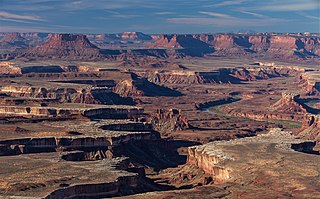
Canyonlands National Park is an American national park located in southeastern Utah near the town of Moab. The park preserves a colorful landscape eroded into numerous canyons, mesas, and buttes by the Colorado River, the Green River, and their respective tributaries. Legislation creating the park was signed into law by President Lyndon B. Johnson on September 12, 1964.

Charles Augustus Steen was a geologist who made and lost a fortune after discovering a rich uranium deposit in Utah during the uranium boom of the early 1950s.

The Slickrock Trail, is a popular mountain biking destination in Grand County, Utah, United States, a few miles northeast of the city of Moab.

The Manti–La Sal National Forest covers more than 1.2 million acres (4,900 km2) and is located in the central and southeastern parts of the U.S. state of Utah and the extreme western part of Colorado. The forest is headquartered in Price, with ranger district offices in Price, Ferron, Ephraim, Moab and Monticello. The maximum elevation is Mount Peale in the La Sal Mountains, reaching 12,721 feet (3,877 m) above sea level. The La Sal Mountains are the second highest mountain range in Utah after the Uintas. Parts of the forest are included in the Bears Ears National Monument.

Canyonlands Regional Airport, Moab is a regional commercial airport in Grand County, Utah, United States, 21 miles (34 km) northwest of Moab. The airport services two airlines, one subsidized by the Essential Air Service program.

State Route 211 is a state route in Utah that is an access road for Newspaper Rock State Historic Monument and the Needles district of Canyonlands National Park. The entire length of the highway has been designated the Indian Creek Corridor Scenic Byway.

Home of Truth is a ghost town located in San Juan County in southeastern Utah, United States. The settlement was a short-lived utopian religious intentional community in the 1930s, led by a spiritualist named Marie Ogden. The Home of Truth started in 1933 with an initial population of 22 people, but grew to around 100 at its peak.

Intrepid Potash, Inc., based in Denver, Colorado, is a fertilizer manufacturer. The company is the largest producer of potassium chloride, also known as muriate of potash, in the United States. It owns three mines, all in the Western U.S., near the cities of Carlsbad, New Mexico; Moab, Utah; and Wendover, Utah.

Fisher Towers are a series of towers made of Cutler sandstone capped with Moenkopi sandstone and caked with a stucco of red mud located near Moab, Utah. The Towers are named for a miner who lived near them in the 1880s. The Towers are world-renowned as a subject for photography and for its classic rock climbing routes.

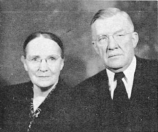
Oscar Walter McConkie was a Utah State Senator and leader in the Church of Jesus Christ of Latter-day Saints. He was the father of Bruce R. McConkie, a member of the Quorum of the Twelve Apostles of the LDS Church. A second son, Oscar W. McConkie, Jr., was a member of the Utah State Senate.

In geology, the Paradox Formation Is a Pennsylvanian age formation which consists of abundant evaporites with lesser interbedded shale, sandstone, and limestone. The evaporites are largely composed of gypsum, anhydrite, and halite. The formation is found mostly in the subsurface, but there are scattered exposures in anticlines in eastern Utah and western Colorado. These surface exposures occur in the Black Mesa, San Juan and Paradox Basins and the formation is found in the subsurface in southwestern Colorado, southeastern Utah, northeastern Arizona and northeastern New Mexico.
Monticello Airport is a city-owned, public-use airport located three nautical miles (6 km) north of the central business district of Monticello, a city in San Juan County, Utah, United States. The airport's current site on the east side of U.S. Route 191 opened in 2011, replacing the former Monticello Airport which was located on the west side of the highway.

The Sixshooter Peaks are two iconic sandstone summits located in Bears Ears National Monument in San Juan County, Utah, United States. The larger and higher North Sixshooter Peak rises to an elevation of 6,379 feet, whereas South Sixshooter Peak rises to 6,154 feet, with approximately 1.5 miles (2.4 km) separation between the two. These buttes tower nearly 1,400 feet above the surrounding terrain, and are historic landmarks visible from State Route 211 between Newspaper Rock and the Needles District of Canyonlands National Park. They are situated 1.5 mile outside the boundary of the park, and four miles northwest of Bridger Jack Butte. Variant names for the peaks include "North Six-Shooter Peak", "South Six-shooter Peak", "Six Shooter Peaks", and "Six-shooter Peak". They are so named because of their resemblance to a pair of revolvers pointing skyward.

Bridger Jack Butte is a sandstone butte located in Bears Ears National Monument, in San Juan County, Utah, United States. Set at the northern tip of Bridger Jack Mesa and above the confluence of Indian and Lavender Creeks, the summit rises to an elevation of 5,890 feet, and towers over 700 feet above the surrounding terrain and floor of Lavender Canyon to its west. This landmark is situated four miles southeast of the Sixshooter Peaks, and is visible from State Route 211 between Newspaper Rock and the Needles District of Canyonlands National Park. "Bridger Jack" was a Paiute medicine man.


