
The Ouse Valley Way is a 150-mile footpath in England, following the River Great Ouse from its source near Syresham in Northamptonshire to its mouth in The Wash near King's Lynn. The path begins outside the King's Head pub in Syresham (52.0683°N 1.0807°W) and ends on the Green Quay in King's Lynn (52.7512°N 0.3935°E).
Yzeures-sur-Creuse is a commune in the Indre-et-Loire department in central France.

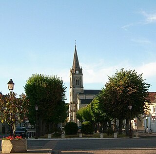
Tournon-Saint-Pierre is a commune in the Indre-et-Loire department in central France.
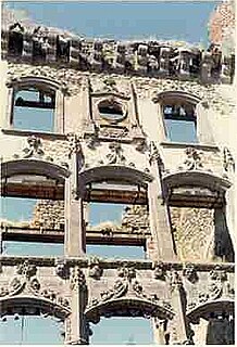
The Château des Vallées is a château from the 19th century in Tournon-Saint-Pierre, Indre-et-Loire, France.
The arrondissement of Loches is an arrondissement of France in the Indre-et-Loire department in the Centre-Val de Loire region. Since the January 2017 reorganization of the arrondissements of Indre-et-Loire, it has 112 communes.

The arrondissement of Tournon-sur-Rhône is an arrondissement of France in the Ardèche department in the Auvergne-Rhône-Alpes region. Since the January 2017 reorganization of the arrondissements of Ardèche, it has 118 communes.

Tain-l'Hermitage is a commune in the Drôme department in southeastern France.
Ayrens is a commune in the Cantal department in the Auvergne region of south-central France.

Accons is a commune in the Ardèche department in the Rhone-Alpes region of southern France.

The Château de Grangent is a ruined castle in the commune of Saint-Just-Saint-Rambert in the Loire département of France.
The Château de Lastours is a ruined castle in the commune of Rilhac-Lastours in the Haute-Vienne département of France.

The Pont Grand is a stone bridge connecting Tournon-sur-Rhône to Saint-Jean-de-Muzols, in Ardèche, France, built between 1379 and 1583. The bridge features a single, semi-circular arch over the river Doux with a span of 49.20 m. The height of the piers is 17.73 m.
The Châteaux de Curemonte are three castles in the commune of Curemonte, in the Corrèze département of France.
Pont de Vieille-Brioude is located in France, crossing the Allier River. It is a masonry arch bridge with a span of 45 metres (148 ft) that was built in 1832.

The Château de Ventadour is a ruined castle in the commune of Tournon-sur-Rhône in the Ardèche département of France. Situated to the south east of Meyras, the castle has architectural elements dating from the 11th, 12th, 15th and 16th centuries.

The Château de Montrond is a ruined castle in the commune of Montrond-les-Bains in the Loire département of France.
The Château de Rochetaillée is a ruined feudal castle in the city of Saint-Étienne in the Loire département of France.
The canton of Albertville-2 is an administrative division of the Savoie department, southeastern France. It was created at the French canton reorganisation which came into effect in March 2015. Its seat is in Albertville.
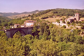
The canton of Tournon-sur-Rhône is an administrative division of the Ardèche department, southern France. Its borders were modified at the French canton reorganisation which came into effect in March 2015. Its seat is in Tournon-sur-Rhône.
The canton of Descartes is an administrative division of the Indre-et-Loire department, central France. Its borders were modified at the French canton reorganisation which came into effect in March 2015. Its seat is in Descartes.


