| Cleddau River | |
|---|---|
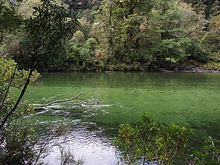
 Cleddau River in The Chasm | |
| Location | |
| Country | New Zealand |
| Physical characteristics | |
| Mouth | |
• location | Milford Sound |
The Cleddau River is a river of New Zealand. It flows into the head of Milford Sound.
| Cleddau River | |
|---|---|
| Cleddau River in The Chasm | |
| Location | |
| Country | New Zealand |
| Physical characteristics | |
| Mouth | |
• location | Milford Sound |
The Cleddau River is a river of New Zealand. It flows into the head of Milford Sound.

The Homer Tunnel is a 1.2 km long road tunnel in the Fiordland region of the South Island of New Zealand, opened in 1953. New Zealand State Highway 94 passes through the tunnel, linking Milford Sound to Te Anau and Queenstown, by piercing the Darran Mountains at the Homer Saddle. It connects between the valley of the Hollyford River to the east and that of the Cleddau to the west.
Pembroke River is a short waterway near Pembroke, Pembrokeshire, West Wales.

Milford Sound Airport is a small but very busy airport in Milford Sound, in New Zealand's Fiordland region of the South Island. It is mainly used by tourist / flightseeing operators.
The Freshwater River is the longest river on Stewart Island, the third largest of New Zealand's islands. It arises close to the island's northwestern point, from which it is separated by a ridge, and flows southeastward through the Ruggedy Flat for 25 kilometres (16 mi) before reaching the Paterson Inlet on the island's central east coast. The Freshwater is the longest New Zealand river not to be located in either of the country's two main islands.
The Mariner Glacier is a major glacier over 60 nautical miles long, descending southeast from the plateau of Victoria Land, Antarctica, between Mountaineer Range and Malta Plateau, and terminating at Lady Newnes Bay, Ross Sea, where it forms the floating Mariner Glacier Tongue.
The Clinton River is a river in the Southland Region of the South Island of New Zealand. There is also a Clinton River in Canterbury, which is a tributary of the Puhi Puhi River.
The Dark River, New Zealand is a river of Fiordland, New Zealand. It rises west of Barrier Peak and flows westward through Fiordland National Park into Lake Grave, which drains into Te Hāpua / Sutherland Sound.

The Donne River is a river in the Southland Region of New Zealand. It arises in the Darran Mountains, and flows south-west to join the Cleddau River. State Highway 94 crosses the Donne just before it reaches the Cleddau. The river was named by W. G. Grave in 1907 after Thomas Edward Donne, the General Manager of the Tourism Department.
The Edith River is a river of Fiordland, New Zealand. It rises to the west of the Edith Saddle and flows westward into Lake Alice, which drains into George Sound.
The Glaisnock River is a river in the Southland Region of New Zealand. It arises between the Stuart and Franklin Mountains, and flows east and south-east into the North Fiord of Lake Te Anau.

The Gulliver River is a river in the Fiordland area of New Zealand. It starts in the Darran Mountains near the Grave-Talbot Pass, and flows north and then west into the Cleddau River, which runs into Milford Sound. The river was named in 1906 by W.G. Grave for Alf Grenfell, who had a nickname of "Gulliver". A track along the Gulliver River from the Cleddau is suitable for day walks in summer and autumn and can be extended on the Grave Talbot Track into the Espereance valley, past the 59 m (194 ft) high De Lambert Falls and over the Grave Talbot Pass.
The Kaipo River is a river of New Zealand, flowing into Kaipo Bay, northern Fiordland. The river is very large. Fly fishing is popular there.
The Kopuaranga River is a river of the Wairarapa, in New Zealand's North Island. It flows generally south from rough hill country southwest of Eketāhuna, reaching its outflow into the Ruamahanga River 5 kilometres (3 mi) north of Masterton.
The Pitt River is a river in Fiordland, New Zealand. It rises north-west of Oilskin Pass and flows north-westward into Lake Beddoes and Wild Natives River.
The Rakeahua River is a river in Stewart Island/Rakiura, New Zealand, flowing into Paterson Inlet.
The Thurso River is a river in northern Fiordland, New Zealand. It rises west of Mount Pembroke and flows westward into the Tasman Sea north of Milford Sound.

The Tūtoko River is a river located in the Darran Mountains in New Zealand. Originating from the western flank of Mount Tūtoko it is a tributary of the Cleddau River.
Nansen Ice Sheet is a 30 nautical miles long by 10 nautical miles wide ice shelf. It is nourished by the Priestley and Reeves Glaciers and abuts the north side of the Drygalski Ice Tongue, along the coast of Victoria Land, Antarctica. This feature was explored by the South Magnetic Polar Party of the British Antarctic Expedition, 1907-09 and by the Northern Party of the British Antarctic Expedition, 1910-13. Frank Debenham, geologist with the latter expedition, applied the name Nansen Sheet as the feature is adjacent to Mount Nansen, the dominating summit in the area.
Cape Bird is a cape which marks the north extremity of Ross Island in Antarctica. It was discovered in 1841 by a British expedition under James Clark Ross, and named by him after Lieutenant Edward J. Bird of the ship HMS Erebus.