Col de Rousset

Last updated
Col de Rousset
Col de Rousset F.JPG
Elevation 1.254 m
Location Isère, Rhône-Alpes, France
Range Vercors Massif
Coordinates 44°50′26.2″N05°24′21.61″E / 44.840611°N 5.4060028°E / 44.840611; 5.4060028 Coordinates: 44°50′26.2″N05°24′21.61″E / 44.840611°N 5.4060028°E / 44.840611; 5.4060028
France relief location map.jpg
Red pog.svg
Col de Rousset
France

The Col de Rousset is a mountain pass located in the Vercors Regional Natural Park, Drôme, Auvergne-Rhône-Alpes, France and it is a part of the Vercors Massif and has a height of 1.254 meter, the mountain pass is popular among cyclists and the area around it for winter sports.

Vercors Regional Natural Park French regional natural park

The Vercors Regional Natural Park is a protected area of forested mountains in the Rhône-Alpes region of southeastern France.

Drôme Department of France

Drôme is a department in Auvergne-Rhône-Alpes named after the Drôme River.

Auvergne-Rhône-Alpes Administrative region of France

Auvergne-Rhône-Alpes or ARA is a region of France created by the territorial reform of French Regions in 2014; it resulted from the merger of Auvergne and Rhône-Alpes. The new region came into effect on 1 January 2016, after the regional elections in December 2015.

Contents

Location

The mountain pass is situated in the arrondissement of Die and the mountain is 19 km away from the town with the same name. The Rousset Pass is one of the few crossing points, with the Col de la Bataille as an allowing access to the South-Vercors. It connects precisely Die south to Vassieux-en-Vercors nearby the northwest through a tunnel at 1254 meters and drilled in 1979 and a length of 769 m. It replaces a previous work from 1866 and parallel to it. True neck, the top of the ridge overlooking the tunnel, is for its part to 1367 meters and is within walking distance. The hamlet of Rousset to which the collar belongs to the municipality of Saint-Agnan-en-Vercors, in the Drôme department.

Die, Drôme Subprefecture and commune in Auvergne-Rhône-Alpes, France

Die is a commune, former episcopal see, and subprefecture of the Drôme department in southeastern France. The region around Die is known as the Diois.

Vassieux-en-Vercors Commune in Auvergne-Rhône-Alpes, France

Vassieux-en-Vercors is a commune in the department of Drôme in southeastern France.

Saint-Agnan-en-Vercors Commune in Auvergne-Rhône-Alpes, France

Saint-Agnan-en-Vercors is a commune in the Drôme department in southeastern France.

Tunnel of the Col de Rousset Tunnel du col de Rousset - Cote Die.JPG
Tunnel of the Col de Rousset

Station Col de Rousset

There is also an Alpine ski resort at with a funicular and six ski lifts which are serving thirty tracks offering all levels of difficulty. Nearby is also a snow stadium, the stadium Raphael Poiree, with tracks of Nordic skiing and dog sledding in the winter. The cervix is the start of the Great Crossing of Vercors (GTV), which leads to Villard-de-Lans, cross country skiing during the winter and mountain biking during the summer, through the high plateaus of Vercors.

Funicular an inclined railway in which a cable moves a pair of permanently attached cars couterbalancing each other along a steep slope

A funicular is one of the modes of transportation which uses a cable traction for movement on steep inclined slopes.

Villard-de-Lans Commune in Auvergne-Rhône-Alpes, France

Villard-de-Lans is a commune in the Isère department of the Auvergne-Rhones-Alpes region in southeastern France. The town is also situated in the Vercors Massif. It was the administrative centre of the eponymous canton until the departmental elections of 2015. After the elections, Villard-de-Lans and the communes of its former canton were all incorporated into the new canton of Fontaine-Vercors. The town remains the seat of the Community of Communes in the Vercors Massif (CCMV).

Col de Rousset during the winter Col rousset.JPG
Col de Rousset during the winter

Tour de France

The mountain pass was visited three times by the Tour de France in 1984, 1996 and 1998, with the results of the winners here:

1984 Tour de France

The 1984 Tour de France was the 71st edition of the Tour de France, run over 4,021 km (2,499 mi) in 23 stages and a prologue, from 29 June to 22 July.

Jean-René Bernaudeau former road racing cyclist, directeur sportif

Jean-René Bernaudeau is a French former road bicycle racer, who competed professionally from 1978 to 1988. Bernaudeau is currently directeur sportif for UCI Professional Continental team Direct Énergie.

1996 Tour de France

The 1996 Tour de France was the 83rd edition of the Tour de France, starting on 29 June and ending on 21 July, featuring 19 regular stages, 2 individual time trials, a prologue and a rest day. It was won by Danish rider Bjarne Riis.

Related Research Articles

Isère Department of France

Isère is a department in the Auvergne-Rhône-Alpes region in eastern France named after the river Isère.

Col du Galibier mountain pass

The Col du Galibier is a mountain pass in the southern region of the French Dauphiné Alps near Grenoble. It is the ninth highest paved road in the Alps and the sixth highest mountain pass. It is often the highest point of the Tour de France.

Morzine Commune in Auvergne-Rhône-Alpes, France

Morzine is a commune in the Haute-Savoie department and Auvergne-Rhône-Alpes region of south-eastern France.

Chartreuse Mountains mountains in France

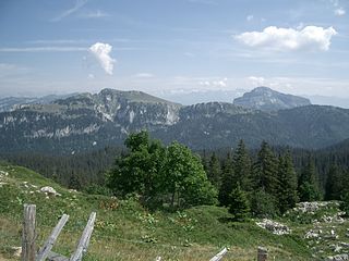
The Chartreuse Mountains is a mountain range in southeastern France, stretching from the city of Grenoble in the south to the Lac du Bourget in the north. It is part of the French Prealps, which continue as the Bauges to the north and the Vercors to the south.

Vercors Massif mountains in France

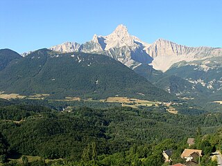
The Vercors Massif is a range in France consisting of rugged plateaux and mountains straddling the départements of Isère and Drôme in the French Prealps. It lies west of the Dauphiné Alps, from which it is separated by the rivers Drac and Isère. The cliffs at the massif's eastern limit face the city of Grenoble.

Donner Pass mountain pass in the northern Sierra Nevada above Donner Lake about 9 miles (14 km) west of Truckee, California

Donner Pass is a mountain pass in the northern Sierra Nevada, above Donner Lake about 9 miles (14 km) west of Truckee, California. Like the Sierra Nevada mountains themselves, the pass has a steep approach from the east and a gradual approach from the west.

French Alps part of the Alps mountain range in France

The French Alps are the portions of the Alps mountain range that stand within France, located in the Auvergne-Rhône-Alpes and Provence-Alpes-Côte d'Azur regions. While some of the ranges of the French Alps are entirely in France, others, such as the Mont Blanc massif, are shared with Switzerland and Italy.

Col de lIseran mountain pass

Col de l'Iseran is a mountain pass in France, the highest paved pass in the Alps. A part of the Graian Alps, it is situated in the department of Savoie, near the border with Italy, and is crossed by the D902 roadway.

La Clusaz Commune in Auvergne-Rhône-Alpes, France

La Clusaz is a commune in the Haute-Savoie department in the Auvergne-Rhône-Alpes region in south-eastern France.

Montgenèvre Commune in Provence-Alpes-Côte dAzur, France

Montgenèvre is a commune of the Hautes-Alpes department in southeastern France.

Autrans part of Autrans-Méaudre-en-Vercors in Auvergne-Rhône-Alpes, France

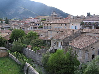
Autrans is a former commune in the Isère department in the Rhône-Alpes region of south-eastern France. On 1 January 2016, it was merged into the new commune of Autrans-Méaudre-en-Vercors.

Lus-la-Croix-Haute Commune in Auvergne-Rhône-Alpes, France

Lus-la-Croix-Haute is a commune in the Drôme department in southeastern France.

Dauphiné Prealps mountains in France

The Dauphiné Prealps are a mountain range in the south-western part of the Alps. They are located in Rhône-Alpes and, marginally, in Provence-Alpes-Côte d'Azur. Dauphiné Prealps are the central section of the French Prealps.

Rocher Rond mountain in France

The Rocher Rond is a summit in the Dévoluy massif of the French Alps. It is the highest point of the Vercors Regional Natural Park, although it is not part of the Vercors massif, and also the highest point in the department of Drôme. It has an elevation of 2453 metres, and an isolation of 8.77 km. It is the 14th highest French department highpoint.

Moucherotte Mountain in France

Le Moucherotte is the easternmost peak of the Vercors Massif, and also the northern culmination of the long ridge that runs along the eastern edge of the Vercors high plateau, and overlooks the city of Grenoble. The mountain is divided between the communes of Saint-Nizier-du-Moucherotte, Lans-en-Vercors, Seyssins and Claix.

Col de Font-de-Cère

The Col de Font-de-Cère is a mountain pass culminating at 1,289 m (4,229 ft), located in the Mounts of Cantal, in the department of the same name, and in the region of Auvergne-Rhône-Alpes, France.

References