Related Research Articles
Kootenay—Columbia is a federal electoral district in British Columbia, Canada, that has been represented in the House of Commons of Canada since 1997.

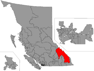
The Columbia-Shuswap Regional District is a regional district in the Canadian province of British Columbia, located in the Southern Interior region on the Trans-Canada Highway between Vancouver and Calgary, Alberta. The regional district borders the Province of Alberta across the Rocky Mountains.

Shuswap is a provincial electoral district for the Legislative Assembly of British Columbia, Canada.

North Okanagan—Shuswap is a federal electoral district in the province of British Columbia, Canada, that has been represented in the House of Commons of Canada since 1988. The district has been sporadically known as Okanagan—Shuswap.
Kootenay East was a federal electoral district in British Columbia, Canada, that was represented in the House of Commons of Canada from 1917 to 1968 and from 1979 to 1997.
Kamloops was a federal electoral district in British Columbia, Canada, that was represented in the House of Commons of Canada from 1935 to 1968, and from 1988 to 2004. From 1998 to 2004, it was known as Kamloops, Thompson and Highland Valleys.
Kamloops — Shuswap was a federal electoral district in British Columbia, Canada, that was represented in the House of Commons of Canada from 1979 to 1988.
Okanagan North was a federal electoral district in the province of British Columbia, Canada, that was represented in the House of Commons of Canada from 1979 to 1988.
Kootenay West—Revelstoke was a federal electoral district in British Columbia, Canada, that was represented in the House of Commons of Canada from 1988 to 1997. This riding was created in 1987 from Kootenay West riding. It was eliminated in 1996 when it was merged into the new riding of West Kootenay—Okanagan.
Columbia River-Revelstoke is a provincial electoral district for the Legislative Assembly of British Columbia, Canada.
Kamloops was a provincial electoral district for the Legislative Assembly of British Columbia, Canada from 1903 to 2009. The provincial constituency should not be confused with the former federal electoral district of Kamloops, which encompassed a much larger area.
Columbia-Shuswap C is a regional district electoral area in the Columbia-Shuswap Regional District, British Columbia, Canada. The electoral area is located in south-central BC between the Main Arm and Salmon Arm of Shuswap Lake. It has no governmental or administrative function and only describes voting boundaries for the election of rural representatives to the regional district board.
Shuswap-Revelstoke was a provincial electoral district in the Canadian province of British Columbia from 1979 to 1991. The riding was formed by merging the northern portions of the Revelstoke-Slocan riding with the Shuswap riding. The successor riding for the Revelstoke area is the current Columbia River-Revelstoke riding.
Salmon Arm was the name of a provincial electoral district in the Canadian province of British Columbia including on the town of Salmon Arm on Shuswap Lake. The riding first appeared in the 1924 election. After the 1966 election there was a redistribution with the resulting riding in the same area being Shuswap.
Shuswap may refer to:
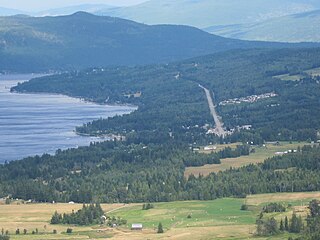
Sorrento is an unincorporated settlement located on the south shore of Shuswap Lake in the Southern Interior of the Canadian province of British Columbia. It is located on the Trans-Canada Highway, and is 16 miles (25 km) southeast of the town of Chase and 28 miles (45 km) northwest of the city of Salmon Arm. Sorrento is in the Columbia-Shuswap C electoral region of the Columbia-Shuswap Regional District.

The British Columbia Interior, popularly referred to as the BC Interior or simply the Interior, is a geographic region of the Canadian province of British Columbia. While the exact boundaries are variously defined, the British Columbia Interior is generally defined to include the 14 regional districts that do not have coastline along the Pacific Ocean or Salish Sea, and are not part of the Lower Mainland. Other boundaries may exclude parts of or even entire regional districts, or expand the definition to include the regional districts of Fraser Valley, Squamish-Lillooet, and Kitimat-Stikine.

Spallumcheen is a district municipality in the Canadian province of British Columbia. Located in the Okanagan region between Vernon and Enderby, the township had a population of 5,055 and land area of 255.77 square kilometres (98.75 sq mi) in the Canada 2011 Census. The district, whose official name is the Township of Spallumcheen and which is the oldest rural municipality in the British Columbia Interior, consists primarily of agricultural land surrounding the separately incorporated City of Armstrong. Both Spallumcheen and Armstrong are member municipalities of the Regional District of North Okanagan.
The Shuswap Country, or simply the Shuswap and called Secwepemcúl̓ecw in Secwepemctsín, is a term used in the Canadian province of British Columbia to refer to the environs of Shuswap Lake. The upper reaches of the Shuswap basin, southeast of Shuswap Lake and northeast of the Okanagan, are generally considered to be part of Okanagan or of the Monashee Country rather than "the Shuswap". Roughly defined, the Shuswap Country begins on its west at the town of Chase, located on Little Shuswap Lake, west of which is the South Thompson area of the Thompson Country, and includes Adams Lake to the northwest of Shuswap Lake as well as communities in the Eagle River area as far as Craigellachie and/or Three Valley Gap, which is at the summit of Eagle Pass, beyond which eastwards is the Columbia Country.
References
- "'Columbia-Shuswap Regional District - Electoral Area D" . Retrieved 2020-12-28.