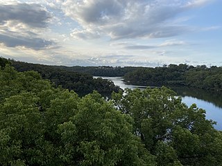
Georges River National Park is a protected Australian National Park, under the management of the NSW National Parks and Wildlife Service. The park falls in the regions of the Sutherland Shire Council and Canterbury-Bankstown Council. Located in the city of Sydney, 25 km south-west of the CBD, surrounded by neighbouring suburbs of Lugano, Illawong, Alfords Point, Padstow Heights, Revesby Heights, Picnic Point and Sandy Point. The primary use of the park is to service for recreational activities such as; bush walking, picnics, barbeques, boating, fishing, and water/jet skiing. The park is Segmented into 15 sectors along the riverbanks of the Georges River, encompassing 514 hectares, housing many native aquatic and terrestrial Australian flora and fauna. The traditional custodians are the Dharug people located on the north side of the river, and Dharawal people located on the south of the river.

Ku-ring-gai Chase National Park is a national park on the northern side of Sydney in New South Wales, Australia. The 14,977-hectare (37,010-acre) park is 25 kilometres (16 mi) north of the Sydney central business district and generally comprises the land east of the M1 Pacific Motorway, south of the Hawkesbury River, west of Pittwater and north of Mona Vale Road. It includes Barrenjoey Headland on the eastern side of Pittwater.

Kincumber is a south-eastern suburb of the Central Coast region of New South Wales, Australia, nested between the Kincumba Mountain Reserve and the Kincumber Broadwater and located 87 kilometres (54 mi) north of Sydney via the Sydney-Newcastle Freeway (F3). It is part of the Central Coast Council local government area. It is on The Guringgai land
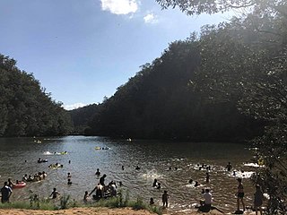
Bents Basin is a protected nature reserve and state park near Wallacia, New South Wales, Australia in the Sydney metropolitan area. The lake basin, which formed at the efflux of the Nepean River from the Hawkesbury Sandstone gorge, is a popular swimming hole with a camping area and an education centre used by local school groups. Also featuring a large woodland area and native wildlife, the reserve is the only picnic area along the Nepean River and it is one of the most popular water-based picnic parks in Greater Western Sydney.
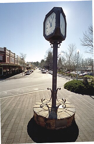
Wentworth Falls is a town in the Blue Mountains region of New South Wales, situated approximately 100 kilometres (62 mi) west of the Sydney central business district, and about 8 kilometres (5.0 mi) east of Katoomba, Australia on the Great Western Highway, with a Wentworth Falls railway station on the Main Western line. The town is at an elevation of 867 metres (2,844 ft) AHD. At the 2016 census, Wentworth Falls had a population of 6,076.

Waverton is a harbour-side suburb on the lower North Shore of Sydney, New South Wales, Australia. Waverton is 4 kilometres north of the Sydney central business district, in the local government area of North Sydney Council.
Picnic Point, a suburb of local government area City of Canterbury-Bankstown, is 23 kilometres south-west of the Sydney central business district, in the state of New South Wales, Australia. It is a part of South-western Sydney region. Picnic Point is a residential suburb on the northern bank of the Georges River. Located within Picnic Point is Yeramba Lagoon which is the largest tract of National Park within the Canterbury – Bankstown Council, it is home to numerous species of native fauna and flora.

Malabar is a suburb in the Eastern Suburbs of Sydney, in the state of New South Wales, Australia 12 kilometres south-east of the Sydney central business district, in the local government area of the City of Randwick.
Killarney Heights is a suburb of Northern Sydney, situated on Middle Harbour, in the state of New South Wales, Australia. Killarney Heights is 12 kilometres north-east of the Sydney central business district in the local government area of Northern Beaches Council. Killarney Heights is part of the Forest District, colloquially known as The Forest.

The Hacking River is a watercourse that is located in the Southern Sydney region of New South Wales in Australia. For thousands of years traditional owners called the river Deeban, however the colonial settlers renamed the river after Henry Hacking, a British seaman who killed Pemulwuy and was a pilot at Port Jackson in colonial New South Wales.

Shark Island is an island located within Sydney Harbour, in New South Wales, Australia. The island is 1.5 hectares in area, measuring some 250 metres by 100 metres, and lies off the Sydney suburbs of Point Piper, Rose Bay and Vaucluse, in the eastern section of the harbour between the Harbour Bridge and the harbour entrance. The island was known by the local Aboriginal people as Boambilly, and the current name comes from its shape, which is claimed to resemble a shark. Shark Island Light is an active pile lighthouse located just north of Shark Island, an island in Sydney Harbour, New South Wales, Australia. Its light is only visible on in the fairway of the harbour, between Shark Point and Point Piper.

Bobbin Head is a point on Cowan Creek in the north of the suburb of North Turramurra, New South Wales, Australia. It is a "near-urban" part of Ku-ring-gai Chase National Park. Bobbin Head is easily reached by taking Bobbin Head Road through North Turramurra or Kuringai Chase Road, Mount Colah near Hornsby.

Cabarita is a bayside suburb in the Inner West of Sydney, in the state of New South Wales, Australia. Cabarita is located 16 kilometres west of the Sydney central business district, in the local government area of the City of Canada Bay.
The Darkinjung are the Local Aboriginal Land Council in the Central Coast, New South Wales, participating in formal joint management of some areas of state forest in the region. It represents over 450 local Aboriginal residents. The Darkinjung Local Aboriginal Land Council are caretakers of the Central Coast of NSW Australia.

Bradleys Head is a headland protruding from the north shore of Sydney Harbour, within the metropolitan area of Sydney, New South Wales, Australia. It is named after the First Fleet naval officer William Bradley. The original Aboriginal inhabitants, who belonged to the Borogegal clan of the Eora nation, knew Bradleys Head as Borogegy, Booraghee, Booragy or Burrogy. On the headland is an active lighthouse, Bradleys Head Light, constructed in 1905.
Somersby is a semi-rural locality of the Central Coast region of New South Wales, Australia, to the northwest of Gosford along the Pacific Highway. It is part of the Central Coast Council local government area.
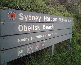
Obelisk Beach is a nude beach in Mosman, New South Wales, Australia.
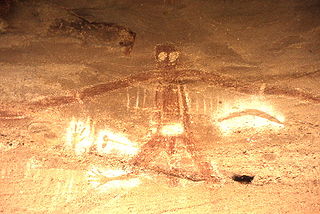
Aboriginal sites of New South Wales consist of a large number of places in the Australian state of New South Wales where it is still possible to see visible signs of the activities and culture of the Australian Aboriginals who previously occupied these areas.
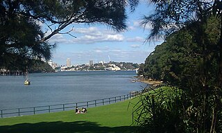
Berry Island is a locality in Wollstonecraft on the lower North Shore of Sydney, New South Wales, Australia. It was originally one of Sydney's Harbour Islands, but it is now connected to the mainland by a constructed isthmus.

The Balls Head Reserve is a forested headland nature reserve situated on Balls Head in Sydney. The headland is in Port Jackson, 1.5 kilometres (0.93 mi) west of the Sydney Harbour Bridge, between Berrys Bay to the east and Balls Head Bay to the west. It is named after Lieutenant Henry Lidgbird Ball, a Royal Naval officer who commanded HMS Supply on the First Fleet. The park is accessed via Balls Head Drive, Waverton, New South Wales, Australia.


