Copacabana | |
|---|---|
Municipality and village | |
| Country | |
| Province | Catamarca Province |
| Time zone | UTC−3 (ART) |
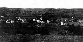
Copacabana is a village and municipality in Catamarca Province in northwestern Argentina. [1]
Copacabana | |
|---|---|
Municipality and village | |
| Country | |
| Province | Catamarca Province |
| Time zone | UTC−3 (ART) |
Copacabana is a village and municipality in Catamarca Province in northwestern Argentina. [1]

The Prince Charles Mountains are a major group of mountains in Mac. Robertson Land in Antarctica, including the Athos Range, the Porthos Range, and the Aramis Range. The highest peak is Mount Menzies, with a height of 3,228 m (10,591 ft). Other prominent peaks are Mount Izabelle and Mount Stinear. These mountains, together with other scattered peaks, form an arc about 420 km (260 mi) long, extending from the vicinity of Mount Starlight in the north to Goodspeed Nunataks in the south.

The GAZ-64 was a 4x4 vehicle made by GAZ, succeeding the earlier GAZ-61. Its design was led by Vitaliy Grachev. The design process was exceptionally quick, taking only a few weeks.
Condor is a municipality in the state of Rio Grande do Sul, Brazil. As of 2020, the estimated population was 6,759.
Protásio Alves is a municipality in the state of Rio Grande do Sul, Brazil. As of 2020, the estimated population was 1,938.

Merthyr Cynog is a hamlet and a community in the modern county of Powys, Wales, in the historic county of Brecknockshire. The population of the community at the 2011 Census was 245.
Cumbers Reef is a group of rocks aligned in an arc forming the north and west parts of the Amiot Islands, off the southwest part of Adelaide Island. It was named by the UK Antarctic Place-Names Committee for Roger N. Cumbers, 3rd officer of RRS John Biscoe, 1961–62, the ship which assisted the Royal Navy Hydrographic Survey Unit in the charting of this area in 1963.

Turner Glacier is a glacier on the east side of Mount Liotard flowing northeast into Ryder Bay, Adelaide Island. The glacier was surveyed by Falkland Islands Dependencies Survey (FIDS), 1948, and photographed from the air by Falkland Islands and Dependencies Aerial Survey Expedition (FIDASE), 1956–57. Named by the United Kingdom Antarctic Place-Names Committee (UK-APC) in 1977 after Andrew John Turner, British Antarctic Survey (BAS) builder, Halley Station, 1973–74; Signy Island, 1974–75; Rothera Station, 1976–77, 1978–80; and Faraday Station, 1982–83.
Forel Glacier is a glacier 1.5 nautical miles (3 km) wide and 4 nautical miles (7 km) long, flowing southwest into Blind Bay, on the west coast of Graham Land, Antarctica. It was first roughly surveyed in 1936 by the British Graham Land Expedition under John Rymill. Its lower reaches were surveyed in 1949 by the Falkland Islands Dependencies Survey, and the glacier named by them for François-Alphonse Forel, a noted Swiss glacier physicist and author, and first President of the International Commission of Glaciers in 1894.
McArthur Glacier is a glacier between the Christie Peaks and Swine Hill, flowing west from Palmer Land, Antarctica, into George VI Sound. It was named by the UK Antarctic Place-Names Committee for Alistair H. McArthur, a British Antarctic Survey geophysicist at Stonington Island, 1967–68.
Relay Hills is a group of low, ice-covered hills, mainly conical in shape, between Mount Edgell and Kinnear Mountains in western Antarctic Peninsula. First roughly surveyed from the ground by British Graham Land Expedition (BGLE), 1936–37. Photographed from the air by Ronne Antarctic Research Expedition (RARE), November 1947. Resurveyed by Falkland Islands Dependencies Survey (FIDS), November 1958. The name, applied by the United Kingdom Antarctic Place-Names Committee (UK-APC), arose because both the BGLE and the FIDS sledging parties had to relay their loads through this area to the head of Prospect Glacier.
Robison Glacier is a broad tributary glacier flowing northwest along the north side of La Gorce Mountains to enter Scott Glacier, in the Queen Maud Mountains. It was discovered in December 1934 by the Byrd Antarctic Expedition geological party under Quin Blackburn, and was named by the Advisory Committee on Antarctic Names (US-ACAN) for Lieutenant Commander Layton E. Robison, a pilot with U.S. Navy Squadron VX-6 during Operation Deep Freeze 1964, 1965 and 1966.
German submarine U-473 was a Type VIIC U-boat of Nazi Germany's Kriegsmarine during World War II.
German submarine U-483 was a Type VIIC U-boat of Nazi Germany's Kriegsmarine during World War II.
German submarine U-664 was a Type VIIC U-boat built for Nazi Germany's Kriegsmarine for service during World War II. She was laid down on 11 July 1941 by Howaldtswerke, Hamburg as yard number 813, launched on 28 April 1942 and commissioned on 17 June 1942 under Oberleutnant zur See Adolf Graef.
German submarine U-631 was a Type VIIC U-boat built for Nazi Germany's Kriegsmarine for service during World War II. She was laid down on 5 September 1941 by Blohm & Voss, Hamburg as yard number 607, launched on 27 May 1942 and commissioned on 16 July 1942 under Oberleutnant zur See Jürgen Krüger.
German submarine U-680 was a Type VIIC U-boat of Nazi Germany's Kriegsmarine during World War II. The submarine was laid down on 12 October 1942 at the Howaldtswerke yard at Hamburg, launched on 20 November 1943, and commissioned on 23 December 1943 under the command of Oberleutnant zur See Max Ulber.

German submarine U-907 was a Type VIIC U-boat of Nazi Germany's Kriegsmarine during World War II.
28°12′S67°29′W / 28.200°S 67.483°W
| | This article about a place in Catamarca Province, Argentina is a stub. You can help Wikipedia by expanding it. |