Related Research Articles

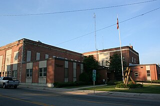
Nez Perce CountyNEZZ-purse; is a county located in the U.S. state of Idaho. As of the 2020 census, the population was 42,090. The county seat is Lewiston. The county is named after the Native American Nez Perce tribe. Nez Perce County is part of the Lewiston, Idaho–WA Metropolitan Statistical Area.

Boundary County is the northernmost county of the U.S. state of Idaho. As of the 2020 census, the population was 12,056. The county seat and largest city is Bonners Ferry.

Bonner County is a county in the northern part of the U.S. state of Idaho. As of the 2020 census, the population was 47,110. The county seat and largest city is Sandpoint. Partitioned from Kootenai County and established in 1907, it was named for Edwin L. Bonner, a ferry operator. Bonner County comprises the Sandpoint, Idaho Micropolitan Statistical Area.

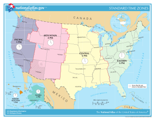
In the United States, time is divided into nine standard time zones covering the states, territories and other US possessions, with most of the country observing daylight saving time (DST) for approximately the spring, summer, and fall months. The time zone boundaries and DST observance are regulated by the Department of Transportation, but no single map of those existed until the agency announced intentions to make one in September 2022. Official and highly precise timekeeping services (clocks) are provided by two federal agencies: the National Institute of Standards and Technology (NIST) ; and the United States Naval Observatory (USNO). The clocks run by these services are kept synchronized with each other as well as with those of other international timekeeping organizations.

The Boise, Idaho Metropolitan Statistical Area (MSA) is an area that encompasses Ada, Boise, Canyon, Gem, and Owyhee counties in southwestern Idaho, anchored by the cities of Boise and Nampa. It is the main component of the wider Boise–Mountain Home–Ontario, ID–OR Combined Statistical Area, which adds Elmore and Payette counties in Idaho and Malheur County, Oregon. It is the state's largest officially designated metropolitan area and includes Idaho's three largest cities: Boise, Nampa, and Meridian. Nearly 40 percent of Idaho's total population lives in the area.

The Columbia River drainage basin is the drainage basin of the Columbia River in the Pacific Northwest region of North America. It covers 668,000 km2 or 258,000 sq mi. In common usage, the term often refers to a smaller area, generally the portion of the drainage basin that lies within eastern Washington.

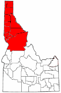
The Idaho panhandle—locally known as North Idaho, Northern Idaho, or simply the Panhandle—is a salient region of the U.S. state of Idaho encompassing the state's 10 northernmost counties: Benewah, Bonner, Boundary, Clearwater, Idaho, Kootenai, Latah, Lewis, Nez Perce, and Shoshone. The panhandle is bordered by the state of Washington to the west, Montana to the east, and the Canadian province of British Columbia to the north. The Idaho panhandle, along with Eastern Washington, makes up the region known as the Inland Northwest, headed by its largest city, Spokane, Washington.

The Northwestern United States, also known as the American Northwest or simply the Northwest, is an informal geographic region of the United States. The region consistently includes the states of Oregon, Washington, Idaho, Montana and Wyoming. Some sources include Southeast Alaska in the Northwest. The related but distinct term Pacific Northwest generally excludes areas from the Rockies eastward, whereas the term "Inland Northwest" excludes areas west of the Cascades.

KPND is a commercial FM radio station licensed to Deer Park, Washington, and serving the Spokane metropolitan area and the Inland Northwest. It is owned by Blue Sky Broadcasting and it airs an Adult Album Alternative radio format, which it calls "Progressive Radio for the Inland Northwest." KPND shares studios and offices with its sister stations at 327 Marion Avenue in Sandpoint, Idaho.

The Spokane International Railroad was a short line railroad between Spokane, Washington, and the Canadian Pacific Railway (CP) at Kingsgate, British Columbia. The line became an important one for the CP with its connections to the Union Pacific Railroad and Portland, Oregon.
Gem State Adventist Academy or just Gem State Academy is a private, Seventh-day Adventist high school located in Caldwell, Idaho. Gem State Adventist Academy is a part of the Seventh-day Adventist education system, the world's second largest Christian school system.
Cavendish is an unincorporated community in Clearwater County, Idaho, United States, in the mountains between the towns of Orofino and Kendrick. Cavendish contains an elementary school, a cemetery, and a park.

The Clearwater River is in the northwestern United States, in north central Idaho. Its length is 74.8 miles (120.4 km), it flows westward from the Bitterroot Mountains along the Idaho-Montana border, and joins the Snake River at Lewiston. In October 1805, the Lewis and Clark Expedition descended the Clearwater River in dugout canoes, putting in at "Canoe Camp," five miles (8 km) downstream from Orofino; they reached the Columbia Bar and the Pacific Ocean about six weeks later.
Big Creek is an unincorporated community in Shoshone County, Idaho, United States, outside the city of Kellogg. It is near where National Forest Develop Road 264 becomes Big Creek Road. The Shoshone Country Club was developed north of Big Creek.

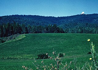
Cottonwood Air Force Station is a former United States Air Force General Surveillance Radar station. The radar site was located at the summit of Cottonwood Butte, 5.7 miles (9.2 km) west-northwest of Cottonwood in Idaho County, Idaho. It was closed in 1965 and transferred to the state of Idaho in 1974, when it was converted to its present use as a minimum-security correctional facility.
Avon is an unincorporated community in Latah County, in the U.S. state of Idaho.
Crescent is an unincorporated community in Latah County, in the U.S. state of Idaho.
Cornwall is an unincorporated community in Latah County, in the U.S. state of Idaho.
Elmira is an unincorporated community in Bonner County, in the U.S. state of Idaho.
Garfield is an unincorporated community in Bonner County, in the U.S. state of Idaho. The community is situated on Garfield Bay, an inlet of Lake Pend Oreille.
References
- ↑ U.S. Geological Survey Geographic Names Information System: Copeland, Idaho
- ↑ World Book Encyclopedia. Vol. I. Field Enterprises Corporation. 1960. p. 27.
48°54′08″N116°23′20″W / 48.90222°N 116.38889°W
u
