Related Research Articles
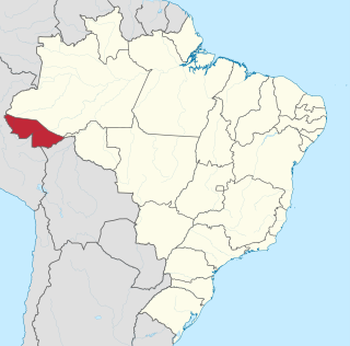
Acre is a state located in the northern region of Brazil. Located in the westernmost part of the country with a two hours time difference from Brasília, Acre is bordered clockwise by Amazonas to the north and northeast, Rondônia to the east, the Bolivian department of Pando to the southeast, and the Peruvian regions of Madre de Dios, Ucayali and Loreto to the south and west. It occupies an area of 152,581.4 km2, being slightly smaller than Tunisia.
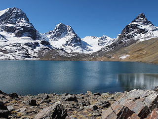
The La Paz Department of Bolivia comprises 133,985 square kilometres (51,732 sq mi) with a 2012 census population of 2,706,359 inhabitants. It is situated at the western border of Bolivia, sharing Lake Titicaca with adjacent Peru. It contains the Cordillera Real, which reaches altitudes of 6.6 kilometers (4.1 mi). Northeast of the Cordillera Real are the Yungas, the steep eastern slopes of the Andes Mountains that make the transition to the Amazon River basin to the northeast. The capital of the department is the city of La Paz and is the administrative city and seat of government/national capital of Bolivia.

Potosí is a department in southwestern Bolivia. It comprises 118,218 km² with 823,517 inhabitants. The capital is the city of Potosí. It is mostly a barren, mountainous region with one large plateau to the west, where the largest salt flat in the world, Salar de Uyuni, is located.
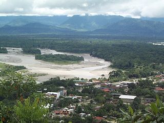
Chapare, also called The Chapare and is pronounced Cha-pa-reh, is a rural province in the northern region of Cochabamba Department in central Bolivia. The majority of the territory consists of valley rainforests that surround the area's main waterway, the Chapare River, which is also a tributary of the Amazon River. The provincial capital is Sacaba, 11 km east of Cochabamba, its principal town is Villa Tunari, a popular tourist destination.

Quillacollo is a province in the Cochabamba Department, Bolivia. It is known for its festival in August where people from all over Bolivia come and pay homage to the Virgin of Urqupiña. Quillacollo is said to be one of the fastest growing cities in Bolivia.

Abel Iturralde is one of the twenty provinces of the Bolivian La Paz Department. It is situated in its northern part. Its name honors Abel Iturralde Palacios, a Bolivian politician. Madidi National Park is partially in this province.

Rafael Bustillo is a province in the Bolivian Potosí Department. Its name honors the Bolivian diplomat and foreign secretary Rafael Bustillo. The capital of the province is Uncía with a population of 5,709 in the year 2001, the largest town is Llallagua with 20,065 inhabitants.

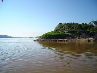
The Río Grande in Bolivia rises on the southern slope of the Cochabamba mountains, east of the city Cochabamba, at 17°26′11″S65°52′22″W. At its source it is known as the Rocha River. It crosses the Cochabamba valley basin in a westerly direction. After 65 km the river turns south east and after another 50 km joins the Arque River at 17°42′10″S66°14′45″W and an elevation of 2.350 m.

The A360 is a minor A road in Wiltshire, England, running from Devizes to Salisbury, through the villages of Potterne, West Lavington, Tilshead, and Shrewton, and passing near the Stonehenge ancient monument.
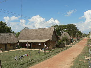
Santa Rosa de Yacuma or Santa Rosa del Yacuma is a small town in the Amazon pampas of the Bolivian Beni Department.
Silla is an ancient city of Mali. It was settled in about the 10th century AD to focus on the trans-Saharan trade.
Federico Román is one of the five provinces of the Bolivian department of Pando and is situated in the department's northeastern parts. Its name honours General Federico Román.

Onoppunai Station is an unmanned. railway station in Horonobe, Teshio District, Hokkaidō, Japan. According to JR Hokkaidō, only one person uses the station daily, on average.
The Apere River is a river of Bolivia. It is a tributary of the Mamoré River, in the Department of Beni.

Arque Municipality is the first municipal section of the Arque Province in the Cochabamba Department, Bolivia. Its seat is Arque. At the time of census 2001 the municipality had 11,806 inhabitants. It has the lowest HDI of Bolivia with 0.311.
Morochata Municipality is the second municipal section of the Ayopaya Province in the Cochabamba Department, Bolivia. Its seat is Morochata.
Tacobamba is a small town in Bolivia.
El Espinal is a corregimiento in Guararé District, Los Santos Province, Panama with a population of 1,243 as of 2010. Its population as of 1990 was 1,117; its population as of 2000 was 1,206.
Cedar Township is an inactive township in Cedar County, in the U.S. state of Missouri.
La Belle Township is an inactive township in Lewis County, in the U.S. state of Missouri.
References
- Rand McNally, The New International Atlas, 1993.
Coordinates: 15°56′09″S66°52′09″W / 15.9358°S 66.8692°W

A geographic coordinate system is a coordinate system that enables every location on Earth to be specified by a set of numbers, letters or symbols. The coordinates are often chosen such that one of the numbers represents a vertical position and two or three of the numbers represent a horizontal position; alternatively, a geographic position may be expressed in a combined three-dimensional Cartesian vector. A common choice of coordinates is latitude, longitude and elevation. To specify a location on a plane requires a map projection.
| This La Paz Department geography article is a stub. You can help Wikipedia by expanding it. |
| This article related to a river in Bolivia is a stub. You can help Wikipedia by expanding it. |