Cougar Fork is a stream in the U.S. state of West Virginia. [1]
A stream is a body of water with surface water flowing within the bed and banks of a channel. The stream encompasses surface and groundwater fluxes that respond to geological, geomorphological, hydrological and biotic controls.
In the United States, a state is a constituent political entity, of which there are currently 50. Bound together in a political union, each state holds governmental jurisdiction over a separate and defined geographic territory and shares its sovereignty with the federal government. Due to this shared sovereignty, Americans are citizens both of the federal republic and of the state in which they reside. State citizenship and residency are flexible, and no government approval is required to move between states, except for persons restricted by certain types of court orders. Four states use the term commonwealth rather than state in their full official names.
West Virginia is a state located in the Appalachian region in the Southern United States and is also considered to be a part of the Middle Atlantic States. It is bordered by Pennsylvania to the north, Maryland to the east and northeast, Virginia to the southeast, Kentucky to the southwest, and Ohio to the northwest. West Virginia is the 41st largest state by area, and is ranked 38th in population. The capital and largest city is Charleston.
Cougar Fork may derive its name from John R. Cogar, an early settler. [2]
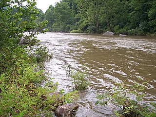
The Cherry River is a tributary of the Gauley River in southeastern West Virginia in the United States. Via the Gauley, Kanawha and Ohio rivers, it is part of the watershed of the Mississippi River. The Cherry River drains mostly rural and forested areas and flows for much of its length through the Monongahela National Forest. Throughout its entire length the Cherry goes over a series of whitewater rapids in a mountainous setting.
Lunice Creek is a 7.3-mile-long (11.7 km) tributary of the South Branch Potomac River, belonging to the Potomac River and Chesapeake Bay watersheds. The creek is located in Grant County, West Virginia. Lunice Creek is created by its North and South Forks and empties into the South Branch at Petersburg.
Beards Fork is a census-designated place (CDP) and coal town in Fayette County, West Virginia, United States that was founded as a coal town. As of the 2010 census, its population was 199.
Alum Fork is a stream in the U.S. state of West Virginia. It is a tributary of Leading Creek.
Arches Fork is a stream in the U.S. state of West Virginia.
Canoe Run is a stream in the U.S. state of West Virginia. It is a tributary of West Fork River.
Cassity Fork is a stream in the U.S. state of West Virginia.
Clifty is an unincorporated community in Fayette County, in the U.S. state of West Virginia.
Cutlips Fork is a stream in the U.S. state of West Virginia.
Elliott is an extinct town in Fayette County, in the U.S. state of West Virginia.
Hughes Fork is a stream in the U.S. state of West Virginia.
Knob Fork is a stream in the U.S. state of West Virginia.
Mulberry Fork is a stream in the U.S. state of West Virginia. It is a tributary of Loop Creek.
Pad Fork is a stream in the U.S. state of West Virginia.
Sleith Fork is a stream in the U.S. state of West Virginia. The stream consists of Upper Sleith Fork and Lower Sleith Fork.
Sleith is an extinct town in Braxton County, in the U.S. state of West Virginia.
Spruce Fork is a stream in the U.S. state of West Virginia.
Westfall Fork is a stream in the U.S. state of West Virginia.
Wheeler Fork is a stream in the U.S. state of West Virginia.
Whiteman Fork is a stream in the U.S. state of West Virginia.
This article related to a river in West Virginia is a stub. You can help Wikipedia by expanding it. |