Related Research Articles

Mills County is a county located in Central Texas, United States. It was created on March 15, 1887, from parts of four existing counties—Brown, Comanche, Hamilton, and Lampasas—and named after John T. Mills. The 2020 census reported a population of 4,456. The county seat is Goldthwaite. A long-time resident of the county quipped that residing here is the closest a person could get to living in Mayberry.

The Colorado River is an approximately 862-mile-long (1,387 km) river in the U.S. state of Texas. It is the 11th longest river in the United States and the longest river with both its source and its mouth within Texas.

The Chenango River is a 90-mile-long (140 km) tributary of the Susquehanna River in central New York in the United States. It drains a dissected plateau area in upstate New York at the northern end of the Susquehanna watershed.

Brandywine Creek is a tributary of the Christina River in southeastern Pennsylvania and northern Delaware in the United States. The Lower Brandywine is 20.4 miles (32.8 km) long and is a designated Pennsylvania Scenic River with several tributary streams. The East Branch and West Branch of the creek originate within 2 miles (3 km) of each other on the slopes of Welsh Mountain in Honey Brook Township, Pennsylvania, about 20 miles (32 km) northwest of their confluence.

Route 181 is a highway in southern Missouri. Its southern terminus is at US 160 in Gainesville in Ozark County. It passes through eastern Douglas County and reaches its northern terminus at Business U.S. Route 60 in Cabool in Texas County.

The Big River is a tributary of the Meramec River in east-central Missouri. The river rises in western Iron County near the summit of Johnson Mountain just north of Missouri Route 32 and approximately 3.5 miles southeast of the community of Enough. It flows through Washington, Saint Francois, and Jefferson counties. It forms part of the boundary between Jefferson and Saint Francois counties and also part of the boundary between Jefferson and Washington counties. It empties into the Meramec River opposite Eureka where the Meramec forms the border between Jefferson and Saint Louis counties. The river flows through Washington State Park, St. Francois State Park, and the Lead Belt mining district. The elevation of the river at its source is approximately 1,300 feet (400 m) above sea level and at its mouth about 400 feet (120 m). The length of the river is approximately 145 miles (233 km), while the airline distance between source and mouth is about 56 miles (90 km). Its watershed area is 955 square miles (2,470 km2).
The Leon River is a river in the U.S. state of Texas. It has three primary forks - the North, Middle, and South Leon Rivers, which meet near Eastland and then run for around 185 miles (298 km) until it meets with the Lampasas River and the Salado Creek to form the Little River near Belton.
Sweetwater Creek is a stream in the Texas Panhandle and western Oklahoma. It is a tributary to the North Fork of the Red River.

Mill Creek Falls, is a waterfall located in the Rogue River Canyon within the Prospect State Scenic Viewpoint in Jackson County, in the U.S. state of Oregon. The waterfall is located at the south end of Mill Creek as it plunges into the Rogue River over a carved cliff surrounded by walls of petrified volcanic ash consequence of Mount Mazama eruption.
Coffee Mill Creek is a 16.6-mile-long (26.7 km) tributary of the Red River in Texas. It is part of the Mississippi River watershed. It flows entirely within Fannin County.
Cummins Creek in Lee County, Texas, rises near Giddings and runs southeast through Lee, Fayette, and Colorado counties for sixty-five miles to its mouth on a horseshoe bend of the Colorado River, opposite Columbus.
Mill Creek is a river in the U.S. state of Texas, draining into the Brazos River.
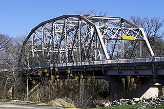
The Pecan Bayou, said to be the westernmost "bayou" in the United States, is a slow-moving Texas stream that originates in northwestern Callahan and eastern Taylor Counties and flows southeast through Coleman and Brown Counties, before ending in northern Mills County where it joins the Colorado River approximately 8 miles west of Goldthwaite, Texas. The stream is fed by over twenty creeks and is one of five major tributaries of the Texas Colorado River. Between 1930 and 1933 a dam was constructed on the Pecan Bayou seven miles north of Brownwood forming Lake Brownwood. Below Lake Brownwood, the stream flows through Brownwood and Early, Texas.
The Sabinal River, formerly Arroyo de la Soledad, is a stream in Uvalde and Bandera counties of the U.S. state of Texas. The upper part of the river runs through the Lost Maples State Natural Area, being fed by Hale, Hollow, and Can Creeks. The Mill, Little, Onion, Rancheros, Nolton, and East Elm Creeks feed in the lower region, where it runs underground in some places. The Sabinal exits into the Frio River about 16 miles south of the city of Sabinal.
Sauquoit Creek is a 17.0-mile-long (27.4 km) river in New York, United States. It lies within the southern part of Oneida County. The creek flows eastward, then turns sharply and flows generally northward through the Sauquoit Valley to the Mohawk River, entering the river on the east side of Whitesboro. It is therefore part of the Hudson River watershed.
Oaks Creek is a river that drains Canadarago Lake, which is situated in the north central region of Otsego County, New York. The creek begins by the Hamlet of Schuyler Lake and flows southeast approximately 9.32 miles (15.00 km), dropping only 105 feet (32 m) in elevation, before converging with the Susquehanna River south of the Village of Cooperstown, by the Hamlet of Index. From the source to Oaksville the creek flows along Panther Mountain. Fly Creek is a main tributary, that converges with Oaks Creek south of the Hamlet of Fly Creek.

Steele Creek is a river in Herkimer County in the state of New York. The creek begins in an unnamed swamp south of Cedarville, and flows in a northeast direction before emptying into the Mohawk River in the village of Ilion. Steele Creek travels through the Ilion Gorge and alongside NY-51 for most of its length. Steele Creek derives its name from Rudolph Stahl, who built the first grist mill in Ilion along the creek.

Buffalo Creek is a stream which runs through the United States commonwealths of Pennsylvania and West Virginia. It rises in East Finley Township, Washington County, Pennsylvania.
References
- "An Analysis of Texas Waterways" . Retrieved 2006-05-04.
- USGS Geographic Names Information Service
- USGS Hydrologic Unit Map - State of Texas (1974)
| | This article related to a river in Texas is a stub. You can help Wikipedia by expanding it. |