Crenshaw/LAX Line

Last updated

LAMetroLogo.svg  Crenshaw/LAX Line
LACMTA Circle K Line.svg
Crenshaw corridor jerjoz.jpg
Map of the project study area and potential route of the Crenshaw/LAX Line with the Northern Extension as outlined in 2008
Overview
Other name(s)C Line (rerouting of current line), K Line (proposed new designation)
StatusUnder construction
Locale Crenshaw, Inglewood, Westchester
Termini Aviation/Century (south)
Expo/Crenshaw (north)
Stations8 [1] (+ 1 under construction infill station)
Website Crenshaw/LAX Transit Project
Service
Type Light rail
System Los Angeles Metro Rail
Operator(s)LAMetroLogo.svg  Metro (LACMTA)
History
OpenedMid-2021 (expected) [2]
Technical
Line length8.5 miles (13.7 km) [1]
CharacterAt-grade, underground sections and aerial sections
Track gauge 4 ft 8 12 in (1,435 mm)
Electrification 750  V   DC overhead catenary (overhead rigid rail; tunnels only)
Route map

Contents

BSicon uextCONTg.svg
future extension
to   LACMTA Circle B Line.svg   LACMTA Circle D Line.svg  
BSicon uCONTgq.svg
BSicon uINTq.svg
BSicon uextINT.svg
BSicon uCONTfq.svg
Expo/Crenshaw
BSicon PARKING.svg LACMTA Circle E Line.svg  
BSicon uextBHF.svg
Martin Luther King Jr.
BSicon uextBHF.svg
Leimert Park
BSicon PORTALg.svg
BSicon uexBHF.svg
Hyde Park
BSicon uexTUNNEL1.svg
BSicon uexBHF.svg
Fairview Heights
BSicon PARKING.svg
BSicon uexBHF.svg
Downtown Inglewood
BSicon PARKING.svg ( BSicon MONO.svg 2026)
BSicon uexSKRZ-G4o.svg
BSicon uexBHF.svg
Westchester/Veterans
BSicon uexSKRZ-G4o.svg
BSicon uexINT.svg
Aviation/96th Street
BSicon MONO.svg (2023)
BSicon uexhBHFa.svg
Aviation/Century
BSicon FLUG.svg
BSicon uexhTUNNEL2.svg
BSicon MSTRq.svg
BSicon RP4oq.svg
BSicon uexhSTR.svg
BSicon uhCONTgq.svg
BSicon ueABZqlr.svg
BSicon uhABZqlr.svg
BSicon uhCONTfq.svg
LACMTA Circle C Line.svg  C Line
Detailed diagram
showing all crossings
BSicon uextCONTg.svg
future extension
to   LACMTA Circle B Line.svg   LACMTA Circle D Line.svg  
LACMTA Circle E Line.svg   BSicon PARKING.svg Expo/Crenshaw
BSicon uCONTgq.svg
BSicon uINTq.svg
BSicon uextINT.svg
BSicon uCONTfq.svg
Martin Luther King Jr.
BSicon uextHST.svg
Leimert Park
BSicon uextHST.svg
BSicon RP2nl.svg
BSicon uexdSTR.svg
BSicon dPORTALg.svg
BSicon RP2nr.svg
Crenshaw Blvd
Hyde Park
BSicon uexHST.svg
BSicon vRP2.svg
BSicon RP2sr.svg
BSicon uexCSTRa@g.svg
BSicon PORTALf.svg
BSicon uexdSTR.svg
BSicon RP2sl.svg
Crenshaw Blvd
BSicon uextSTR.svg
Hyde Park Tunnel
BSicon PORTALg.svg
BSicon uexCSTRe@f.svg
BSicon uexBUE-us.svg
BSicon RP2q.svg
Brynhurst Avenue
BSicon uexBUE-us.svg
BSicon RP2q.svg
West Boulevard
BSicon PARKING.svg Fairview Heights
BSicon uexHST.svg
BSicon uexBUE-us.svg
BSicon RP2q.svg
High Street
BSicon uexBUE-us.svg
BSicon RP2q.svg
Centinela Avenue
BSicon PARKING.svg Downtown Inglewood
BSicon uexHST.svg
BSicon uexSKRZ-G2o.svg
La Brea Avenue
BSicon uexBUE-us.svg
BSicon RP2q.svg
Ivy Avenue
BSicon uexBUE-us.svg
BSicon RP2q.svg
Eucalyptus Avenue
BSicon uexBUE-us.svg
BSicon RP2q.svg
Cedar Avenue
BSicon uexBUE-us.svg
BSicon RP2q.svg
Oak Street
BSicon uexhSKRZ-G2a.svg
Hyde Park Boulevard
BSicon uexhSKRZ-G4.svg
I-405 (1961).svg I-405 (San Diego Freeway)
BSicon uexhSKRZ-G2e.svg
La Cienega Avenue
BSicon uexBUE-us.svg
BSicon RP2q.svg
Hindry Avenue
Westchester/Veterans
BSicon uexHST.svg
BSicon uexSKRZ-G4o.svg
Manchester Avenue
BSicon uexBUE-us.svg
BSicon RP2q.svg
Arbor Vitae Street
Division 16 OMSF
BSicon uYRD.svg
BSicon MONO.svg Aviation/96th Street (2023)
BSicon ueINT.svg
BSicon FLUG.svg Aviation/Century
BSicon uehHSTa.svg
BSicon uhSKRZ-G4e.svg
Century Boulevard
BSicon PORTALf.svg
BSicon uCSTRa@g.svg
LAX Runway North trench
BSicon utSTR.svg
LAX Runway Tunnel
BSicon PORTALg.svg
BSicon uCSTRe@f.svg
LAX Runway South trench
BSicon uhSKRZ-G2a.svg
111th Street
BSicon uhSKRZ-G4.svg
Imperial Highway
BSicon MSTRq.svg
BSicon RP4oq.svg
BSicon uhSTR.svg
I-105 (1961).svg I-105 (Century Freeway)
LACMTA Circle C Line.svg  
BSicon uhCONTgq.svg
BSicon uhABZqlr.svg
BSicon uhCONTfq.svg
Handicapped Accessible sign.svg all stations accessible

The Crenshaw/LAX Line is an under-construction light rail line that will run through southwest Los Angeles, in a north to south direction. It will connect the Crenshaw neighborhood and Leimert Park to the City of Inglewood and Los Angeles International Airport (LAX). When completed, the line will be a part of the Los Angeles County Metro Rail System.

The project is being built by Los Angeles County Metropolitan Transportation Authority (Metro). The project has been given high priority by Metro in its long-range plan; [3] it has funding set aside in Measure R. [4] The Final EIR was certified on September 22, 2011. [5] The Federal Transit Administration (FTA) gave its approval to build the $1.766 billion [6] light rail line in January 2012. [7]

Metro began pre-construction in July 2012, and a Notice to Proceed was issued by Metro in September 2013. [8] An official ground-breaking ceremony for the project was held on January 21, 2014. [9] Heavy construction began in June 2014 and initial revenue service was projected to begin by mid-2020. [2] As of January 2021, the line is behind schedule and 97.9% completed. Metro projects revenue service in late 2021. [10] According to internal Metro documents, current plans are for some or all of the new line to be designated as part of the K Line. [11]

Route

The Metro Crenshaw/LAX Line project is an 8.5-mile light rail (LRT) route, starting at the Expo/Crenshaw station on the E Line and connecting at a wye to the existing C Line just to the west of Aviation/LAX station. The initial segment includes eight stations; an infill station, Aviation/96th Street station, will be built later to accommodate a planned people mover system at LAX. [12]

The northern half of the route follows Crenshaw Boulevard from Exposition Boulevard down to 67th Street. The southern half of the route utilizes the Harbor Subdivision Right-Of-Way (ROW) from Crenshaw Boulevard to the Green Line just west of Imperial/Aviation.

At its northern terminus, Metro has decided not to directly connect the Crenshaw Line track to the at-grade E Line track. Such a connection would have allowed the Crenshaw Line to interline with the E Line and terminate in Downtown Los Angeles. However, Metro argues that this is not operationally feasible (three lines would share tracks on Flower Street leading into Downtown, putting the tracks above their maximum capacity, leading to delays), and is therefore not worth the cost. Instead, its northern terminus will be an underground subway station at Expo/Crenshaw, built to enable a planned northern extension to the D Line and the Hollywood/Highland station on the B Line in Hollywood.

Station listing

The project will include nine new Metro stations, including an infill station that will not open until several years after the rest of the line: [13] [9]

StationDate OpeningCity/ NeighborhoodMajor connections and notes
Expo/Crenshaw 2021 (planned)Los Angeles
(Jefferson Park)
Connects with LACMTA Circle E Line.svg  E Line
Martin Luther King Jr. Los Angeles
(Baldwin Hills/Leimert Park)
Leimert Park Los Angeles
(Leimert Park)
Hyde Park Los Angeles
(Hyde Park)
Fairview Heights
Downtown Inglewood Inglewood Future connection to Inglewood Transit Connector
Westchester/Veterans
Aviation/96th Street 2023 (planned) [14]
Los Angeles
(Westchester)
Future connection to LAX Automated People Mover (elevated)
Aviation/Century 2021 (planned)

Service

Operating plan approved for the Crenshaw/LAX Line Crenshaw operating plan.png
Operating plan approved for the Crenshaw/LAX Line

The question of how the new segment would be integrated into the Metro Rail system was the subject of some controversy in 2018 as completion of the project seemed looming. Early proposals had suggested that a new line would operate between Expo/Crenshaw station in the north and Aviation/Century station in the south or possibly extend to Redondo Beach station once the stations west of Aviation/LAX station could accommodate 3-car trains, with the stretch southwest of the wye continuing to be served by the C Line as well. [15] An additional service would have connected Norwalk station to the new Aviation/Century station and planned 96th Street Transit station, as well as the Airport Metro Connector. [16]

The service plan would have required trains passing all three directions through the wye connecting the new and existing infrastructure, which Metro staff felt would unduly wear down the points. Instead, in 2018 Metro proposed a service plan that would see the newly opened segment connected to the bulk of the current C Line; the southwest segment of the C Line in the South Bay would operate as a separate shuttle between Redondo Beach and the new Aviation/Century station. The arrangement was meant to provide a seamless rail option for the many passengers who currently transfer between the C Line and north to south bus lines in the area, as well as operationally combine the Norwalk–LAX and Crenshaw/Expo–LAX legs, which have matching capacity needs, rather than combining either with the more sparsely used Redondo Beach leg. [17]

However, the new plan was met with resistance from some board members, particularly Supervisor Janice Hahn, because it would require South Bay passengers to make multiple transfers to complete trips then possible with only one transfer. [18] A faction of the Metro board led by Hahn proposed a one-year pilot of an alternative routing scheme under which one line would travel from Norwalk station to Expo/Crenshaw station and another from Redondo Beach station to Willowbrook/Rosa Parks station. The proposal, dubbed C-3, was approved by the Metro board on December 6, 2018. [19] This option will entail an additional $10 million annual operating cost over Metro's initial proposal, in large part because a substantial segment of the current C Line between Willowbrook and Aviation/LAX will see three-minute headways at peak hours. The adopted proposal will also limit the potential length of trains on the new segment to two cars due to power constraints; it will preclude a one-seat ride from the South Bay to LAX [20] but maintains the ability of South Bay passengers to transfer directly to the J and A Lines.

History

Los Angeles Railway Line 5 yellow streetcars served Crenshaw and Florence Boulevards until 1955 when the service was replaced with buses. [21]

Extending the Green Line to LAX was an early goal of Los Angeles transit planners. Studies in 1984 and 1988 outlined a route from the junction near Aviation/Century and running to the northeast, similar to later plans for the second section of the Sepulveda Pass Transit Corridor. [22]

The line was planned following the Los Angeles riots of 1992 as a way to better serve transit-dependent residents in the corridor while at the same time providing stimulus for positive economic growth in the South Los Angeles region. [21] It was championed by State Senator Diane Watson and County Supervisor Yvonne Brathwaite Burke, both representing portions of the corridor.

In 1993 and 1994, a Major Investment Study (MIS) was initiated. [1] At that time, the project was referred to as the Crenshaw–Prairie Corridor. A route refinement study followed in 1999–2000 to improve the shelf life and to narrow down the number of alternatives. An architectural design and planning visioning was performed by the University of Southern California school of Architecture in 1996. A new Major Investment Study (MIS) was completed in 2003. From 2007 through 2009, Metro conducted a draft environmental review of the line, taking public input and analyzing the environmental impacts and benefits of various alternatives. In December 2009, the Metro Board approved the Draft Environmental Impact Report [23] and chose a "Locally Preferred Alternative". [24]

This alternative, which included the preferred mode and route, became the subject of a final environmental study, resulting in a Final Environmental Impact Report. This final study was completed in May 2011. [25] Local community leaders, neighborhood councils, Los Angeles County Supervisors Yvonne Burke and Mark Ridley-Thomas, as well as U.S. Representative Diane Watson continued to express enthusiastic support for the proposed light rail line. In a letter to Metro dated November 5, 2007, Watson wrote:

Having advocated strenuously for a light rail 'spur line' to carry passengers from the Wilshire Corridor down the Crenshaw Corridor and, ultimately, to LAX for 25 years now, I am delighted to offer continued encouragement, advocacy and feedback for a Metro study (to)…avoid aggravating (the) Leimert Park traffic bottleneck, Coliseum to Vernon;…Wilshire/La Brea station connection to Westside Corridor line, avoiding hydrogen sulfide;…fully consider (the) below-grade option. (Comment ID 116-125 in the cited link) [26]

In April 2020, Metro announced that the completion date for the project would be pushed to no earlier than May 2021 due to construction issues. The support structures for bridges and tunnels had concrete plinths that were incorrectly installed, requiring extensive repairs to sections where tracks had already been installed. [2]

Environmental review process

The Draft Environmental Impact Report (DEIR) describes several alternatives, as well as "Design Options" (optional features with additional cost). [23] Many other alignments were considered previously, but eliminated due to lack of feasibility or benefit.

The following table summarizes key characteristics of each alternative:

NameCost
(millions)*
Description
Project Alternatives
No-Build$0Nothing is built. (This is required for comparison to other alternatives.)
TSM$25"Transportation Systems Management": expanded bus service.
BRT (Bus Rapid Transit)$554High capacity buses, dedicated bus lanes, 12 bus stations along route between Imperial/Aviation and Wilshire/Western.
LRT (Light-Rail Transit)$1,306Light-rail trains, double-track route, 7-8 stations along route between Imperial/Aviation and Exposition/Crenshaw.
Design Options (LRT only)
Design Option 1$11Adds aerial grade separation at Century/Aviation, station also aerial.
Design Option 2$16Adds aerial grade separation at Manchester/Aviation.
Design Option 3$13Adds cut-and-cover (below-grade) grade separation at ROW/Centinela.
Design Option 4$29Replaces aerial grade-separation between 60th Street and Victoria Avenue with cut-and-cover (below-grade).
Design Option 5$155Adds a below-grade station at Leimert Park (Vernon Avenue).
Design Option 6$236Adds below-grade grade separation between Exposition and 39th Street.

* in 2008 dollars.

Grade separations

The route had several segments under consideration for grade-separations. The LRT Baseline (DEIR) included a minimal set of grade separations: the design options specified additional grade separations. The locally preferred alternative (LPA) adopted by the Metro Board included the LRT Baseline plus some additional grade separations (e.g. Design Options 1, 2 and 4). Other grade separations were also still under consideration. All grade separations are subject to the Metro Grade Crossing Policy. [27]

The following table describes the Crenshaw Corridor's route, divided into segments with potential grade-separations:

Segment startSegment endLength (miles)LocationLRT Baseline [23] Locally preferred alternative [24] Additional proposedStations in segment
Crenshaw/Expo
(northern terminus)
Crenshaw/39th
(north of King)
0.5street medianat-gradeat-gradebelow-grade (DO6)Exposition
Crenshaw/39th
(north of King)
Crenshaw/48th
(south of Vernon)
1.1street medianbelow-gradebelow-gradeKing, Vernon
Crenshaw/48th
(south of Vernon)
Crenshaw/60th
(south of Slauson)
1.0street medianat-gradeat-gradebelow-grade (PMH)Slauson
Crenshaw/60th
(south of Slauson)
ROW/Victoria
(west of Crenshaw)
0.6street medianaerialbelow-grade (DO4)
ROW/Victoria
(west of Crenshaw)
Florence east of Centinela0.9ROWat-gradeat-gradeWest
Florence east of CentinelaFlorence/Locust
(betw. Centinela and La Brea)
0.4ROW
crossing Centinela
at-gradeat-gradebelow-grade (DO3)
Florence/Locust
(betw. Centinela and La Brea)
Florence/Eucalyptus
(west of La Brea)
0.6ROW
crossing La Brea
aerialaerialLa Brea
Florence/Eucalyptus
(west of La Brea)
Florence/Hyde Park
(east of 405)
0.6ROWat-gradeat-grade
Florence/Hyde Park
(east of 405)
Florence west of La Cienega0.3ROW
crossing 405
and La Cienega
aerialaerial
Florence west of La CienegaFlorence/Hindry
(north of Manchester)
0.3ROWat-gradeat-grade
Florence/Hindry
(north of Manchester)
Aviation south of Manchester0.2ROW
crossing Manchester
at-gradeaerial (DO2)Manchester
Aviation south of ManchesterAviation north of Century0.7ROWat-gradeat-grade
Aviation north of CenturyAviation south of Century0.4ROW
crossing Century
at-gradeaerial (DO1)Century
Aviation south of CenturyAviation north of Imperial0.7ROWbelow-gradebelow-grade
Aviation north of ImperialAviation/Imperial
(southern terminus)
0.2ROW
crossing Imperial
aerialaerial

Notes:

  • DO1: Design Option 1, $11 million. Approved and in LPA.
  • DO2: Design Option 2, $16 million. Approved and in LPA.
  • DO3: Design Option 3, $13 million. Studied; ultimately not adopted.
  • DO4: Design Option 4, $29 million. Approved and in LPA.
  • DO6: Design Option 6, $236 million. Studied; added to project in 2013.
  • PMH: Study of grade-separating (underground) the line through Park Mesa Heights between 48th and 60th Streets, requested by County Supervisor Mark Ridley-Thomas. See section below.

Maintenance facility

Metro staff studied and ranked 16 potential sites for the required maintenance facility. [28] Through several rounds of screening, all but five were eliminated.

In March 2011, a Supplemental DEIS/R was released to the public, specifically related to the maintenance facility. This study was completed due to changes to capacity requirements of the Crenshaw Line. Three of the screened sites were carried forward into this study, and one new site was added. [29] The four site options studied in the Supplemental DEIS/R (from north to south) are:

Site #NameLocationSize (acres)Operation
14Arbor Vitae/BellancaWestchester17.6standalone
15Manchester/AviationInglewood20.5standalone
17Marine/Redondo BeachRedondo Beach14.2satellite to Division 22
D22NDivision 22 ExpansionHawthorne3.5satellite to Division 22

Following the public comment period in April 2011, staff recommended adoption of the Arbor Vitae/Bellanca site, since it had no public objections and all environmental impacts could be mitigated. [25]

Park Mesa Tunnel

In 2010, Supervisor Mark Ridley-Thomas requested study of a tunnel through Park Mesa Heights on Crenshaw Boulevard between 48th and 59th Streets. Metro staff studied the option and recommended against it. Staff concluded the option offers minimal benefit but high cost. The additional cost for the tunnel would be $219 million, or $167 million with Slauson station removed. Instead that section of the line will be at-grade level. [30] [31]

Leimert Park and Hindry stations

In May 2011, Supervisor Ridley-Thomas asked the Metro Board to vote on a motion requiring construction of both the tunnel and the subway station in Leimert Park Plaza (Crenshaw/Vernon). The Board voted to include an underground station at Leimert Park and approved the station only under the condition that the entire project can be completed within its original budget. [32]

In May 2013, the Metro Board voted 10-1 to officially include an underground station at Leimert Park (Crenshaw/Vernon, at Crenshaw Blvd and 43rd Place), and another at-grade station at Hindry Ave (Florence/Hindry), in the Crenshaw/LAX Line project. [6]

Aviation/96th station

In 2014, Metro approved the planning and scoping of an infill station at 96th and Aviation, which would connect to the proposed LAX Train automated people mover system to the airport terminals. [14] [33] The station would be less than half a mile north of the under construction Aviation/Century station, and would serve as Metro Rail's main gateway to the airport itself, while the Aviation/Century station would serve destinations along the busy Century Boulevard corridor. The proposed station would be served by Green Line trains as well as trains along the new Crenshaw/LAX Line. [34]

Route Selection: Alternative 6

In December 2009, the Metro Board selected a Locally Preferred Alternative (LPA), and in 2010 Metro conducted the Final Environmental Study for this alternative. This alternative included the LRT Baseline alignment, plus Design Options 1, 2 and 4. At this time, Metro also authorized further study of the remaining design options.

In selecting this alternative, Metro staff eliminated the BRT (bus rapid transit) alternative, stating that it was too slow to provide much benefit, and that it generally lacked public support.

Metro staff also concluded that the northernmost portion of the Crenshaw Corridor between Exposition and Wilshire was too expensive to include in the project if implemented as light-rail. Thus, study and implementation of that segment was deferred, to be considered separately in the future as a northern extension ("Phase 2") of the Crenshaw Line (see section below).

Metro estimated the light-rail line will initially have a daily ridership between 13,000 and 16,000, would cost $1.3 billion - $1.8 billion (in 2008 dollars), would take five years to complete construction, and would generate 7,800 construction jobs over this period. [23]

Measure R assumes a project cost of $1.470 billion (2008). Its sales tax revenues will provide up to $1.207 billion (82% of the budgeted cost). The remaining $263 million is expected to come from local funding. The Crenshaw Corridor project did not seek state or federal funding. [35] The LPA (including Design Options 1, 2 and 4) was estimated to cost $1.306 billion, which was within budget. If Metro were to include the remaining three design options, the cost would rise to $1.766 billion, exceeding the Measure R project cost by nearly $300 million, requiring cost deferments.

In October 2010, the Federal government of the United States awarded the Crenshaw Corridor a $546 million loan, to be paid back by Measure R tax revenue. The loan allowed pre-construction for the project to begin in summer 2012. The final Crenshaw/LAX Transit Corridor budget was $1.763-billion, [6] as it included most of the design options. At that time, project completion was expected in 2019. [1] Ultimately, the LPA, with the addition of Design Option 6 and the underground Leimert Park station, is budgeted at $1.766 billion. [6]

Northern extension to Hollywood

The original plans for the Crenshaw Corridor project connected Wilshire Blvd to LAX. However, during environmental review, Metro determined that if LRT were selected as the preferred mode, the cost for the entire route would exceed the project budget. In December 2009, the Metro Board selected LRT as the preferred mode; as a result, the part of the corridor north of Exposition Boulevard was deferred until funds become available. This segment can be considered a "Phase 2" extension of the original line. Any Phase 2 extension would be expected to connect to the portion of the D Line currently under construction as part of the Purple Line Extension project, as well as to the B Line.

In May 2009, Metro released a report on the feasibility of an extension north to Wilshire Boulevard. [36] It first screened two routes—one to Wilshire/La Brea, and another to Wilshire/Crenshaw. Through this screening, staff concluded that Wilshire/La Brea station would be more cost-effective and more compatible with land uses and plans along its route. Specifically, the report cited the following advantages of the La Brea route over the Crenshaw route:

  • Greater residential and job density,
  • Supportive land-uses for a high capacity subway,
  • Stronger regional potential to link this corridor northward towards Hollywood in the future,
  • Strong community support in the Hancock Park area and
  • Fewer geotechnical soil impacts compared to the Hydrogen sulfide soil along Crenshaw Blvd north of Pico Boulevard.

In October 2010, the Metro Board voted to eliminate the Wilshire/Crenshaw station from the Purple Line Subway Extension project, for similar reasons. [37]

The 3.5-mile Wilshire/La Brea route heads north on Crenshaw to Venice, west on Venice to San Vicente, continuing northwest on San Vicente to La Brea, and then north on La Brea to Wilshire. It has three possible stations: Crenshaw/Adams (optional), Pico/San Vicente, and Wilshire/La Brea.

The feasibility report also allowed for two possible branches/extensions along La Brea Ave, Fairfax Ave, La Cienega Blvd or San Vicente Blvd heading north of Wilshire into West Hollywood and/or Hollywood.

In November 2010, Metro staff produced an initial review of the feasibility of studying a new transit corridor to connect the Crenshaw Corridor to West Hollywood and/or Hollywood. [38]

In May 2014, the West Hollywood City Council considered a proposal by Councilmembers John Heilman and Jeffrey Prang to engage a lobbyist to promote the need for Metro rail services in West Hollywood. The Heilman/Prang proposal notes that “former Los Angeles Mayor Antonio Villaraigosa assured West Hollywood representatives that West Hollywood would be ‘next in line’.” [39] In 2015, the West Hollywood City Council launched the West Hollywood Advocates for Metro Rail (WHAM) as part of a campaign to win grassroots support for a Metro rail extension into the city. [40]

In September 2016, in a letter to West Hollywood City Councilmember Lindsey Horvath, Metro CEO Phil Washington outlined several steps Metro is taking to make the Crenshaw/LAX northern extension “shovel ready” should county voters approve Measure M, a countywide ballot measure adding new transit projects and expediting others previously approved under Measure R. [41]

Connection to the first phase

The final design of the first phase (the original project line south of Exposition Blvd to LAX) would determine how the Phase 2 project could or would connect to Phase 1. The original locally preferred alternative (LPA) for the Crenshaw/LAX Line from the draft environmental impact study (Draft EIS/EIR) specified an at-grade station at the Phase 1 Expo/Crenshaw terminus, with the Leimert Park tunnel ending several blocks south of that, near 39th Street. If Phase 1 had been built per the LPA, then Phase 2 would have require the building of a new tunnel with a connection near 39th Street. This would have required the north end of the Leimert Park tunnel to be outfitted with knockout panels to allow for the possible future extension north. [42]

Metro also studied "Design Option 6" for Phase 1, which would extend the Leimert Park tunnel north to the line's northern terminus at Exposition, with an underground station at Crenshaw/Exposition. This design option was selected so that Phase 2 can connect to Phase 1 directly at the Crenshaw/Exposition station's tunnels. This design option increased the cost of the original Phase 1 project by $236 million. [43]

See also

Related Research Articles

Los Angeles County Metropolitan Transportation Authority

The Los Angeles County Metropolitan Transportation Authority (LACMTA), commonly branded as Metro is the agency that plans, operates, and coordinates funding for most of the transportation system in Los Angeles County. The agency directly operates a large transit system that includes bus, light rail, heavy rail (subway), and bus rapid transit services; and provides funding for transit it does not operate, including Metrolink commuter rail, municipal bus operators and paratransit services. Metro also provides funding and directs planning for railroad and highway projects within Los Angeles County.

Crenshaw Boulevard Major street in Los Angeles

Crenshaw Boulevard is a north-south thoroughfare in Los Angeles, California, that runs through Crenshaw and other neighborhoods along a 23-mile route in the west-central part of the city.

Los Angeles Metro Rail urban rail system serving Los Angeles County, California

The Los Angeles Metro Rail is an urban rail transportation system serving Los Angeles County, California. It consists of six lines, including two subway lines and four light rail lines serving 93 stations. It connects with the Metro Busway bus rapid transit system and also with the Metrolink commuter rail system.

G Line (Los Angeles Metro) Bus rapid transit line operating on a dedicated right-of-way in Los Angeles County

The G Line is a bus rapid transit line in the Metro Busway network in Los Angeles, California. It operates between Chatsworth and North Hollywood stations in the San Fernando Valley. The 18-mile (29 km) G Line uses a dedicated, exclusive right-of-way for the entirety of its route with stations located at approximately one mile (1.6 km) intervals; fares are paid via TAP cards at vending machines on station platforms before boarding to improve performance. It is one of the two lines in the Metro Busway system and is operated by the Los Angeles County Metropolitan Transportation Authority (Metro).

Hollywood/Highland station Los Angeles Metro Rail station

Hollywood/Highland is a heavy rail subway station in the Los Angeles County Metro Rail system. It is located at the intersection of Hollywood Boulevard and Highland Avenue in the Hollywood section of Los Angeles. This station is served by the B Line.

Harbor Subdivision

The Harbor Subdivision is a historic single-track main line of the BNSF Railway which stretches 26 miles (42 km) between rail yards near downtown Los Angeles and the ports of Los Angeles and Long Beach across southwestern Los Angeles County. It was the primary link between two of the world's busiest harbors and the transcontinental rail network. Mostly displaced with the April 15, 2002, opening of the more direct Alameda Corridor, the Harbor Sub takes a far more circuitous route from origin to destination, owing to its growth in segments over the decades. The subdivision was built in this fashion beginning in the early 1880s to serve the ports and the various businesses that developed along it.

C Line (Los Angeles Metro)

The C Line is a 20-mile (32 km) light rail line running between Redondo Beach and Norwalk within Los Angeles County. It is one of six lines forming the Los Angeles Metro Rail system, and opened on August 12, 1995. It also serves El Segundo, Hawthorne, South Los Angeles, Lynwood, Downey, Paramount and Willowbrook. A free shuttle bus to Los Angeles International Airport (LAX) is available at the line's Aviation/LAX Station. The line is the only one in the entire Metro Rail system not to serve Downtown Los Angeles but passengers can reach it by connecting with the J Line busway at the Harbor Freeway Station, the A Line light rail at Willowbrook Station, or Metro Express 460 at Norwalk Station. The fully grade-separated route runs mostly in the median of the Century Freeway, with a separate mostly elevated section to the west.

Regional Connector Light rail tunnel under construction in Downtown Los Angeles

The Regional Connector Transit Project is a 1.9 mi (3.1 km) light rail subway tunnel under construction in Downtown Los Angeles. It is designed to connect the existing Metro Rail A (Blue) and E (Expo) Lines at 7th Street/Metro Center station to the existing L (Gold) Line and Union Station. When completed, the project will provide a one-seat ride into the core of Downtown LA for passengers on these lines who currently need to transfer, and will reduce or eliminate transfers for many passengers traveling across the region via downtown.

Measure R was a ballot measure during the November 2008 elections in Los Angeles County, California, that proposed a half-cent sales taxes increase on each dollar of taxable sales for thirty years in order to pay for transportation projects and improvements. The measure was approved by voters with 67.22% of the vote, just over the two-thirds majority required by the state of California to raise local taxes. The project was touted as a way to "improve the environment by getting more Angelenos out of their cars and into the region's growing subway, light rail, and bus services." It will result in the construction or expansion of a dozen rail lines in the county.

Expo/Crenshaw station Los Angeles Metro Rail station

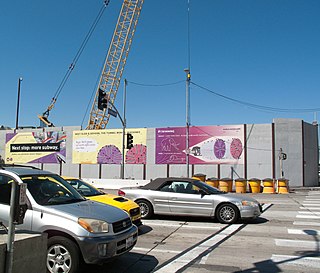
Expo/Crenshaw is a light rail station in the Los Angeles County Metro Rail system located in the Jefferson Park neighborhood of Los Angeles at the intersection of Crenshaw and Exposition Boulevards. The station currently consists of at-grade platforms served by the E Line; new subway platforms, to be served by the Crenshaw/LAX Line, are under construction.

Purple Line Extension Future subway corridor in western Los Angeles County

The Purple Line Extension, formerly known as the Westside Subway Extension and the Subway to the Sea, is a new heavy rail subway corridor in Los Angeles County, California, extending the D Line from its current terminus at Wilshire/Western in Koreatown, Los Angeles to the Westside region. Currently under construction, the corridor will become part of the Los Angeles Metro Rail system. The project is being supervised by Los Angeles County Metropolitan Transportation Authority (Metro). The subway has been given high priority by Metro in its long-range plans, and funding for the project was included in two county sales tax measures, Measure R and Measure M.

This article discusses the history of the Los Angeles County Metropolitan Transportation Authority, the regional transportation planning agency for Los Angeles County, California.

Sepulveda Pass Transit Corridor

The Sepulveda Pass Transit Corridor is a two-phased planned heavy rail transit corridor connecting the Los Angeles Basin to the San Fernando Valley through the Sepulveda Pass in Los Angeles, California, by supplementing the existing freeway. The corridor would partly parallel I-405, and proposed alternatives include heavy rail subway and monorail connecting the G Line in the Valley to the D Line and E Line on the Westside, and the Crenshaw/LAX Line near Los Angeles International Airport.

Westchester/Veterans is an under construction at-grade light rail station in the Los Angeles County Metro Rail system. It will be located near the intersection of Florence and Hindry Avenues in Inglewood, California. The station will be served by the Crenshaw/LAX Line. It is currently under construction and is slated to be completed in 2021.

Wilshire/La Brea station

Wilshire/La Brea is an under-construction heavy-rail subway station in the Los Angeles County Metro Rail system and is slated to open in early 2023. It will be served by the D Line and will be the first station on that line west of Wilshire/Western station.

Wilshire/Fairfax station

Wilshire/Fairfax is an under-construction heavy-rail subway station in the LA Metro system in LA's Miracle Mile area along Wilshire Boulevard. It is slated to open in 2023. It will be served by the D Line and will be the second station west of Wilshire/Western station.

LAX/Metro Transit Center is an under-construction infill light rail transport hub in the Los Angeles County Metro Rail system, located near the intersection of Aviation and 96th Street in the Westchester district of Los Angeles. The station was designed as a station for the Crenshaw/LAX Line and the new terminal station of the C Line. In 2014, LAWA and the LA Metro committee approved a plan for a people mover to the LAX airport terminals, which will connect to Metro at this station.

The Crenshaw Northern Extension Rail Project is a planned Los Angeles Metro Rail light rail transit corridor extension connecting Expo/Crenshaw station to Hollywood/Highland station in Hollywood. The corridor is a north to south route along mostly densely populated areas of the Los Angeles Basin; it would be operated as part of the Crenshaw/LAX Line. The Los Angeles County Metropolitan Transportation Authority (Metro) is prioritizing the project along with pressure from the West Hollywood residents. Construction is slated to start in 2041 and begin service by 2047 unless means to accelerate the project are found.

The history of the Los Angeles Metro Rail and Busway system begins in the early 1970s, when the traffic-choked region began planning a rapid transit system. The first dedicated busway opened along the 10 freeway in 1973, and the region's first light rail line, the Blue Line opened in 1990. Today the system includes over 160 miles (260 km) of heavy rail, light rail, and bus rapid transit lines, with multiple new lines under construction as of 2019.

References

  1. 1 2 3 4 "Crenshaw/LAX Transit Corridor (project website)". Metro (LACMTA). June 27, 2013. Retrieved September 11, 2013.
  2. 1 2 3 Nelson, Laura J. (April 10, 2020). "Construction problems delay Metro's $2-billion Crenshaw Line opening until 2021". Los Angeles Times . Retrieved April 10, 2020.
  3. "Long Range Transportation Plan" (PDF). Metro (LACMTA). Retrieved August 30, 2010.
  4. "Measure R". Metro (LACMTA). Retrieved August 30, 2010.
  5. "Recap/Draft Minutes, Regular Board Meeting, 22 September 2011" (PDF). Metro (LACMTA). September 22, 2011. Retrieved October 1, 2011.
  6. 1 2 3 4 "Metro Board votes to fully fund Leimert Park Village and Hindry stations for Crenshaw/LAX Line". The Source. Metro (LACMTA). May 23, 2013. Retrieved January 22, 2013.
  7. "FTA approves L.A. Metro light rail project". Metro Magazine. January 5, 2012. Retrieved January 23, 2014.
  8. "Metro issues Notice to Proceed for Crenshaw/LAX Line!". The Source. Metro (LACMTA). September 10, 2013. Retrieved January 22, 2014.
  9. 1 2 "And so it begins: ground is broken for 8.5-mile Crenshaw/LAX Line". The Source. Metro (LACMTA). January 21, 2014. Retrieved January 21, 2014.
  10. http://libraryarchives.metro.net/DPGTL/StatusReports/December%202020%20Crenshaw%20LAX%20Transit%20Project%20QPSR%20with%20cover%20letter.pdf
  11. "Letter Line ID Project" (PDF). Metro (LACMTA). Retrieved July 23, 2020.
  12. Ubaldo, Jose (August 7, 2015). "Construction update: Crenshaw/LAX Line". metro.net. Retrieved December 6, 2018.
  13. Hymon, Steve (July 23, 2015). "Actions taken today by Metro Board of Directors". The Source. Metro (LACMTA). Retrieved July 27, 2015. The Board adopted the official names for the stations along the Crenshaw/LAX Line that is currently under construction. The names, from north to south: Expo/Crenshaw, Martin Luther King, Jr., Leimert Park, Hyde Park, Fairview Heights, Downtown Inglewood, Westchester/Veterans and Aviation/Century.
  14. 1 2 Hymon, Steve (June 18, 2018). "Report explains operating plan for Crenshaw/LAX Line and Green Line". metro.net. Retrieved December 6, 2018.
  15. Sumers, Brian (January 21, 2014). "Metro breaks ground on new $2 billion L.A. Crenshaw/LAX Line". Daily Breeze . Retrieved January 31, 2016.
  16. "City Council approves long-awaited people mover to LAX". Los Angeles Times . April 11, 2018. Archived from the original on April 12, 2018. Retrieved April 12, 2018.
  17. "Crenshaw/LAX Line Operations Plan Being Debated, Will Affect Green Line". streetsblog.org. June 22, 2018. Retrieved December 6, 2018.
  18. Chiland, Elijah (July 3, 2018). "Will the Crenshaw Line strand South Bay riders?". Curbed LA. Retrieved December 6, 2018.
  19. StreetsblogLA (December 6, 2018). "Metro bd mtg: Barger votes yes. Hahn Crenshaw/Green C3 motion passes 7-4-2 (Ridley-Thomas, Kuehl abstained)". twitter.com. Retrieved December 6, 2018.
  20. "Crenshaw/LAX Line and Green Line Operating Plan Presentation - Sports Competitions - American Football". Scribd. Retrieved December 6, 2018.
  21. 1 2 Barrett, Matthew (2014). "Los Angeles Transportation Transit History – South LA" (PDF). LACMTA . Retrieved January 28, 2021.
  22. COASTAL CORRIDOR RAIL TRANSIT PROJECT NORTH SEGMENT (PDF). Metro (Report). Bechtel. August 1988. Retrieved September 1, 2020.
  23. 1 2 3 4 "Crenshaw Transit Corridor DEIS/DEIR". Metro (LACMTA). October 2009. Retrieved August 20, 2010.
  24. 1 2 "Crenshaw Transit Corridor Locally Preferred Alternative (LPA)" (PDF). Metro (LACMTA). December 2009. Retrieved August 20, 2010.
  25. 1 2 "Planning & Programming Committee Crenshaw/LAX Transit Corridor Adopt the Locally Preferred Alternative Maintenance Facility Site" (PDF). Metro (LACMTA). April 20, 2011. Retrieved January 22, 2014.
  26. "Crenshaw-Prairie Transit Corridor Project Scoping Study". Metro (LACMTA). February 2008. Retrieved 2008-07-21.
  27. "Grade Crossing Policy For Light Rail Transit" (PDF). Metro (LACMTA). December 2003. Retrieved August 20, 2010.
  28. "Crenshaw/LAX Transit Corridor | Maintenance Facility Planning". Metro (LACMTA). February 24, 2011. Retrieved May 28, 2012.
  29. "SDEIS/RDEIR Part I, 2.0 - Alternatives Considered" (PDF). Metro (LACMTA). February 2011. Retrieved January 22, 2014.
  30. Ridley-Thomas, Mark (December 2009). "MTA Board Unanimously Adopts $1.7 Billion Crenshaw To LAX Transit Corridor Light Rail System Championed By Supervisor Ridley-Thomas" . Retrieved August 20, 2010.
  31. "Crenshaw/LAX Transit Corridor Project Park Mesa Heights Grade Separation Analysis" (PDF). Metro (LACMTA). September 16, 2010. Retrieved January 22, 2013.
  32. "Board votes to add Leimert Park Village station to Crenshaw/LAX Line — if the funds can be found". The Source. Metro (LACMTA). May 26, 2011. Retrieved January 22, 2013.
  33. Nelson, Laura J. (June 26, 2014). "Train station to connect Metro rail lines with LAX approved". Los Angeles Times . Retrieved May 21, 2015.
  34. "Airport Metro Connector". Metro (LACMTA). Retrieved May 21, 2015.
  35. "Proposed One-Half Cent Sales Tax for Transportation Outline of Expenditure Categories" (PDF). Metro (LACMTA). August 13, 2008. Retrieved January 22, 2013.
  36. "Crenshaw Transit Corridor Project Final Feasibility Study - Wilshire/La Brea Transit Extension" (PDF). Metro (LACMTA). May 2009. Retrieved January 23, 2014.
  37. "AGENDA Regular Board of Directors Meeting" (PDF). Metro (LACMTA). October 28, 2010. pp. 10–12. Retrieved January 23, 2014.
  38. "Measure R Project Delivery Committee Hollywood/West Hollywood Transit Corridor Connection To Crenshaw/LAX Transit Corridor Initial Review" (PDF). Metro (LACMTA). November 18, 2010. Retrieved January 23, 2014.
  39. "WeHo to Consider Stepping Up Efforts to Lure a Metro Line Stop". wehoville.com. May 2, 2014. Retrieved December 6, 2018.
  40. Broverman, Neal (February 23, 2016). "How West Hollywood Is Fighting for Its Own Subway Los Angeles Magazine". lamag.com. Retrieved December 6, 2018.
  41. "Metro Moves Up Date for Possible Northern Extension of Crenshaw/LAX Line". wehoville.com. September 17, 2016. Retrieved December 6, 2018.
  42. "Crenshaw-Prairie Transit Corridor Project Status Report" (PDF). Metro (LACMTA). March 19, 2008. Retrieved July 21, 2008.
  43. "Crenshaw/LAX Transit Corridor Project Final Environmental Impact Report/Final Environmental Impact Statement Executive Summary" (PDF). Metro (LACMTA). August 2011. p. ES-26. Retrieved January 21, 2014.