This article relies largely or entirely on a single source .(January 2021) |
Crockerhill is a hamlet in south Hampshire, England. The population at the 2011 Census was included in the Borough of Fareham
This article relies largely or entirely on a single source .(January 2021) |
Crockerhill is a hamlet in south Hampshire, England. The population at the 2011 Census was included in the Borough of Fareham

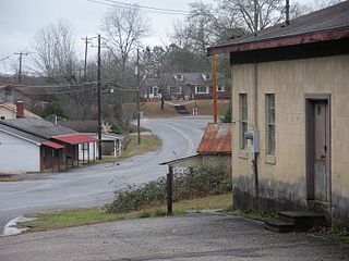
Jackson's Gap is a town in Tallapoosa County, Alabama, United States. It incorporated in 1980. At the 2010 census the population was 828, up from 761.

Stanfield is a census-designated place (CDP) in Pinal County, Arizona, United States. The population was 651 at the 2000 census. Shamrock Farms operates a farm in Stanfield.
Kekuli Bay Provincial Park, formerly Kalamalka West Provincial Park, is a provincial park in British Columbia, Canada, located on the west shore of Kalamalka Lake on BC Highway 97 south of Vernon. The lake is popular for waterskiing and boating, and the park includes a boat launch, as well as a campground with a view of the lake. The park was established in 1990. Its size is about 57 hectares.

Rebecca Spit Marine Provincial Park is a provincial park in British Columbia, Canada, located on the east side of Quadra Island, near the city of Campbell River.
Tahsish-Kwois Provincial Park is a provincial park in British Columbia, Canada. Located west of Woss Lake, it is approximately 10,829 ha. in size.

Sélibaby is a capital town and department of the Guidimaka Region, in Mauritania. It is located at around 15°9′33″N12°11′00″W.

The Gwa'sala-Nakwaxda'xw Nations are an amalgamation of two Kwakwaka'wakw peoples in a band government based on northern Vancouver Island in British Columbia, whose main reserve community is near the town of Port Hardy in the Queen Charlotte Strait region of the Central Coast region of British Columbia, Canada. In the 1960s the Gwa'sala (Gwaʼsa̱la), the 'Nakwaxda'xw (ʼNakʼwaxdaʼx̱w) and the Kwakiutl peoples were amalgamated. Eventually the Gwa'sala-'Nakwaxda'xw Nations and the Kwakiutl First Nation separated into the two groups that are recognized by the federal government to this day. Gwa'sala-'Nakwaxda'xw Nations were forcibly relocated from their homelands to a location near Port Hardy.

Puerres is a town and municipality in the Nariño Department, Colombia.
The Rural Municipality of Park is a former rural municipality (RM) in the Canadian province of Manitoba. It was originally incorporated as a rural municipality on January 1, 1997. It ceased on January 1, 2015 as a result of its provincially mandated amalgamation with the RM of Harrison to form the Municipality of Harrison Park.
Kingcome, also known as Okwunalis or Ukwana'lis is an unincorporated settlement in the Kingcome Inlet area of the Central Coast of British Columbia, Canada, located a few kilometres up the Kingcome River from the head of the inlet. Quaee Indian Reserve No. 7 is the Indian reserve containing the village.
The Nazko First Nation is a First Nations government of the Dakelh people in the north-central Interior of British Columbia. Its reserves are located around the community of Nazko, British Columbia, which is 120 km west of Quesnel and southwest of Prince George.
The Compton Névé is a névé in the Pacific Ranges of the Coast Mountains in southwestern British Columbia, Canada, located southeast of the Homathko Icefield and Mount Gilbert and to the south of the Bishop River. It lies west of the Lillooet Icecap and is connected to it by the Ring Glacier, which sits astride Ring Pass, the divide between the Lillooet and Bishop Rivers, and has an area of 714 km2 (276 sq mi).
The Tahltan First Nation, also known as the Tahltan Indian Band, is a band government of the Tahltan people. Their main community and reserves are located at Telegraph Creek, British Columbia. Their language is the Tahltan language, which is an Athabaskan language also known as Nahanni, is closely related to Kaska and Dunneza. Their Indian and Northern Affairs Canada band number is 682. The Tahltan First Nation is joined with the Iskut First Nation in a combined tribal council-type organization known as the Tahltan Nation.
The Whiting River is a stream, about 50 miles (80 km) long, in the U.S. state of Alaska and the Canadian province of British Columbia. It enters the waters of Stephens Passage at the Borough of Juneau in the Alaska Panhandle between the mouths of the Taku and Stikine Rivers. The main tributary of the Whiting is the South Whiting. The river's basin is at the northern end of the Stikine Icecap The river crosses the international boundary at 58°11′00″N133°13′00″W. Its origin is in the Chechidla Range, and its terminus is at Gilbert Bay, which empties into Stephens Passage.
The Nezinscot River is a 15-mile-long (24 km) river in Maine, traversing the counties of Oxford and Androscoggin. It runs east from the confluence of its East Branch and West Branch in Buckfield to its mouth on the Androscoggin River in Turner.
Rosengart is a hamlet in Saskatchewan.

Aïn Larbaâ District is a district of Aïn Témouchent Province, Algeria.

Burgess is an unincorporated community in Northumberland County, in the U.S. state of Virginia. The ZIP Code is 22432.
Sir Graham Moore Islands may refer to:
Matilpi is a locality on the Central Coast of British Columbia, Canada, located northeast of Hull Island on the east side of Havannah Channel.