
Offa's Dyke Path is a long-distance footpath following closely the Wales–England border. Opened in 1971, it is one of Britain's National Trails and draws walkers from throughout the world. Some of the 177-mile (285 km) route either follows, or keeps close company with, the remnants of Offa's Dyke, an earthwork, most of which was probably constructed in the late 8th century on the orders of Offa of Mercia.

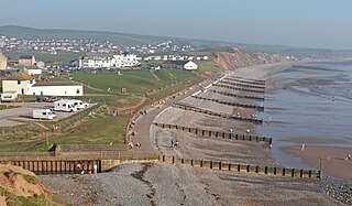
The South West Coast Path is England's longest waymarked long-distance footpath and a National Trail. It stretches for 630 miles (1,014 km), running from Minehead in Somerset, along the coasts of Devon and Cornwall, to Poole Harbour in Dorset. Because it rises and falls with every river mouth, it is also one of the more challenging trails. The total height climbed has been calculated to be 114,931 ft (35,031 m), almost four times the height of Mount Everest. It has been voted 'Britain's Best Walking route' twice in a row by readers of the Ramblers Walk magazine, and regularly features in lists of the world's best walks.

The Icknield Way is an ancient trackway in southern and eastern England that goes from Norfolk to Wiltshire. It follows the chalk escarpment that includes the Berkshire Downs and Chiltern Hills.

The Pennine Way is a National Trail in England, with a small section in Scotland. The trail runs 267 miles (429 km) from Edale, in the northern Derbyshire Peak District, north through the Yorkshire Dales and the Northumberland National Park and ends at Kirk Yetholm, just inside the Scottish border. The path runs along the Pennine hills, sometimes described as the "backbone of England". Although not the United Kingdom's longest National Trail, it is according to the Ramblers' Association "one of Britain's best known and toughest".
The Coast to Coast Walk is a 192-mile (309 km) unofficial and mostly unsignposted long-distance footpath in Northern England. Devised by Alfred Wainwright, it passes through three contrasting national parks: the Lake District National Park, the Yorkshire Dales National Park, and the North York Moors National Park.

The E2 European long distance path or E2 path is a 4850 km (3010-mile) series of long-distance footpaths that is intended to run from Galway in Ireland to France's Mediterranean coast and currently runs through Northern Ireland, Scotland, England, Belgium, Luxembourg and France, with an alternative midsection equally designated via the Netherlands and east coast of England. It is one of the network of European long-distance paths.

The Jurassic Way is a designated and signed long-distance footpath that connects the Oxfordshire town of Banbury with the Lincolnshire town of Stamford in England. It largely follows an ancient ridgeway traversing Britain; most of its 88-mile (142 km) route is in Northamptonshire on the Jurassic limestone ridge in the north of that county.

Barmouth Bridge, or Barmouth Viaduct is a Grade II* listed single-track wooden railway viaduct across the estuary of the River Mawddach near Barmouth, Wales. It is 699 metres (764 yd) long and carries the Cambrian Line. It is the longest timber viaduct in Wales and one of the oldest in regular use in Britain.

The Southern Upland Way is a 338-kilometre (210 mi) long distance coast-to-coast trail in southern Scotland. The route links Portpatrick in the west and Cockburnspath in the east via the hills of the Southern Uplands. It opened in 1984, and was the UK’s first officially recognised coast-to-coast long-distance route. The Way is designated as one of Scotland's Great Trails by Scottish Natural Heritage, and is the longest of the 29 Great Trails. The Southern Upland Way meets with seven of the other Great Trails: the Annandale Way, the Berwickshire Coastal Path, the Borders Abbeys Way, the Cross Borders Drove Road, the Mull of Galloway Trail, the Romans and Reivers Route and St Cuthbert's Way.
The Mendip Way is an 80-kilometre (50 mi) long-distance footpath across the Mendip Hills from Weston-super-Mare to Frome. It is divided into two sections.

The Leeds Country Way is a circular long-distance footpath of 62 miles (99 km) around Leeds, West Yorkshire, England. It is never more than 7 miles (11 km) from Leeds City Square, but is mainly rural with extensive views in the outlying areas of the Leeds metropolitan district. It follows public Rights of Way including footpaths, bridleways and minor lanes, with a few short sections along roads.
The Macmillan Way West is a long distance footpath in Somerset and Devon, England. It runs for 102 miles (164 km) from Castle Cary in Somerset to Barnstaple in Devon. It is one of the Macmillan Ways and connects with the main Macmillan Way at Castle Cary.
The Ramblers, formally known as The Ramblers' Association, is the largest walkers' rights organisation in Great Britain, and aims to represent the interests of walkers. It is a charity registered in England and Wales and in Scotland, with around 123,000 members.

A long-distance trail is a longer recreational trail mainly through rural areas used for hiking, backpacking, cycling, horse riding or cross-country skiing. They exist on all continents except Antartica.
The Macmillan Way is a long-distance footpath in England that links Boston, Lincolnshire to Abbotsbury in Dorset. The route's distance is 290 miles (470 km). It is promoted to raise money for the charity Macmillan Cancer Relief.

The Pendle Way is a Recreational Path in the South Pennines of England which encircles the borough of Pendle. It was officially opened in 1987. The circuit is 45 miles (72 km), and according to the Long Distance Walkers Association involves 1839 m (6033 ft) ascent reaching 557 m (1,827 ft) maximum height. Its attractions include historical associations with the seventeenth century Pendle Witches, connections with the Brontës, stonebuilt villages in the traditional style of East Lancashire and the South Pennines, relics of the weaving and lead mining industry, and limestone meadows and millstone grit moorland culminating in the ascent of Pendle Hill.

The Dava Way is a 38-kilometre (24 mi) long-distance path that mostly follows the route of the former Highland Railway between Grantown and Forres. The railway line, built as a route between Inverness and Perth, opened in 1863 and closed in 1965. The route was reopened as a long distance path in 2005. It is listed as one of Scotland's Great Trails by Scottish Natural Heritage, and links directly to two further Great Trails: the Moray Coast Trail and the Speyside Way. It is currently the shortest of the Great Trails, but can be combined with sections of the Moray Coast Trail and Speyside Way to form a 153-kilometre (95 mi) circular route known as the Moray Way. About 3,000 people use the path every year, of whom about 400 complete the entire route.

A Dales High Way is a long-distance footpath in northern England. It is 90 miles (140 km) long and runs from Saltaire in West Yorkshire to Appleby-in-Westmorland, Cumbria, roughly parallel to the line of the Settle and Carlisle Railway.


