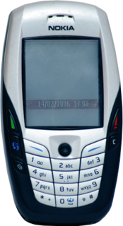
The Nokia 6600 is a smartphone introduced on June 16, 2003 by Nokia, costing approximately €600 when released in October 2003. It was Nokia's high-end model of the 6xxx Classic Business Series. At the time of release, it was the most advanced product ever launched by Nokia, and it runs on Symbian OS 7.0s. It also featured a VGA camera, a music player and video player, Bluetooth and extended storage by memory card, being the second non-Communicator to do so.

The Nokia 6630 is a 3G smartphone announced by Nokia on June 14, 2004 and released in November. It runs on Symbian OS 8.0a. Codenamed Charlie during development, it is an evolution of the 6600 and 6620 smartphones, supporting tri-band GSM.

Charity is a small township in Guyana, located in the Pomeroon-Supenaam region.

The Brazos Valley is a region in the U.S. state of Texas consisting of the counties of Brazos, Burleson, and Robertson, and the neighboring counties of Grimes, Leon, Madison, and Washington.

Villa del Rosario is a Colombian municipality and town located in the eastern part of North Santander department. It is part of the Metropolitan Area of Cúcuta. The municipality is bordered to the north by Venezuela and the municipality of Cúcuta, to the south by the municipalities of Ragonvalia and Chinácota, to the east by Venezuela and to the west by the municipality of Los Patios.
The Little River is a 4.6 mile long river located in southeastern New Hampshire in the United States. It is located entirely in the town of North Hampton, and it flows directly into the Atlantic Ocean, south of Little Boars Head.

Wonder World is a natural theme park located in San Marcos, Texas. The park's primary attraction is Wonder Cave, an ancient earthquake cave and Recorded Texas Historic Landmark. Other attractions include an anti-gravity house, a trackless motor train, and a wildlife park.

The Nokia 6600 slide is a mobile phone series by Nokia. It includes the original 6600 slide and the updated 6600i slide. The phone runs the Series 40 5th edition platform, including Feature Pack 1. This is the slide version of updated Nokia 6600 series.
The Black Rock Rail Yard is on the west side of Buffalo, New York, a half mile inland from the Niagara River, in the Black Rock neighborhood. The rail yard receives Canadian National Railway freight trains arriving from Canada by way of the International Railway Bridge.
Padamo River is a river of Venezuela. It is part of the Orinoco River basin.
Matacuni River is a river of Venezuela. It is part of the Orinoco River basin.
Ocamo River is a river of Venezuela. It is part of the Orinoco River basin.
Mavaca River is a river of Venezuela. It is part of the Orinoco River basin.
Manaviche River is a river of Venezuela. It is part of the Orinoco River basin.

The Unare River is a river of Venezuela. It drains into the Caribbean Sea. In the 17th century the Dutch had a fort at the mouth of the river. It was constructed to protect their salt collection in the area. The other Dutch fort ever to stand on what is now Venezuelan soil stood on the little uninhabited islet La Tortuga, just west of Isla Margarita. It was built for the same reason as the one in Unare: to protect the salt harvesting activities of the Dutch. The Caribbean islands St. Maarten and Bonaire would subsequently satisfy the Dutch demand for salt.
Region 4 is the name of a Statistics Canada census division, one of six in the Northwest Territories, Canada. It was introduced in the 2011 census, along with Regions 1, 2, 3, 5, and 6, resulting in the abolition of the former census divisions of Fort Smith Region and Inuvik Region.

The Roman Catholic Diocese of Bo was created in January 2011, split off from the Archdiocese of Freetown. There are about 50,000 Roman Catholics under the jurisdiction of the diocese. Its first and present bishop is Charles Allieu Matthew Campbell.
Otranto Township is a township in Mitchell County, Iowa, USA.
Pilón is a corregimiento in Montijo District, Veraguas Province, Panama with a population of 890 as of 2010. Its population as of 1990 was 505; its population as of 2000 was 541.

