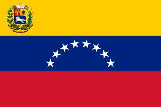
Venezuela is a country in South America, and part of the Caribbean South America, bordering the Caribbean Sea and the North Atlantic Ocean, between Colombia and Guyana. It is situated on major sea and air routes linking North and South America. Located at the northernmost end of South America, Venezuela has a total area of 916,445 square kilometers and a land area of 882,050 square kilometers, about twice the size of California. Shaped roughly like an inverted triangle, the country has a 2,800-kilometer coastline and is bounded on the north by the Caribbean Sea and the Atlantic Ocean, on the east by Guyana, on the south by Brazil, and on the west by Colombia. Its maritime limits border Trinidad and Tobago, Dominica, the Dominican Republic, Grenada, St. Kitts and Nevis, St. Vincent and the Grenadines, France, the United Kingdom, the Netherlands, and the United States.

YVTO is the callsign of the official time signal from the Juan Manuel Cagigal Naval Observatory in Caracas, Venezuela. The content of YVTO's signal, which is a continuous 1 kW amplitude modulated carrier wave at 5.000 MHz, is much simpler than that broadcast by some of the other time signal stations around the world, such as WWV.

Amazonas State is one of the 23 states (estados) into which Venezuela is divided. It covers nearly a fifth of the area of Venezuela, but has less than 1% of Venezuela's population.

The Apure River is a river of southwestern Venezuela, formed by the confluence of the Sarare and Uribante near Guasdualito, in Venezuela, at 7°15′N70°40′W, and flowing across the llanos into the Orinoco. It provides significant transportation in the area.
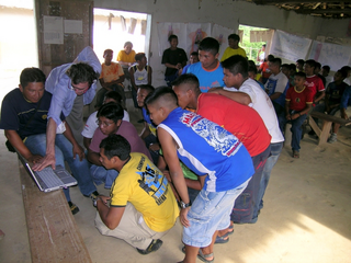
Baniwa are South American Indians, who speak the Baniwa language belonging to the Maipurean (Arawak) language family. They live in the Amazon Region, in the border area of Brazil, Colombia and Venezuela and along the Rio Negro and its tributaries.

The Arauca River rises in the Andes Mountains of north-central Colombia and ends at the Orinoco in Venezuela. For part of its run it is the boundary between Colombia and Venezuela. The major city on its banks is Arauca, Colombia and El Amparo, Venezuela.
The Estadio Universitario is a multi-use stadium in Caracas, Venezuela, and is used mostly for baseball games. The stadium holds 25,690 people and was built in 1952.

Estadio Brígido Iriarte is a multi-purpose stadium in Caracas, Venezuela. It is currently used mostly for football matches and is the home stadium of Venezuelan Primera División teams Atlético Venezuela and Metropolitanos, as well as second tier league team Estudiantes de Caracas. The stadium currently holds 10,000 people.

Petare is a city in Miranda, Venezuela, and is part of the urban area of Caracas. It is located in the Sucre Municipality, one of the five divisions of Caracas. The city was founded in 1621 under the name of San Jose de Guanarito. It grew to become a part of the greater Caracas area as the latter expanded in area and population.
Universidad Católica Andrés Bello (UCAB) is a private university in Venezuela. One of the largest universities in Venezuela, UCAB has campuses in several cities, such as Caracas, Los Teques, Guayana and Coro.
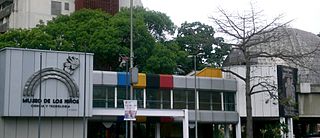
Children's Museum of Caracas is a museum in Caracas, Venezuela aimed at teaching children about science, technology, culture and arts. It was established by the former First Lady of Venezuela, Alicia Pietri de Caldera in 1982.
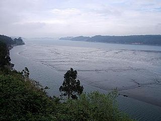
The Eo is a river, 91 kilometres (57 mi) long, in northwestern Spain. Its estuary forms the boundary between the regions of Galicia and Asturias. The river is known for its salmon fishing.

The Gower Branch Canal is a half-mile canal at Tividale in England, linking Albion Junction on the Birmingham Level of the Birmingham Canal Navigations, and Bradeshall Junction on the BCN's older Wolverhampton (473 ft) level, via three locks, the Brades Locks, at the Southern, Bradeshall end.

The Biblioteca Nacional de Venezuela, located in Caracas, is the legal deposit and copyright for Venezuela. It was established on July 13, 1833.

The A386 is a primary route in Devon, England. It runs from Plymouth on the south coast to Appledore on the north coast.

Caicara del Orinoco is a town in, and the administrative seat of, Cedeño Municipality, Bolívar State, Venezuela. It was founded in the middle of the Eighteenth Century.
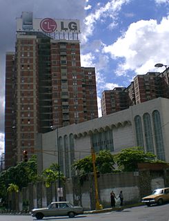
Tiféret Israel Synagogue is a religious temple located in El Recreo, close to Plaza Venezuela in Caracas, capital of Venezuela. It is also the headquarters of the Israelite Association of Venezuela.
Cabuya is a corregimiento in Parita District, Herrera Province, Panama with a population of 1,092 as of 2010. Its population as of 1990 was 1,144; its population as of 2000 was 1,171.
Juan Díaz is a corregimiento within Panama City, in Panamá District, Panamá Province, Panama with a population of 100,636 as of 2010. Its population as of 1990 was 73,809; its population as of 2000 was 88,165.

The Colombia–Venezuela border is an ongoing international border of 2,219 kilometers that separates the territories of Colombia and Venezuela, with a total of 603 milestones that demarcate the line. It is the longest border of both Colombia and Venezuela.
