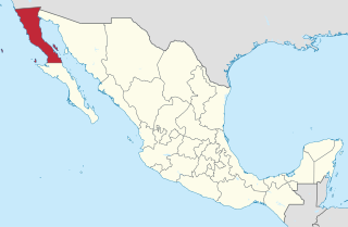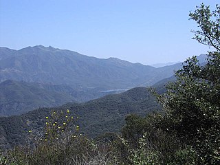
The California chaparral and woodlands is a terrestrial ecoregion of lower northern, central, and southern California and northwestern Baja California (Mexico), located on the west coast of North America. It is an ecoregion of the Mediterranean forests, woodlands, and scrub Biome, and part of the Nearctic ecozone.

Mount Tamalpais is a peak in Marin County, California, United States, often considered symbolic of Marin County. Much of Mount Tamalpais is protected within public lands such as Mount Tamalpais State Park, the Marin Municipal Water District watershed, and National Park Service land, such as Muir Woods.

The Modoc Plateau lies in the northeast corner of California as well as parts of Oregon and Nevada. Nearly 1,000,000 acres (400,000 ha) of the Modoc National Forest are on the plateau between the Medicine Lake Highlands in the west and the Warner Mountains in the east.
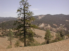
The Diablo Range is a mountain range in the California Coast Ranges subdivision of the Pacific Coast Ranges. It is located in the eastern San Francisco Bay area south to the Salinas Valley area of northern California, the United States.

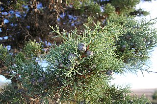
Cupressus guadalupensis, the Guadalupe cypress, is a species of cypress from Guadalupe Island in the Pacific Ocean off western North America.

The Guadalupe storm petrel is a small seabird of the storm petrel family Hydrobatidae. It is apparently extinct.

California oak woodland is a plant community found throughout the California chaparral and woodlands ecoregion of California in the United States and northwestern Baja California in Mexico. Oak woodland is widespread at lower elevations in coastal California; in interior valleys of the Coast Ranges, Transverse Ranges and Peninsular Ranges; and in a ring around the California Central Valley grasslands. The dominant trees are oaks, interspersed with other broadleaf and coniferous trees, with an understory of grasses, herbs, geophytes, and California native plants.

Dwarf forest, elfin forest, or pygmy forest is a rare ecosystem featuring miniature trees, inhabited by small species of fauna such as rodents and lizards. They are usually located at high elevations, under conditions of sufficient air humidity but poor soil. There are two main dwarf forest ecosystem types, involving different species and environmental characteristics: coastal temperate and montane tropical regions. Temperate coastal dwarf forest is common for parts of Southern California. Montane tropical forests are found across tropical highlands of Central America, northern South America and Southeast Asia. There are also other isolated examples of dwarf forests scattered across the world.
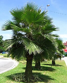
Brahea edulis is a palm endemic to Guadalupe Island, Mexico; a few stands have been planted elsewhere. It is a fan palm which grows 4.5–13 metres tall. It grows between 400 and 1000 meters above mean sea level (ASL).

Cupressus sargentii is a species of conifer in the family Cupressaceae known by the common name Sargent's cypress. It is endemic to California, where it is known from Mendocino County southwards to Santa Barbara County. This taxon is limited to the Coast Range mountains. It grows in forests with other conifers, as well as chaparral and other local mountain habitat, usually in pure stands on serpentine soils. It generally grows 10 to 15 meters tall, but it is known to exceed 22 meters. On Carson Ridge in Marin County, as well as Hood Mountain in Sonoma County, the species comprises a pygmy forest of trees which do not attain heights greater than 240–360 cm due to high mineral concentrations in the serpentine soil.

Kent Island is a small island in Marin County, California. In 1964 it was proposed for large-scale development including a hotel and marina, but the plan was defeated in 1967. The island is now included in the Greater Farallones National Marine Sanctuary.

Bolinas Ridge is a north-south ridge in southwestern Marin County, California. Much of the western side of the ridge is protected parkland in the Golden Gate National Recreation Area, and the eastern side is watershed lands of the Marin Municipal Water District.

Belvedere Island is a rocky island in Marin County, California which was separated by a marsh from the mainland and has now been linked by two spits. Part of the town of Belvedere, California is located on the island.

Cupressus forbesii, now reclassified by some as Hesperocyparis forbesii, and with the common names Tecate cypress or Forbes' cypress, is a species of cypress native to southwestern North America.
Crown sprouting is the ability of a plant to regenerate its shoot system after destruction by activating dormant vegetative structures to produce regrowth from the root crown. These dormant structures take the form of lignotubers or basal epicormic buds. Plant species that can accomplish crown sprouting are called crown resprouters and, like them, are characteristic of fire-prone habitats such as chaparral.

Arctostaphylos virgata is a species of manzanita known by the common names Bolinas manzanita and Marin manzanita.
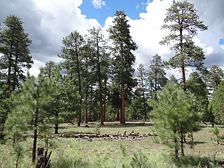
Ponderosa shrub forest is a plant association and plant community found in western North America. It is found from the Rocky Mountains to the Pacific Coast Ranges in the Western United States and Western Canada.
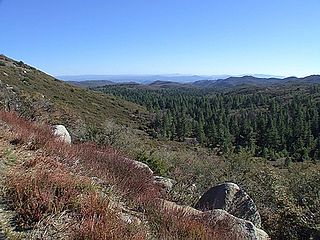
The California coastal sage and chaparral, a sub-ecoregion of the California chaparral and woodlands ecoregion, is found in southwestern California and northwestern Baja California in Mexico.
