The Orange River is the longest river in South Africa and the Orange River Basin extends extensively into Namibia and Botswana to the north. It rises in the Drakensberg mountains in Lesotho, flowing westwards through South Africa to the Atlantic Ocean. The river forms part of the international borders between South Africa and Namibia and between South Africa and Lesotho, as well as several provincial borders within South Africa. Except for Upington, it does not pass through any major cities. The Orange River plays an important role in the South African economy by providing water for irrigation and hydroelectric power. The river was named the Orange River in honour of the Dutch ruling family, the House of Orange, by the Dutch explorer Robert Jacob Gordon. Other names include Gariep River, Groote River or Senqu River.

The Vaal River is the largest tributary of the Orange River in South Africa. The river has its source near Breyten in Mpumalanga province, east of Johannesburg and about 30 kilometres (19 mi) north of Ermelo and only about 240 kilometres (150 mi) from the Indian Ocean. It then flows westwards to its conjunction with the Orange River southwest of Kimberley in the Northern Cape. It is 1,120 kilometres (700 mi) long, and forms the border between Mpumalanga, Gauteng and North West Province on its north bank, and the Free State on its south.

The Molopo River is one of the main rivers in Southern Africa. It has a length of approximately 960 kilometres and a catchment area of 367,201 km2 with Botswana, Namibia and South Africa sharing roughly about a third of the basin each.

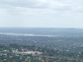
The Umgeni River or Mgeni River, is a river in KwaZulu-Natal, South Africa. It rises in the "Dargle" in the KZN midlands, and its mouth is at Durban, some distance north of Durban's natural harbour. The name is taken to mean the river of entrance in Zulu, though other meanings have been proposed.

The Olifants River, Lepelle or Obalule is a river in South Africa and Mozambique, a tributary of the Limpopo River. It falls into the Drainage Area B of the Drainage basins of South Africa. The historical area of the Pedi people, Sekhukhuneland, is located between the Olifants River and one of its largest tributaries, the Steelpoort River.

Gariep Dam located in South Africa, near the town of Norvalspont, bordering the Free State and Eastern Cape provinces. Its primary purpose is for irrigation, domestic and industrial use as well as for power generation.

The Vanderkloof Dam is situated approximately 130 km (81 mi) downstream from Gariep Dam and is fed by the Orange River, South Africa's largest river. Vanderkloof Dam is the second-largest dam in South Africa, having the highest dam wall in the country at 108 metres (354 ft). The dam was commissioned in 1977; it has a capacity of 3,187.557 million cubic metres (2,584,195 acre⋅ft) and a surface area of 133.43 square kilometres (51.52 sq mi) when full. Other rivers flowing into this dam are the Berg River, two unnamed streams coming in from the direction of Reebokrand, the Knapsak River, Paaiskloofspruit, Seekoei River, Kattegatspruit and the Hondeblaf River, in a clockwise direction.

The Pongola or Phongolo River is a river in South Africa. It is a tributary of the Maputo River. It rises near Utrecht in northern KwaZulu-Natal, flows east through Pongola, is dammed at Pongolapoort, and crosses the Ubombo Mountains; then it flows north towards Mozambique, joining the Maputo River.

The Buffalo River is situated in the city of East London on the East Coast of South Africa. It is to the west of the Nahoon River. It is the only navigable river in South Africa. The town of East London was thus established around it.

Inanda Dam is an earth-fill type dam located on the Mgeni River, near Hillcrest, KwaZulu-Natal, South Africa. It was established in 1989 and its primary purpose is to serve for domestic and industrial use.
Mokolo Dam is a rock-fill type dam located on the Mokolo River, near Lephalale, Limpopo, South Africa. It was established in 1980. The Malmanies River and the Bulspruit River, two tributaries of the Mokolo, also enter the dam from its left side. The dam supplies water to Lephalale town. The dam mainly serves for municipal and industrial purposes and its hazard potentials has been ranked high (3).
Ncora Dam is a gravity type dam located on the Tsomo River, near Tsomo, Eastern Cape, South Africa. It was established in 1972 and serves mainly for irrigation purposes. The hazard potential of the dam has been ranked high (3).

The Levubu River or Levuvhu is located in the northern Limpopo province of South Africa. Some of its tributaries, such as the Mutshindudi River and Mutale River rise in the Soutpansberg Mountains.

The Bushman's River is an east to north-easterly flowing tributary of the Tugela River, in the KwaZulu-Natal province of South Africa. It rises in the Drakensberg Mountain range, with its upper catchment in the Giant's Castle Game Reserve, north of the Giant's Castle promontory. It feeds the Wagendrift Dam and then flows past the town of Estcourt to join the Tugela River near the town of Weenen.
Hazelmere Dam is a combined concrete gravity type dam located on the Mdloti River, Kwazulu Natal, South Africa. It was established in 1977 and its primary purpose is to serve for irrigation and domestic use. The hazard potential of the dam assembly has been ranked high (3).

The Crocodile River is a river in South Africa. After its confluence with the Marico River, both rivers form the Limpopo River.

The Marico River or Madikwe is a river in Southern Africa. There are a number of dams in its basin. Groot Marico town is named after the Marico River. After it is joined on its right bank by the Crocodile River it is known as the Limpopo River.

The Mooi River is a river in North West Province, South Africa. It is a tributary of the Vaal River and belongs to the Upper Vaal Water Management Area.