The Raritan River is a major river of central New Jersey in the United States. Its watershed drains much of the mountainous area of the central part of the state, emptying into the Raritan Bay on the Atlantic Ocean.

The Permian Basin is a large sedimentary basin in the southwestern part of the United States. The basin contains the Mid-Continent Oil Field province. This sedimentary basin is located in western Texas and southeastern New Mexico. It reaches from just south of Lubbock, past Midland and Odessa, south nearly to the Rio Grande River in southern West Central Texas, and extending westward into the southeastern part of New Mexico. It is so named because it has one of the world's thickest deposits of rocks from the Permian geologic period. The greater Permian Basin comprises several component basins; of these, the Midland Basin is the largest, Delaware Basin is the second largest, and Marfa Basin is the smallest. The Permian Basin covers more than 86,000 square miles (220,000 km2), and extends across an area approximately 250 miles (400 km) wide and 300 miles (480 km) long.

An endorheic basin is a limited drainage basin that normally retains water and allows no outflow to other external bodies of water, such as rivers or oceans, but converges instead into lakes or swamps, permanent or seasonal, that equilibrate through evaporation. Such a basin may also be referred to as a closed or terminal basin or as an internal drainage system or interior drainage basin.
In the United States of America, an interstate compact is an agreement between two or more states. Article I, Section 10 of the United States Constitution provides that "No State shall, without the Consent of Congress... enter into any Agreement or Compact with another State." Consent can be obtained in one of three ways. First, there can be a model compact and Congress can grant automatic approval for any state wishing to join it, such as the Driver License Compact. Second, states can submit a compact to Congress prior to entering into the compact. Third, states can agree to a compact then submit it to Congress for approval, which, if it does so, causes it to come into effect. Not all compacts between states require explicit Congressional approval – the Supreme Court ruled in Virginia v. Tennessee that only those agreements which would increase the power of states at the expense of the federal government required it.

The Schuylkill River is an important river running northwest to southeast in eastern Pennsylvania, which was improved by navigations into the Schuylkill Canal. Several of its tributaries drain major parts of the center-southern and easternmost Coal Regions in the state.

Brandywine Creek is a tributary of the Christina River in southeastern Pennsylvania and northern Delaware in the United States. The Lower Brandywine is 20.4 miles (32.8 km) long and is a designated Pennsylvania Scenic River with several tributary streams. The East Branch and West Branch of the creek originate within 2 miles (3 km) of each other on the slopes of Welsh Mountain in Honey Brook Township, Pennsylvania, about 20 miles (32 km) northwest of their confluence.

Penobscot Knob, also Penobscot Mountain, is a summit located in the western fringe of the Poconos nearest to Mountain Top, Pennsylvania which in the Solomon Gap pass below it lies an important multi-modal transportation corridor. At one time before incorporation, Mountain Top and the saddle of the pass was known by the Amerindian name Penobscot. Penobscot Mountain forms part of the drainage divide between the Lehigh Valley & greater Delaware River drainage basin and the Wyoming and Susquehanna Valley, part of the Potomac River drainage basin. The pass formed between Penobscot and Haystack Mountain a few thousand feet to the West was one of the few places a railroad could be envisioned in the 1830s when the fuel crises in eastern cities demanded easier transportation to the Northern Anthracite Coal Fields, which ironically, came to be exploited by the company with a near monopoly in providing coal from the Southern Anthracite region, Lehigh Coal & Navigation Company, which had built both the Lehigh Canal, but also the nation's second railway, the Summit Hill & Mauch Chunk Railroad. The whole uplands north and west faces over look the Wyoming Valley from the southeastern corner near Hazleton towards and through the greater south Wilkes-Barre area. The southern and eastern slopes just give peeks into portions of the Poconos and wider views of the Lehigh Valley descending down to White Haven, for the Poconos technically are left-bank bounded by the Lehigh.

The Delaware and Hudson Canal was the first venture of the Delaware and Hudson Canal Company, which would later build the Delaware and Hudson Railway. Between 1828 and 1899, the canal's barges carried anthracite coal from the mines of Northeastern Pennsylvania to the Hudson River and thence to market in New York City.

A drainage divide, water divide, divide, ridgeline,, watershed, water parting or height of land is elevated terrain that separates neighbouring drainage basins. On rugged land, the divide lies along topographical ridges, and may be in the form of a single range of hills or mountains, known as a dividing range. On flat terrain, especially where the ground is marshy, the divide may be harder to discern.
Delaware Valley University (DelVal) is a private university in Doylestown, Pennsylvania. Founded in 1896, it enrolls approximately 1,800 students on its suburban, 570-acre campus. DelVal offers more than 25 undergraduate majors, six master's programs, a doctoral program, and a variety of adult education courses.

The Delaware River is a 94-mile-long (151 km) river located in the northeastern part of the state of Kansas. The Delaware River basin drains 1,117 square miles (2,890 km2) from the outflow of the Perry Lake reservoir. The river has been classified as a Category 1 watershed by the Kansas Department of Health and Environment, meaning that the watershed is in need of immediate restoration and protection. The river is one of the major tributaries of the Kansas River.

New Jersey is a state within the United States of America that lies on the north eastern edge of the North American continent. It shares a land border with the state of State of New York along the north, ratified by both states after the New York – New Jersey Line War. New Jersey is slightly larger than the country of Kuwait.

The Geology of Pennsylvania consists of six distinct physiographic provinces, three of which are subdivided into different sections. Each province has its own economic advantages and geologic hazards and plays an important role in shaping everyday life in the state. They are: the Atlantic Coastal Plain Province, the Piedmont Province, the New England Province, the Ridge and Valley Province, the Appalachian Plateau Province, and the Central Lowlands Province.

The Delaware River Basin Commission (DRBC) is a United States government agency created in 1961 by an interstate compact, signed into law by President John F. Kennedy, between four states.

Hunterdon Plateau is a plateau in western Hunterdon County, New Jersey. It borders the higher Musconetcong Mountain to the northwest, the Delaware River to the west, Amwell Valley to the south and the lower lying areas of the Newark Basin to the east.

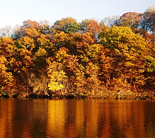
Wallpack Valley is a valley located in Sussex County in northwestern New Jersey formed by Wallpack Ridge on the west, and Kittatinny Mountain on the east. Wallpack Ridge separates the Wallpack Valley from the valley of the Delaware River, and contains the watershed of the Flat Brook and its main tributaries Big Flat Brook and Little Flat Brook. It is a narrow valley, roughly 25 miles (40 km) in length running from Montague Township south of Port Jervis, New York to the Walpack Bend in the Delaware River near Flatbrookville in Walpack Township where the Flat Brook enters the Delaware at 300 feet above sea level.

Basin Corner is an unincorporated community in New Castle County, Delaware, United States. Basin Corner is located at the interchange between U.S. Route 13/U.S. Route 40 and U.S. Route 202/Delaware Route 141 northwest of New Castle and southwest of Wilmington Manor.


