Denton, Arkansas

Last updated

Denton, Arkansas was a village in Lawrence County. It is currently uninhabited and its only remains are the Bethel Cemetery where former residents were buried.

Lawrence County, Arkansas County in the United States

Lawrence County is a county located in the U.S. state of Arkansas. As of the 2010 census, the population was 17,415. The county seat is Walnut Ridge. Lawrence County is Arkansas's second county, formed on January 15, 1815, and named for Captain James Lawrence who fought in the War of 1812. It is an alcohol prohibition or dry county.

Bethel Cemetery (Denton, Arkansas) listed on the National Register of Historic Places

Bethel Cemetery is a cemetery in rural western Lawrence County, Arkansas. It is located off County Road 225, about 1.1 miles (1.8 km) north of Arkansas Highway 117, roughly midway between Black Rock and Smithville. Its oldest portion occupies a roughly triangular parcel of land, surrounded by a perimeter road, with a gate at the eastern corner. It is located next to the site of a church which was established in the 1820s, and its oldest grave is supposedly the 1835 burial of an American Revolutionary War veteran. The oldest dated grave marker is marked 1858, and the cemetery continues to be used today. The cemetery is a reminder of the community of Denton, which flourished in the mid-19th century, but declined after it was bypassed by the railroad.

History

In 1830, Denton was founded. It was one of the first unincorporated communities in Lawrence County. About ten years later in 1844, the New Hope Baptist Church of Denton was established, and still exists today. In 1979, Everett Moore and Loma Moore were the last inhabitants to move away.

32 years later, in 2011, the cemetery was added to the national register of historic places.

Related Research Articles

Sharp County, Arkansas County in the United States

Sharp County is a county located in the U.S. state of Arkansas. As of the 2010 census, the population was 17,264. The county seat is Ash Flat. The county was formed on July 18, 1868, and named for Ephraim Sharp, a state legislator from the area.

Independence County, Arkansas County in the United States

Independence County is a county located in the U.S. state of Arkansas. As of the 2010 census, the population was 36,647. The county seat is Batesville. Independence County is Arkansas's ninth county, formed on October 20, 1820, from a portion of Lawrence County and named in commemoration of the Declaration of Independence. It is an alcohol prohibition or dry county.

Greene County, Arkansas County in the United States

Greene County is a county located in the U.S. state of Arkansas. As of the 2010 census, the population was 42,090. The county seat is Paragould, which sits atop Crowley's Ridge.

Desha County, Arkansas County in the United States

Desha County is a county located in the southeast part of the U.S. state of Arkansas, with its eastern border the Mississippi River. As of the 2010 census, the population was 13,008. It ranks fifty-sixth of Arkansas's seventy-five counties in terms of population. The county seat is Arkansas City. Located in the Arkansas Delta, Desha County's rivers and fertile soils became prosperous for planters under the cotton-based economy of plantation agriculture in the antebellum years and late nineteenth century. Still largely rural, it has suffered population losses and economic decline since the mid-20th century.

Melbourne, Arkansas City in Arkansas, United States

Melbourne is a city in Izard County, Arkansas, United States. The population was 1,848 at the 2010 census. The town is the county seat of Izard County, and home to the main campus of Ozarka College.

Black Rock, Arkansas Town in Arkansas, United States

Black Rock is a town in Lawrence County, Arkansas, United States, along the Black River. The population was 717 at the 2000 census.

Imboden, Arkansas City in Arkansas, United States

Imboden is a city in Lawrence County, Arkansas, United States. The population was 677 at the 2000 census. It is named after a family of settlers.

Lynn, Arkansas Town in Arkansas, United States

Lynn is a town in Lawrence County, Arkansas, United States. The population was 315 at the 2000 census.

Minturn, Arkansas Town in Arkansas, United States

Minturn is a town in Lawrence County, Arkansas, United States. The population was 114 at the 2000 census.

Powhatan, Arkansas Town in Arkansas, United States

Powhatan is a town in Lawrence County, Arkansas, United States, along the Black River. The population was 50 at the 2000 census.

Ravenden, Arkansas Town in Arkansas, United States

Ravenden is a town in Lawrence County, Arkansas, United States. The population was 470 at the 2010 census.

Smithville, Arkansas Town in Arkansas, United States

Smithville is a town in Lawrence County, Arkansas, United States. The population was 73 at the 2000 census.

OKean, Arkansas Town in Arkansas, United States

O'Kean is a town in Randolph County, Arkansas, United States. The population was 201 at the 2000 census.

Russell, Arkansas Town in Arkansas, United States

Russell is a town in White County, Arkansas, United States. Dennis Pierce is the current mayor. The population was 228 at the 2000 census.

West Point, Arkansas Town in Arkansas, United States

West Point is a town in White County, Arkansas, United States.

Myrtle, Missouri unincorporated community in Missouri

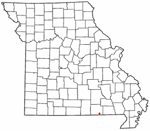
Myrtle is a small, unincorporated community in Oregon County, Missouri. It lies 15 miles southeast of Alton, near the Arkansas state line.

Pine, Missouri unincorporated community in Missouri

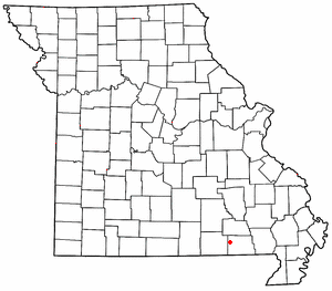
Pine is a small unincorporated community in western Ripley County, Missouri. It is located on a county road in the Mark Twain National Forest, about sixteen miles northwest of Doniphan.

Arkansass 1st congressional district

Arkansas's 1st congressional district is a U.S. congressional district in eastern Arkansas that elects a representative to the United States House of Representatives.

Bald Hill Township, Jefferson County, Illinois Township in Illinois, United States

Bald Hill Township is one of sixteen townships in Jefferson County, Illinois, USA. As of the 2010 census, its population was 767 and it contained 359 housing units.

References

Coordinates: 36°05′42″N91°12′29″W / 36.095°N 91.208°W / 36.095; -91.208

Geographic coordinate system Coordinate system

A geographic coordinate system is a coordinate system that enables every location on Earth to be specified by a set of numbers, letters or symbols. The coordinates are often chosen such that one of the numbers represents a vertical position and two or three of the numbers represent a horizontal position; alternatively, a geographic position may be expressed in a combined three-dimensional Cartesian vector. A common choice of coordinates is latitude, longitude and elevation. To specify a location on a plane requires a map projection.