
The Province of the Cape of Good Hope, commonly referred to as the Cape Province and colloquially as The Cape, was a province in the Union of South Africa and subsequently the Republic of South Africa. It encompassed the old Cape Colony, and had Cape Town as its capital. Following the end of the Apartheid era, the Cape Province was split up to form the new Eastern Cape, Northern Cape and Western Cape provinces, along with part of the North West.

Makhanda is a town of about 70,000 people in the Eastern Cape province of South Africa. It is situated about 110 kilometres (70 mi) northeast of Port Elizabeth and 130 kilometres (80 mi) southwest of East London. Makhanda is the largest town in the Makana Local Municipality, and the seat of the municipal council. It also hosts Rhodes University, the Eastern Cape Division of the High Court, The South African Library for the Blind (SALB) and a diocese of the Anglican Church of Southern Africa and 6 South African Infantry Battalion. The name change to Makhanda was officially gazetted on 29 June 2018.

Cape Howe is a coastal headland in eastern Australia, forming the south-eastern end of the Black-Allan Line, a portion of the border between New South Wales and Victoria. Cape Howe was also the original name of West Cape Howe, a coastal headland near Albany, Western Australia that forms the westernmost extent of the Great Australian Bight.

Cape Hawke is a coastal headland in Australia on the New South Wales coast, just south of Forster/Tuncurry and within the Booti Booti National Park.

Cathcart is a town in the Eastern Cape province of South Africa, named after Sir George Cathcart, governor of the Colony of the Cape of Good Hope 1852–1853. The town is situated on the N6, 48 kilometres (30 mi) north of Stutterheim en route to Queenstown.
The Great Winterberg is an extensive east-west mountain range lying immediately north of the small towns of Bedford, Adelaide and Fort Beaufort in the Eastern Cape of South Africa. Elevation on average is about 1800 metres above sea-level. The Great Winterberg Peak north of Adelaide rises to 2371 metres, high enough to be occasionally covered in snow. The underlying geology consists of shales and sandstones of the Beaufort Series of the Karoo System, frequently with dolerite intrusions. Rainfall on the southern slopes is fairly high. A notable pass over the range is the Katberg Pass built by Andrew Geddes Bain in 1860-64.
De Beer's Pass is located in the Eastern Cape province of South Africa. It is situated on an unmarked road between Cookhouse and Tarkastad.
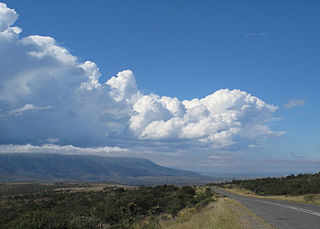
Bruintjieshoogte Pass, is a mountain pass situated in the Eastern Cape province of South Africa, on the Regional road R63, between Somerset East and Pearston.
Cats Pass, is situated in the Eastern Cape, Province of South Africa, on the road between Butterworth and Mazeppa Bay.
Fuller's Hoek Pass,, is situated in the Eastern Cape, province of South Africa, on a road in the Fort Fordyce Nature Reserve.
Hogsback Pass, is situated in the Eastern Cape, province of South Africa. on the regional road R345, between Alice and Cathcart.
Katberg Pass is a mountain pass situated in the Eastern Cape province of South Africa, on the R351 between Seymour and Whittlesea.
The pass climbs almost 700 meters in altitude to summit at 1622m ASL. The average gradient is 1:15 with some sections as steep as 1:3.
Kumajaba Pass, is situated in the Eastern Cape, province of South Africa, near Maclear, Eastern Cape. It stretches over 5 miles and rises some 1840 feet in elevation. Its exact coordinates are -31°17'1.32" S 28°32'5.15" E.
Nico Malan Pass is situated in the Eastern Cape province of South Africa, on the regional tarred road R67 between Fort Beaufort and Whittlesea.
Ouberg Pass,, is situated in the Eastern Cape, province of South Africa, on the regional road R63, between Graaff-Reinet and Murraysburg.
Pefferskop Pass, is situated in the Eastern Cape, province of South Africa, on the road between Seymour, Eastern Cape and Dimfield, Eastern Cape.
Swaershoek Pass,, is situated in the Eastern Cape province of South Africa, on the regional road R337, between Cradock, Eastern Cape and Pearston.

The South African Railways Class 4E of 1952 was an electric locomotive.

The Kat River is a tributary of the Great Fish River, that drains the southern slopes of the Winterberg in the Eastern Cape Province, South Africa.


