| Look up devil's garden in Wiktionary, the free dictionary. |
Devil's Garden is an area of Arches National Park (Utah, U.S.) that features a series of rock fins and arches formed by erosion.
Contents
Devil's Garden or Devils Garden may also refer to:
| Look up devil's garden in Wiktionary, the free dictionary. |
Devil's Garden is an area of Arches National Park (Utah, U.S.) that features a series of rock fins and arches formed by erosion.
Devil's Garden or Devils Garden may also refer to:
| This disambiguation page lists articles associated with the title Devil's Garden. If an internal link led you here, you may wish to change the link to point directly to the intended article. |

Delicate Arch is a 52-foot-tall (16 m) freestanding natural arch located in Arches National Park, near Moab in Grand County, Utah, United States. The arch is the most widely recognized landmark in Arches National Park and is depicted on Utah license plates and a postage stamp commemorating Utah's centennial anniversary of admission to the Union in 1996. The Olympic torch relay for the 2002 Winter Olympics passed through the arch.

A natural arch, natural bridge, or rock arch is a natural rock formation where an arch has formed with an opening underneath. Natural arches commonly form where inland cliffs, coastal cliffs, fins or stacks are subject to erosion from the sea, rivers or weathering.

Landscape Arch is the longest of the many natural rock arches located in Arches National Park, Utah, United States.

The Devil's Punch Bowl is a 282.2-hectare (697-acre) visitor attraction and biological Site of Special Scientific Interest situated just to the east of the village of Hindhead in the English county of Surrey. It is part of the Wealden Heaths Phase II Special Protection Area.

Natural Bridges National Monument is a U.S. National Monument located about 50 miles (80 km) northwest of the Four Corners boundary of southeast Utah, in the western United States, at the junction of White Canyon and Armstrong Canyon, part of the Colorado River drainage. It features the thirteenth largest natural bridge in the world, carved from the white Permian sandstone of the Cedar Mesa Formation that gives White Canyon its name.

The Dirty Devil River is an 80-mile-long (130 km) tributary of the Colorado River, located in the U.S. state of Utah. It flows through southern Utah from the confluence of the Fremont River and Muddy Creek before emptying into the Colorado River at Lake Powell.

Logan Canyon is in the western United States in northeastern Utah, a canyon that cuts its way through the Bear River Mountains, a branch of the Wasatch Range. It is popular for both summer and winter activities, especially rock-climbing, hiking, camping, fishing, snowmobiling, and skiing, at the Beaver Mountain ski resort. The canyon rises to an elevation of approximately 7,800 feet (2,400 m) above sea level, after a vertical climb of about 2,900 feet (880 m). Just beyond the summit is a steep road leading into Bear Lake Valley and scenic overlooks that provide dramatic views of deep blue Bear Lake. The western terminus is at Logan in Cache County and the eastern terminus is at Garden City in Rich County.

The Black Ridge Canyons Wilderness (BRCW) is located in western Colorado with a small portion extending into eastern Utah, USA, within the arid Colorado Plateau region approximately 15 miles (24 km) west of Grand Junction, Colorado. The wilderness lies on the northwest flank of the Uncompahgre Plateau. It is characterized by the high, east-west trending Black Ridge dissected by seven major canyon systems, draining into the Colorado River in Ruby Canyon. Elevations range from 4,700 feet (1,400 m) above sea level along the river to 6,800 feet (2,070 m). Canyons vary in length from several miles to twelve miles in length and may contain interesting side canyons. Geological features in these canyons include spires, windows, giant alcoves and desert varnish. Canyons may reach a depth of almost 1,000 feet (300 m), forming spectacular redrock cliffs. Spring runoff and summer thunderstorms create glistening waterfalls and plunge pools. Rattlesnake Canyon contains the second largest concentration of natural arches in the country. Mee Canyon is even more remote, and contains Arch Tower.

Dark Canyon Wilderness is a designated Wilderness Area in the heart of southeast Utah's canyon country, part of the Bears Ears National Monument. The wilderness is named for its high steep walls that narrow in the lower section so that they block the light in the morning and late afternoon. The roughly horseshoe-shaped wilderness is made up of the upper part of 40-mile-long (64 km) Dark Canyon and two major tributaries, Woodenshoe Canyon and Peavine Canyon in the Manti-La Sal National Forest. These canyons all descend from pine-covered Elk Ridge northeast of Natural Bridges National Monument. Dark Canyon continues west within a U.S. Bureau of Land Management primitive area that is recommended for wilderness designation. The last four miles (6.4 km) of the main canyon drop steeply through Glen Canyon National Recreation Area into Lake Powell.

Devils Garden is an area of Arches National Park, located near Moab, Utah, United States, that features a series of rock fins and arches formed by erosion. The Devils Garden Trail, including more primitive sections and spurs, meanders through the area for 7.2 mi (11.6 km). The trailhead leads directly to Landscape Arch after a 0.8 mi (1.3 km) outbound hike, while Tunnel Arch and Pine Tree Arch can be seen on spur trails on the way to Landscape Arch. Several other arches, including Partition, Navajo, Double O, and Private Arch, as well as the Dark Angel monolith and Fin Canyon, are accessed via the primitive loop trail and its spurs.

The Hole in the Rock Trail is a historic trail running east-southeast from the town of Escalante in southern Utah in the western United States. The Mormon trailblazers who established this trail crossed the Colorado River and ended their journey in the town of Bluff. The Hole-in-the-Rock expedition established the trail in 1879. The trail is located within the borders of the Grand Staircase-Escalante National Monument, the adjacent Glen Canyon National Recreation Area and federal Bureau of Land Management (BLM) public land to the east of the Colorado River. A geologic feature called the Hole in the Rock gave the trail its name. A modern unpaved road called the Hole-in-the-Rock Road closely follows this historic trail to the point where it enters the Glen Canyon National Recreation Area. The modern road is an important access route for visiting the Canyons of the Escalante and the Devils Garden. The trail is listed on the National Register of Historic Places, being added to that list in 1982.

The Canyons of the Escalante is a collective name for the erosional landforms created by the Escalante River and its tributaries—the Escalante River Basin. Located in southern Utah in the western United States, these sandstone features include high vertical canyon walls, numerous slot canyons, waterpockets, domes, hoodoos, natural arches and bridges. This area—extending over 1,500 square miles (3,885 km2) and rising in elevation from 3,600 ft (1,097 m) to over 11,000 ft (3,353 m)—is one of the three main sections of the Grand Staircase-Escalante National Monument, and also a part of the Glen Canyon National Recreation Area, with Capitol Reef National Park being adjacent to the east.

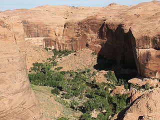
Coyote Gulch is a tributary of the Escalante River, located in Garfield and Kane Counties in southern Utah, in the western United States. Over 25 mi (40 km) long, Coyote Gulch exhibits many of the geologic features found in the Canyons of the Escalante, including high vertical canyon walls, narrow slot canyons, domes, arches, and natural bridges. The upper sections of Coyote Gulch are located within the Grand Staircase-Escalante National Monument while its lower sections are located in the Glen Canyon National Recreation Area.

Wall Arch was a natural sandstone arch in Arches National Park in southeastern Utah, United States. Before its collapse in 2008, it was ranked 12th in size among the park's over 2,000 arches. At its largest, the opening underneath the span was 71 feet (22 m) wide by 33.5 feet (10 m) high. It consisted of Entrada Sandstone, specifically the member known as Slick Rock. Wall Arch was first reported and named in 1948 by Lewis T. McKinney.

Arches National Park is a national park in eastern Utah, United States. The park is adjacent to the Colorado River, 4 miles (6 km) north of Moab, Utah. More than 2,000 natural sandstone arches are located in the park, including the well-known Delicate Arch, as well as a variety of unique geological resources and formations. The park contains the highest density of natural arches in the world.

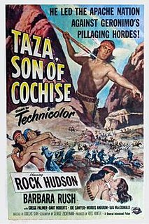
Taza, Son of Cochise is a 1954 American Technicolor Western film directed by Douglas Sirk and starring Rock Hudson and Barbara Rush. The film was shot in 3D, and is one of just two films confirmed to have been released in the Pola-Lite 3D System using one projector.

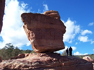
A balancing rock, also called a balanced rock or precarious boulder, is a naturally occurring geological formation featuring a large rock or boulder, sometimes of substantial size, resting on other rocks, bedrock, or on glacial till. Some formations known by this name only appear to be balancing, but are in fact firmly connected to a base rock by a pedestal or stem. No single scientific definition of the term exists, and it has been applied to a variety of rock features that fall into one of four general categories:

The Devils Garden of the Grand Staircase–Escalante National Monument (GSENM) in south central Utah, United States, is a protected area featuring hoodoos, natural arches and other sandstone formations. The United States Geological Survey (USGS) designated the name Devils Garden on December 31, 1979. The area is also known as the Devils Garden Outstanding Natural Area within the National Landscape Conservation System.
A fin is a geologic formation that is a narrow, residual wall of hard sedimentary rock that remains standing after surrounding rock has been eroded away along parallel joints or fractures. Fins are formed when a narrow butte or plateau develops many vertical, parallel cracks. There are two main modes of following erosion. The first is when water flows along joints and fractures and opens them wider and wider, eventually causing erosion. The second is where the rock type (stratum) is harder and more erosion resistant than neighboring rocks, causing the weaker rock to fall away.