
Duke of Devonshire is a title in the Peerage of England held by members of the Cavendish family. This branch of the Cavendish family has been one of the wealthiest British aristocratic families since the 16th century and has been rivalled in political influence perhaps only by the marquesses of Salisbury and the earls of Derby.
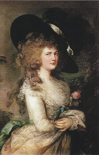
Georgiana Cavendish, Duchess of Devonshire, was an English aristocrat, socialite, political organiser, author, and activist. Born into the Spencer family, married into the Cavendish family, she was the first wife of William Cavendish, 5th Duke of Devonshire, and the mother of the 6th Duke of Devonshire.
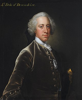
William Cavendish, 4th Duke of Devonshire,, styled Lord Cavendish before 1729, and Marquess of Hartington between 1729 and 1755, was a British Whig statesman and nobleman who was briefly nominal Prime Minister of Great Britain. He was the first son of William Cavendish, 3rd Duke of Devonshire and his wife, Catherine Hoskins. He is also a great-great-great-great-great-grandfather of King Charles III through the king's maternal great-grandmother.
Eight ships of the Royal Navy have been named HMS Devonshire, originally in honour of William Cavendish, 1st Duke of Devonshire, and later after the county of Devonshire.

Central is a heritage-listed railway station located in the centre of Sydney, New South Wales, Australia. The station is Australia's largest and second busiest railway station, and is a major transport interchange for NSW TrainLink inter-city rail services, Sydney Trains commuter rail services, Sydney Metro services, Sydney light rail services, bus services, and private coach transport services. The station is also known as Sydney Terminal. The property was added to the New South Wales State Heritage Register on 2 April 1999. It recorded 85.4 million passenger movements in 2018 and serves over 250,000 people daily.

The University of Derby, formerly known as Derby College, is a public university in the city of Derby, England. It traces its history back to the establishment of the Derby Diocesan Institution for the Training of Schoolmistresses in 1851. It gained university status in 1992.

Devonshire House in Piccadilly, was the London townhouse of the Dukes of Devonshire during the 18th and 19th centuries. Following a fire in 1733 it was rebuilt by William Cavendish, 3rd Duke of Devonshire, in the Palladian style, to designs by William Kent. Completed circa 1740, it stood empty after the First World War and was demolished in 1924.
William Cavendish may refer to:
The Devonshire Quarter is an area in the centre of Sheffield, England. Its heart is the Division Street and Devonshire Street shopping areas, known for their small independent shops and variety of pubs and bars. The district also has The Forum shopping centre and Devonshire Green, one of the largest open areas in central Sheffield.

The Devonshire Regiment was a line infantry regiment of the British Army that served under various titles and served in many wars and conflicts from 1685 to 1958, such as the Second Boer War, the First World War and the Second World War. In 1958 the regiment was amalgamated with the Dorset Regiment to form the Devonshire and Dorset Regiment which, in 2007, was amalgamated with the Royal Gloucestershire, Berkshire and Wiltshire Regiment, the Royal Green Jackets and The Light Infantry to form a new large regiment, The Rifles.

Railway Square is a plaza at the southern end of the Sydney central business district, New South Wales, Australia, formed by the confluence of Broadway, Lee Street, Pitt Street and George Street. The square itself is a very busy intersection and is the site of a large bus terminus. The University of Technology, Central railway station and the now-closed Kent Brewery are adjacent to Railway Square.
Devonshire is a historical name for Devon, a ceremonial county in South West England.
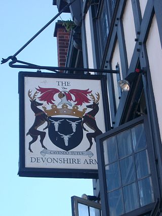
The Devonshire Arms is a moderately common name for an English pub. The name is for the Dukes of Devonshire, members of the peerage from a wealthy aristocratic family.

Santa Susana Pass State Historic Park is a California State Park of 670.68 acres (2.7141 km2) located in the city of Los Angeles, in Los Angeles County on the boundary between Ventura and Los Angeles counties, between the communities of Chatsworth and Simi Valley. Geologically, the park is located where the Simi Hills meet the Santa Susana Mountains. Here in the western part of the Transverse Ranges, the land is dominated by high, narrow ridges and deep canyons covered with an abundant variety of plant life. The park offers panoramic views of the rugged natural landscape as a striking contrast to the developed communities nearby. The park is also rich in archaeological, historical, and cultural significance.
Devonshire Street was a short-lived railway station in the parish of Mile End Old Town, in the East End of London. It was opened on 20 June 1839 as a temporary London terminus of the Eastern Counties Railway (ECR) from Romford prior to the construction of Shoreditch station which became the permanent terminus.
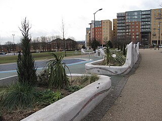
Devonshire Green is a small public open space at 53.3789°N 1.4783°W within Sheffield city centre in South Yorkshire, England. It covers an area of approximately 9000 square metres and is designated as a district park by Sheffield City Council. It stands in the Devonshire Quarter of the city centre, bordered on its four sides by Devonshire Street, Fitzwilliam Street, Eldon Street and Wellington Street. It is the only large green space in the city centre.
Some women to have held the title Duchess of Devonshire, as wives of the Duke of Devonshire, include:
Devonshire ministry may refer to:
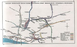
Globe Road & Devonshire Street was a railway station on the Great Eastern Main Line, 1 mile 54 chains (2.7 km) down the line from Liverpool Street. It was opened by the Great Eastern Railway on 1 July 1884 when the company quadrupled the double-track main line section, and it was situated close to the site of the former Devonshire Street terminus, which had closed in 1840.
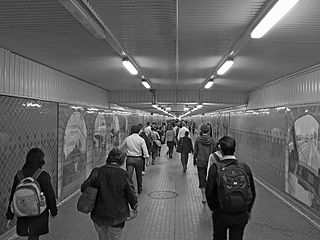
The Devonshire Street Tunnel is a 300-metre-long (980 ft) pedestrian tunnel located beneath the southern end of Central station connecting the suburb of Surry Hills with Railway Square in the Sydney central business district.