
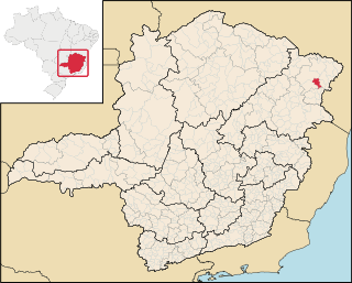
Minas Gerais is one of the 27 federative units of Brazil, being the fourth largest state by area and the second largest in number of inhabitants with a population of 20,539,989 according to the 2022 census. Located in the Southeast Region of the country, it is limited to south and southwest with São Paulo; Mato Grosso do Sul to the west; Goiás and the Federal District to the northwest; Bahia to the north and northeast; Espírito Santo to the east; and Rio de Janeiro to the southeast. The state's capital and largest city, Belo Horizonte, is a major urban and finance center in Brazil, being the sixth most populous municipality in the country while its metropolitan area ranks as the third largest in Brazil with just over 5.8 million inhabitants, after those of São Paulo and Rio de Janeiro. Minas Gerais' territory is subdivided into 853 municipalities, the largest number among Brazilian states.

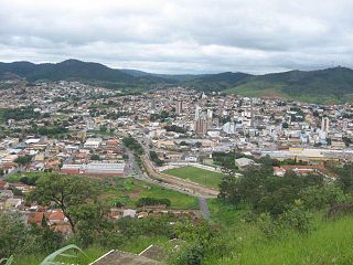
Almenara, is a municipality in the northeast of the Brazilian state of Minas Gerais. Situated on the Jequitinhonha River it is the largest city in that river valley. Its 2020 population was estimated at 42,143 and the municipal area was 2,301 km².

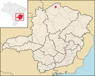
Ubaí is a municipality in the north of the Brazilian state of Minas Gerais. As of 2020 the population was 12,599 in a total area of 821 km2. It became a municipality in 1962.
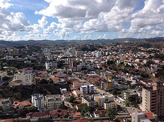
Teófilo Otoni is a municipality in northeast Minas Gerais, Brazil. The population of the municipality was 140,937 in 2020 and the area is 3,242.818 km2.

The Maxakalían languages were first classified into the Jê languages. It was only in 1931 that Čestmír Loukotka separated them from the Jê family. Alfred Métraux and Curt Nimuendajú considered the Maxakalían family isolated from others. John Alden Mason suggests a connection with the Macro-Jê stock, confirmed by Aryon Rodrigues.

The Mantiqueira Mountains are a mountain range in Southeastern Brazil, with parts in the states of São Paulo, Minas Gerais and Rio de Janeiro.

Purian languages are a pair of extinct languages of eastern Brazil:
Pará de Minas is a Brazilian municipality located in the state of Minas Gerais.
Felisburgo is a Brazilian municipality located in the northeast of the state of Minas Gerais.
Jequitinhonha is a Brazilian municipality located in the northeast of the state of Minas Gerais.

Joaíma is a Brazilian municipality located in the northeast of the state of Minas Gerais.
Miravânia is a municipality in the north of the state of Minas Gerais in Brazil. As of 2020 the population was 4,914 in an area of 603 km². It is located on the left bank of the São Francisco River. It is connected by dirt road to São João das Missões by paved BR-135. The distance is 112 km. Neighboring municipalities are: Montalvânia, Manga, Cônego Marinho, and São João das Missões.

Pedras de Maria da Cruz is a municipality in the north of the state of Minas Gerais in Brazil. As of 2020 the population was 12,212 in an area of 1,520 km². The elevation of the municipal seat is 476 meters. It became a municipality in 1993. The postal code (CEP) is 39492-000 and it belonged to the statistical microregion of Januária

Ibiaí is a Brazilian municipality located in the north of the state of Minas Gerais. In 2020 the population was 8,437 in a total area of 870 km². It became a municipality in 1963.

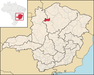
Jequitaí is a Brazilian municipality located in the north of the state of Minas Gerais. In 2020 the population was 7,468 in a total area of 1,268 km2. It became a municipality in 1948.
São Romão is a Brazilian municipality located in the north of the state of Minas Gerais. In 2020 the population was 12,529 in a total area of 2,432 km². It became a municipality in 1943.
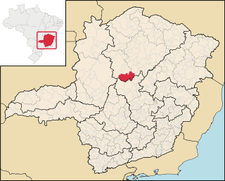
Lassance is a Brazilian municipality located in the north of the state of Minas Gerais. In 2020 the population was 6,503 in a total area of 3,213 km². It became a municipality in 1953.

União de Minas is a municipality in the west of the Brazilian state of Minas Gerais.

Senador Modestino Gonçalves is a Brazilian municipality in the state of Minas Gerais.
