The Cape Cod National Seashore (CCNS) encompasses 43,607 acres on Cape Cod, in Massachusetts. CCNS was created on August 7, 1961, by President John F. Kennedy, when he signed a bill enacting the legislation he first co-sponsored as a Senator a few years prior. It includes ponds, woods and beachfront of the Atlantic coastal pine barrens ecoregion. The CCNS includes nearly 40 miles (64 km) of seashore along the Atlantic-facing eastern shore of Cape Cod, in the towns of Provincetown, Truro, Wellfleet, Eastham, Orleans and Chatham. It is administered by the National Park Service.
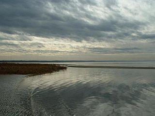
Eastham is a town in Barnstable County, Massachusetts, United States, Barnstable County being coextensive with Cape Cod. The population was 5,752 at the 2020 census.

North Eastham is a census-designated place (CDP) in the town of Eastham in Barnstable County, Massachusetts, United States. The population was 1,806 at the 2010 census.

Orleans is a town in Barnstable County, Massachusetts, United States, situated along Cape Cod. The population was 6,307 at the 2020 census.
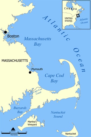
Cape Cod Bay is a large bay of the Atlantic Ocean adjacent to the U.S. state of Massachusetts. Measuring 604 square miles (1,560 km2) below a line drawn from Brant Rock in Marshfield to Race Point in Provincetown, Massachusetts, it is enclosed by Cape Cod to the south and east, and Plymouth County, Massachusetts, to the west. To the north of Cape Cod Bay lie Massachusetts Bay and the Atlantic Ocean. Cape Cod Bay is the southernmost extremity of the Gulf of Maine. Cape Cod Bay is one of the bays adjacent to Massachusetts that give it the name Bay State. The others are Narragansett Bay, Buzzards Bay, and Massachusetts Bay.

The Eastham Windmill, located in Eastham, Massachusetts, is the oldest windmill on Cape Cod. It was constructed by Eastham resident Thomas Paine in Plymouth in 1680. It was first moved to nearby Truro in 1770, then finally to Eastham in 1793. In 1808 the windmill was moved to its present location, near the Eastham Town Hall and the Eastham Public Library. Eastham Windmill, as part of the Eastham Center Historic District, was added to the National Register of Historic Places in 1999.

Nauset Light, officially Nauset Beach Light, is a restored lighthouse on the Cape Cod National Seashore near Eastham, Massachusetts, erected in 1923 using the 1877 tower that was moved here from the Chatham Light. It is listed on the National Register of Historic Places. The tower is a cast-iron plate shell lined with brick and stands 48 feet (15 m) high. The adjacent oil house is made of brick and has also been restored. Fully automated, the beacon is a private aid to navigation. Tours of the tower and oil house are available in summer from the Nauset Light Preservation Society which operates, maintains and interprets the site. The tower is located adjacent to Nauset Light Beach.

Waquoit Bay is a public national estuary, which is typically used as a research reserve. It is a part of Nantucket Sound and is located on the southern shore of Cape Cod in Massachusetts, USA. This bay forms the border of the towns of Falmouth and Mashpee, Massachusetts.

Nauset Regional High School is an NEASC accredited high school located in Eastham, Massachusetts, United States and a part of Nauset Public Schools. Nauset is inside the Cape Cod National Seashore, making it the only high school on the East Coast located within a National Park. The open campus is situated about a half-mile from Nauset Light. Nauset's colors are Black and Gold and the school's mascot is the Warrior.

The Cape Cod Rail Trail (CCRT) is a 25.5-mile (41.0 km) paved rail trail located on Cape Cod in Massachusetts. The trail route passes through the towns of Yarmouth, Dennis, Harwich, Brewster, Orleans, Eastham, and Wellfleet. It connects to the 6-plus mile (10 km) Old Colony Rail Trail leading to Chatham, the 2 mile Yarmouth multi-use trail, and 8 miles (13 km) of trails within Nickerson State Park. Short side trips on roads lead to national seashore beaches including Coast Guard Beach at the end of the Nauset Bike Trail in Cape Cod National Seashore. The trail is part of the Claire Saltonstall Bikeway.

Oyster Pond River, also called Oyster Creek, is a 1.7-mile-long (2.7 km) river in Chatham, Massachusetts on Cape Cod.

The Pamet River is a 4.2-mile-long (6.8 km) river in Truro, Massachusetts on Cape Cod. It is named for the Paomet tribe.
Cape Symphony, located on Cape Cod, is one of the largest professional orchestras in Massachusetts.
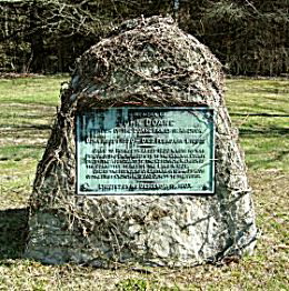
John Doane was a politician in English Colonial North America. He arrived in Plymouth Colony on an unknown ship sometime between 1628 and 1632. During his long life he is considered a person of note in Plymouth Colony serving in many government capacities associated with the colony government, such as government committees and deputy for Plymouth as well as Assistant Governor in 1632/33. He left government service for a time in the 1630s to serve as deacon in the Plymouth Church.

Rocky Woods is a 491-acre (199 ha) open space preserve located in Medfield, Massachusetts. The preserve, managed by the land conservation non-profit organization The Trustees of Reservations, is notable for its rugged terrain. Rocky Woods offers 6.5 miles (10.5 km) of trails and former woods roads available for hiking, horseback riding, mountain biking, dog walking, catch and release fishing, camping, snowshoeing and cross country skiing. The preserve is part of a larger area of protected open space including the abutting Fork Factory Brook preserve, also managed by The Trustees of Reservations.
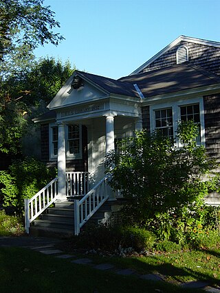
Eastham Public Library is the public library of Eastham, Massachusetts that has been serving the community for over 130 years. It provides a collection of print, non-print, and electronic resources for the community. The Eastham Public Library is a part of the Cape Libraries Automated Materials Sharing library network on Cape Cod and the Islands.
Jeremiah's Gutter, also called Jeremy’s Dream was a canal located on the border of Orleans and Eastham, Massachusetts, the first canal to cut across the peninsula of Cape Cod. It connected Cape Cod Bay in the west to the Atlantic Ocean in the east. It was active for over 100 years, although it gradually fell out of use and was replaced by the Cape Cod Canal.
Rock Harbor is a man-made harbor on Cape Cod Bay located on the border between Orleans, Massachusetts, and Eastham, Massachusetts.
Great Pond (Truro) is one of three ponds in Barnstable County that share the name. The others are located in Eastham and Provincetown. Great Pond in Truro is 17-acre natural kettle pond with an average depth of 14 feet (4.3 m) and a maximum depth of 35 feet (11 m). Transparency is very good, extending to 14 feet (4.3 m), and aquatic vegetation is scarce. The bottom is composed primarily of sand. The shoreline is lightly developed with residential homes.
Hokum Rock is a glacial erratic boulder left by the last retreating ice age glacier, the Laurentide ice sheet, 20,000 to 12,000 years ago, when Cape Cod was formed. Hokum Rock is the second largest erratic boulder on the Cape. The largest is Doane Rock at Cape Cod National Seashore in Eastham. Hokum Rock is in Dennis, Barnstable County, Massachusetts. It is on the southeast shore of Scargo Lake 1 mile (1.6 km) east-southeast of Dennis. Black Ball Hill is located west and Scargo Hill is located northwest of Hokum Rock.


