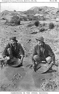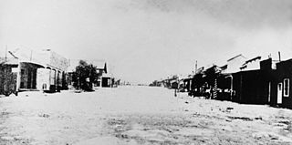
The Victorian gold rush was a period in the history of Victoria, Australia approximately between 1851 and the late 1860s. It led to a period of extreme prosperity for the Australian colony, and an influx of population growth and financial capital for Melbourne, which was dubbed "Marvellous Melbourne" as a result of the procurement of wealth.

Beaconsfield is a former gold mining town near the Tamar River, in the north-east of Tasmania, Australia. It lies 40 kilometres north of Launceston on the West Tamar Highway. It is part of the Municipality of West Tamar.

Aberfeldy is a small town in Victoria, Australia on Mount Lookout, north east of the Thomson Dam, 125 kilometres east of Melbourne.

Adelaide Lead is a district in Victoria, Australia, site of a former settlement, located on Old Avoca Road, south-west of Maryborough, west of the Paddy Ranges State Park, in the Shire of Central Goldfields. Located on the northern slopes of the Central Highlands, 225 metres above sea level, the area is naturally characterised by Box-Ironbark forest. Remnants of aboriginal settlement include rock wells beside the Possum Gully Road.

The Walhalla railway line was a 2 ft 6 in narrow gauge railway located in Gippsland, Victoria, Australia. The line ran from Moe to the former gold-mining town and popular tourist destination of Walhalla. Construction began in 1904. The line closed in sections from 1944 to 1954.

The Thomson River, a perennial river of the West Gippsland catchment, is located in the Gippsland region of the Australian state of Victoria.

Gold mining in Alaska, a state of the United States, has been a major industry and impetus for exploration and settlement since a few years after the United States acquired the territory from Russia. Russian explorers discovered placer gold in the Kenai River in 1848, but no gold was produced. Gold mining started in 1870 from placers southeast of Juneau, Alaska.

Gold was discovered in the Yentna Cache-Creek Mining District in the US state of Alaska of the upper Susitna Valley in 1898, soon followed by claim staking. Placer mining was reported in the Cache Creek drainage of the Dutch Hills by 1906. Quaternary glaciofluvial deposits, alluvial deposits, and Cenozoic conglomeratic white quartz-breccia units have been mined in the Dutch Hills. About 200,000 oz of gold has been produced from these placer deposits.

Silver Reef is a ghost town in Washington County, Utah, United States, about 15 miles (24 km) northeast of St. George and 1 mile (1.6 km) west of Leeds. Silver Reef was established after John Kemple, a prospector from Nevada, discovered a vein of silver in a sandstone formation in 1866. At first, geologists were uncertain about Kemple's find because silver is not usually found in sandstone. In 1875, two bankers from Salt Lake City sent William Barbee to the site to stake mining claims. He staked 21 claims, and an influx of miners came to work Barbee's claims and to stake their own. To accommodate the miners, Barbee established a town called Bonanza City. Property values there were high, so several miners settled on a ridge to the north of it and named their settlement "Rockpile". The town was renamed Silver Reef after silver mines in nearby Pioche closed and businessmen arrived.

Big Dan Mine is an abandoned underground mine in Northeastern Ontario, Canada. It is located about 1 km (0.62 mi) southwest of Net Lake and just west of the Ontario Northland Railway in east-central Strathy Township. It is named after Dan O'Connor, who first claimed the site in the 1890s.
The Jordan River Diversion Tunnel - a relic of the Victorian gold rush - is on the Jordan River near the locality of Jericho, about 7 km south of Woods Point in Gippsland, Victoria, Australia. The tunnel is about 30 m long x 4 m high x 3 m wide, cut through rock. The river still runs through it.

The Jordan River, a perennial river of the West Gippsland catchment, is located in the Alpine region of the Australian state of Victoria.

The Oriental Claims are a former gold mining operation, or claim, located 2 km south of Omeo, Victoria, Australia. The Oriental Claims are named in reference to The Oriental Company which mined in the area from 1876 to 1904, and also in memory of the many Chinese miners ('Orientals') that worked the area for over 50 years.

During the Australian gold rushes, significant numbers of workers relocated to areas in which gold had been discovered. A number of gold finds occurred in Australia prior to 1851, but only the gold found from 1851 onwards created gold rushes. This is mainly because, prior to 1851, the colonial government of New South Wales had suppressed news of gold finds which it believed would reduce the workforce and destabilise the economy.

The Gibbo River, a perennial river of the North-East Murray catchment of the Murray-Darling basin, is located in the alpine and East Gippsland regions of Victoria, Australia. It flows from the northwestern slopes of the Australian Alps, south and joins with Morass Creek southeast of Lake Dartmouth.
Frederick Charles Porter (1832–1869) was an Australian miner and explorer of the Gippsland region of Victoria. His exploration work in early 1862 was critical in helping open up the Jordan goldfields.
James Frederick Porter (1855-1919) was an Australian engineer and mine manager of the Gippsland region of Victoria.

George Edward Clarke (1846–1895) was a prospector in Queensland, Australia. He was a member of the expedition that found gold at Charters Towers.

Coopers Creek is a former township and mine in the Gippsland region of Victoria, Australia. In the 1860s, Coopers Creek was settled during the Victorian gold rush and, throughout its history, gold, copper and lime have been mined there. Today, Coopers Creek is effectively limited to two camping sites, the first near the site of the mining town and the second to the east at Bruntons Bridge. Ruins from the town's mining history, and the Copper Mine Hotel are all of the town's history which survives.


