This page is based on this
Wikipedia article Text is available under the
CC BY-SA 4.0 license; additional terms may apply.
Images, videos and audio are available under their respective licenses.

Geography of the United States Virgin Islands

The Virgin Islands are geologically and biogeographically the easternmost part of the Greater Antilles, the northern islands belonging to the Puerto Rican Bank and St. Croix being a displaced part of the same geologic structure. Politically, the British Virgin Islands have been governed as the western island group of the Leeward Islands, which are the northern part of the Lesser Antilles, and form the border between the Caribbean Sea and the Atlantic Ocean. The archipelago is separated from the true Lesser Antilles by the Anegada Passage and from the main island of Puerto Rico by the Virgin Passage.

Hudson Strait links the Atlantic Ocean and Labrador Sea to Hudson Bay in Canada. This strait lies between Baffin Island and Nunavik, with its eastern entrance marked by Cape Chidley in Newfoundland and Labrador and Resolution Island off Baffin Island. The strait is about 750 km long with an average width of 125 km, varying from 70 km at the eastern entrance to 240 km at Deception Bay.

The Arctic Archipelago, also known as the Canadian Arctic Archipelago, is a group of islands north of the Canadian mainland.

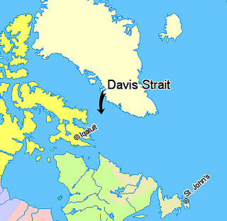
Davis Strait is a northern arm of the Labrador Sea. It lies between mid-western Greenland and Nunavut, Canada's Baffin Island. To the north is Baffin Bay. The strait was named for the English explorer John Davis (1550–1605), who explored the area while seeking a Northwest Passage. By the 1650s it was used for whale hunting.

Cruz Bay, U.S. Virgin Islands is the main town on the island of Saint John in the United States Virgin Islands. According to the 2000 census, Cruz Bay had a population of 2,743.
The area code (340) is the local telephone area code of U.S. Virgin Islands. The (340) area code was created during a split from the original (809) area code, which began permissive dialing on 1 June 1997 and ended 30 June 1998.
Area code 284 is the local telephone area code of the British Virgin Islands (BVI). The 284 area code was created during a split from the original (809) area code which began permissive dialing on 1 October 1997 and ended 30 September 1998.

Arthur Harbour is a small harbour entered between Bonaparte Point and Norsel Point on the south-west coast of Anvers Island in the Palmer Archipelago of Antarctica.

Ireland Island is the northwesternmost island in the chain which comprises Bermuda. It forms a long finger of land pointing northeastwards from the main island, the last link in a chain which also includes Boaz Island and Somerset Island. It lies within Sandys Parish, and forms the northwestern coast of the Great Sound. it is regarded as one of the six principal islands of Bermuda.

Lionel Roberts Stadium is a multi-use stadium in Charlotte Amalie, United States Virgin Islands. It is currently used mostly for soccer matches, as well as baseball and American football. The stadium holds 9,000.

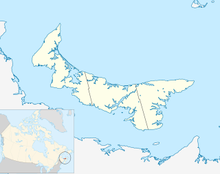
Miminegash is a municipality that holds community status in Prince Edward Island, Canada. It is located 8 miles (13 km) northwest of Alberton and 11 miles (18 km) southwest of Tignish. It is part of a small area known as either the St. Louis, Palmer Road, or Miminegash area. This area is often associated with Tignish due to the shared Acadian roots between these areas.

Sports and Fitness Center is an indoor sporting arena located in Saint Thomas, United States Virgin Islands. The capacity of the arena is 3,500 people and is home to the University of the Virgin Islands Buccaneers. It hosts the United States Virgin Islands Paradise Jam, a pre-season college basketball tournament.
Abram-Village is a Canadian rural municipality located in Prince County, Prince Edward Island.
Wickams Cay and Little Wickam's Cay were former islands of the British Virgin Islands in the Caribbean. They were both located in Road Harbour, but due to reclamation of land projects in Tortola, Wickhams Cay now makes up part of Road Town, the capital of the British Virgin Islands. The areas are known as Wickhams Cay and Wickhams Cay II. Also included in the same reclamation projects were former islands known as Bird Cay and Dead Horse Cay.

Dog Islands are a small group of islets among the British Virgin Islands in the Caribbean.

Besboro Island is a small island in the Norton Sound, Bering Sea, off the shores of Alaska. It is located 11 miles (18 km) west of the mainland and 38 miles (61 km) southwest of Christmas Mountain, Nulato Hills.

Mont Carmel is a Canadian unincorporated area in Prince County, Prince Edward Island. The community is located in the "Evangeline Region" which is a cluster of Acadian communities in the central part of Prince County. The village is home to the Notre-dame-du-Mont-Carmel, a massive 450000-brick Catholic church built in 1898.


