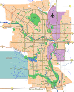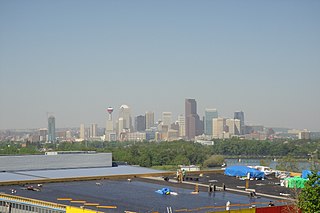
McKenzie Lake is a suburban neighbourhood in southeast Calgary, Alberta. The community was in development from the mid-1980s through to present. The area is bordered by Deerfoot Trail on the east, Stoney Trail on the south, Fish Creek Provincial Park on the west, and 130th Ave SE on the north. The community is most known for its private lake and island in the centre of the community. Multimillion-dollar homes can be seen along both the ridge and the lake.

Albert Park/Radisson Heights is a residential neighbourhood in the southeast quadrant of Calgary, Alberta. It is bounded to the west by the Bow River and Deerfoot Trail, to the north by Memorial Drive and to the south by 17 Avenue SE. The community of Forest Lawn lies to the east.

Shaganappi is a residential neighbourhood in the southwest quadrant of Calgary, Alberta. It is located between 17 Avenue SW and the Bow River. The Shaganappi golf course is located north of the Bow Trail.

Renfrew is a residential neighbourhood in the northeast quadrant of Calgary, Alberta. It is located south of the Trans-Canada Highway, and north of the inner city community of Bridgeland. To the east it is bordered by the Nose Hill Creek and the Deerfoot Trail and is separated from Crescent Heights to the west by Edmonton Trail.

Glendale is a residential neighbourhood in the southwest quadrant of Calgary, Alberta. It is located south of 17th Avenue SW, east of Sarcee Trail and Signal Hill and west of 37 Street SW and Killarney. The Optimist Athletic Park is located in this community.

Winston Heights/Mountview is a residential neighbourhood in the northeast quadrant of Calgary, Alberta. It is bounded by 32 Avenue to the north, the Nose Creek and Deerfoot Trail to the east, Trans-Canada Highway to the south and Edmonton Trail to the west. Fox Hollow Golf Course and The Winston Golf Club are developed at the eastern edge of the neighbourhood.

Tuxedo Park is a residential neighbourhood in the northeast and northwest quadrants of Calgary, Alberta. The inner city community is bounded to the north by 32 Avenue N, by Edmonton Trail to the east, the Trans-Canada Highway to the south and 2 Street NW to the west. The community is bisected by Centre Street from north to south.

Vista Heights is a residential neighbourhood in the northeast quadrant of Calgary, Alberta. It is bounded to the south by the Trans-Canada Highway and to the west by Deerfoot Trail. To the north and east it borders the South Airways Industrial Area.

Chaparral is a residential neighbourhood in the southeast quadrant of Calgary, Alberta. It is located at the southern edge of the city, south of the Stoney Trail. To the east it is bordered by the Bow River Valley, to the south by 194 Avenue SE, and to the west by Macleod Trail. It has three sub sections that are not officially recognized, Lake Chaparral, Chaparral Valley, and Chaparral Ridge.

Thorncliffe is a residential neighbourhood in the northwest quadrant of Calgary, Alberta. It is bounded by 64 Avenue to the north, Deerfoot Trail to the east, McKnight Boulevard to the south and 14 Street West and Nose Hill Park to the west.

Coventry Hills is a suburban residential neighbourhood in the northeast quadrant of Calgary, Alberta. It is at the northern edge of the city and is bounded by Stoney Trail to the north, Deerfoot Trail and the Nose Creek to the east, Country Hills Boulevard to the south, and Harvest Hills Boulevard to the west.

Ogden is a residential neighbourhood in the southeast quadrant of Calgary, Alberta. It includes the districts of Lynnwood and Millican Estates. It is bounded by Glenmore Trail to the south, Deerfoot Trail and the Bow River to the west, and the CPR tracks and the industrial areas of Ogden Shops to the north and east.

Shawnessy is a suburban residential neighbourhood in the southwest quadrant of Calgary, Alberta. It is bounded by Shawnessy Boulevard to the north, MacLeod Trail to the east, 162 Avenue S to the south and James McKevitt Road to the west.

Dover is a residential neighbourhood in the southeast quadrant of Calgary, Alberta. It is bounded by 26 Avenue SE to the north, Peigan Trail to the south, 24 Street SE and Deerfoot Trail to the west and 36 Street SE to the east. The Inglewood golf course, developed in the Bow River valley, borders the community to the west.

Mayland Heights is a residential neighbourhood in the northeast quadrant of Calgary, Alberta. It is bounded by Barlow Trail to the east, Memorial Drive to the south, Deerfoot Trail to the west and Trans-Canada Highway to the north.

Riverbend is a residential neighbourhood in the southeast quadrant of Calgary, Alberta. It is bounded to the north by Glenmore Trail, to the east by 24 Street E and to the west by Deerfoot Trail. It is developed in the Bow River floodplain, on its escarpment and the upland plain.

Diamond Cove is a small residential neighbourhood in the southeast quadrant of Calgary, Alberta. It is bounded to the north by Anderson Road and Deerfoot Trail, to the east by the Bow River, to the south by Queensland, and to the west by Bow Bottom Trail.

Greenview is a residential neighbourhood in the northeast quadrant of Calgary, Alberta. It is bounded to the north by 64 Avenue N, to the east by Deerfoot Trail, to the south by McKnight Boulevard and Edmonton Trail and to the west by 14 Street W.

Highland Park is a residential neighbourhood in the northwest quadrant of Calgary, Alberta. It is bounded to the north by McKnight Boulevard, to the east by Edmonton Trail, to the south by 32 Avenue N and to the west by 4 Street W. Confederation Park and Nose Hill Park are located in close proximity. The Queens Park Cemetery occupies the southwestern corner of the neighbourhood, and the Highland golf course is developed in the north.

Huntington Hills is a residential neighbourhood in the northwest and northeast quadrant of Calgary, Alberta. It is bounded to the north by Beddington Boulevard, to the east by Deerfoot Trail and the Nose Creek, to the south by 64 Avenue N and to the west by the Nose Hill Park and 14 Street W. Centre Street runs through the neighbourhood.


