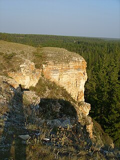
The Republic of Sakha (Yakutia) (Russian: Республика Саха, tr. Respublika Sakha , IPA: [rʲɪsˈpublʲɪkə sɐˈxa jɪˈkutʲɪjə]; Yakut: Саха Өрөспүүбүлүкэтэ, translit. Sakha Öröspüübülükete, IPA: [saˈxa øɾøsˈpyːbylykete] is a federal Russian republic. It had a population of 958,528 at the 2010 Census, mainly ethnic Yakuts and Russians.

Scouting in Russia comprises several dozen Scout associations, based on religion, politics and geography.

Ust-Yansky District is an administrative and municipal district, one of the thirty-four in the Sakha Republic, Russia. It is located in the north of the republic in the Yana River delta on the coast of the Laptev Sea and borders with Allaikhovsky and Abyysky Districts in the east, Momsky District in the south, Verkhoyansky District in the southwest, and with Bulunsky District in the west. The area of the district is 120,300 square kilometers (46,400 sq mi). Its administrative center is the urban locality of Deputatsky. Population: 8,056 (2010 Census); 10,009 ; 41,265 (1989 Census). The population of Deputatsky accounts for 37.0% of the district's total population.

Churapchinsky District is an administrative and municipal district, one of the thirty-four in the Sakha Republic, Russia. It is located in the center of the republic and borders Tattinsky District in the north, Ust-Maysky District in the east and southeast, Amginsky District in the south, Megino-Kangalassky District in the west, and Ust-Aldansky District in the northwest. The area of the district is 12,600 square kilometers (4,900 sq mi). Its administrative center is the rural locality of Churapcha. As of the 2010 Census, the total population of the district was 20,387, with the population of Churapcha accounting for 43.0% of that number.

Abyysky District is an administrative and municipal district, one of the thirty-four in the Sakha Republic, Russia. It is located in the north of the republic around the Indigirka River and borders with Allaikhovsky District in the north, Srednekolymsky District in the east, Verkhnekolymsky District in the southeast, Momsky District in the south, and with Ust-Yansky District in the west. The area of the district is 69,400 square kilometers (26,800 sq mi). Its administrative center is the urban locality of Belaya Gora. As of the 2010 Census, the total population of the district was 4,425, with the population of Belaya Gora accounting for 50.7% of that number.

Allaikhovsky District is an administrative and municipal district, one of the thirty-four in the Sakha Republic, Russia. It is located in the northeast of the republic towards the mouth of the Indigirka River and borders with the East Siberian Sea in the north, Nizhnekolymsky District in the east, Srednekolymsky District in the southeast, Abyysky District in the south, and with Ust-Yansky District in the west. The area of the district is 107,300 square kilometers (41,400 sq mi). Its administrative center is the urban locality of Chokurdakh. As of the 2010 Census, the total population of the district was 3,050, with the population of Chokurdakh accounting for 77.6% of that number.

Aldansky District is an administrative and municipal district, one of the thirty-four in the Sakha Republic, Russia. It is located in the south of the republic on the right bank of the Lena River near the mouth of the Aldan River and borders with Khangalassky and Amginsky Districts in the north, Ust-Maysky District in the northeast, Khabarovsk Krai in the east, Neryungrinsky District in the south, and with Olyokminsky District in the west and southwest. The area of the district is 156,800 square kilometers (60,500 sq mi). Its area is larger than the country of Bangladesh. Its administrative center is the town of Aldan. As of the 2010 Census, the total population of the district was 42,632, with the population of Aldan accounting for 49.9% of that number.

Lensk is a town and the administrative center of Lensky District of the Sakha Republic, Russia, located on the left bank of the Lena River, approximately 840 kilometers (520 mi) west of Yakutsk, the capital of the republic. As of the 2010 Census, its population was 24,966.

Amginsky District is an administrative and municipal district, one of the thirty-four in the Sakha Republic, Russia. It is located in the southeast of the republic and borders with Churapchinsky District in the north, Ust-Maysky District in the east and southeast, Aldansky District in the south and southwest, and with Khangalassky and Megino-Kangalassky Districts in the northwest. The area of the district is 29,400 square kilometers (11,400 sq mi). Its administrative center is the rural locality of Amga. As of the 2010 Census, the total population of the district was 17,183, with the population of Amga accounting for 38.0% of that number.

Bulunsky District is an administrative and municipal district, one of the thirty-four in the Sakha Republic, Russia. It is located in the north of the republic and borders Ust-Yansky District in the east, Verkhoyansky District in the southeast, Eveno-Bytantaysky and Zhigansky Districts in the south, Olenyoksky District in the west, and Anabarsky District in the northwest. The area of the district is 223,600 square kilometers (86,300 sq mi). Its administrative center is the urban-type settlement of Tiksi. As of the 2010 Census, the total population of the district was 9,054, with the population of Tiksi accounting for 55.9% of that number.

Khangalassky District is an administrative and municipal district, one of the thirty-four in the Sakha Republic, Russia. It is located in the center of the republic and borders Megino-Kangalassky District in the east, Amginsky and Aldansky Districts in the south, Olyokminsky District in the southwest, Gorny District in the northwest, and the territory of the city of republic significance of Yakutsk in the north. The area of the district is 24,700 square kilometers (9,500 sq mi). Its administrative center is the town of Pokrovsk. As of the 2010 Census, the total population of the district, excluding its administrative center, was 24,557.

Megino-Kangalassky District is an administrative and municipal district, one of the thirty-four in the Sakha Republic, Russia. It is located in the central part of the republic, on the Lena River opposite Yakutsk, the capital of the republic. It borders Ust-Aldansky District in the north, Churapchinsky District in the east, Amginsky District in the southeast, Khangalassky District in the southwest, and is bounded by the Lena River in the west. The area of the district is 11,700 square kilometers (4,500 sq mi). Its administrative center is the rural locality of Mayya. As of the 2010 Census, the total population of the district was 31,278, with the population of Mayya accounting for 23,.3% of that number.

Momsky District is an administrative and municipal district, one of the thirty-four in the Sakha Republic, Russia. It is located in the northeast of the republic. The area of the district is 104,600 square kilometers (40,400 sq mi). Its administrative center is the rural locality of Khonuu. As of the 2010 Census, the total population of the district was 4,452, with the population of Khonuu accounting for 55.6% of that number.

Namsky District is an administrative and municipal district, one of the thirty-four in the Sakha Republic, Russia. The district is located in the center of the republic and borders Ust-Aldansky District in the east, Megino-Kangalassky District in the southeast, the territory of the city of republic significance of Yakutsk in the south, Gorny District in the west, and Kobyaysky District in the north. The area of the district is 11,900 square kilometers (4,600 sq mi). Its administrative center is the rural locality of Namtsy. As of the 2010 Census, the total population of the district was 23,198, with the population of Namtsy accounting for 38.3% of that number.

The State Anthem of the Sakha Republic or National Anthem of Yakutia is the regional anthem of the Sakha Republic, a federal subject of Russia. The national anthem is one of the official symbols of the Sakha Republic, alongside with the flag and the coat of arms of the Sakha Republic. It was originally written in the Sakha language by Savva Tarasov and Mikhail Timofeyev. The anthem was translated into Russian by Vladimir Fedorov. The music was composed by Kirill Gerasimov. The anthem was officially adopted on 15 July 2004.

The Vladimir Lenin All-Union Pioneer Organization, abbreviated as or the Young Pioneers, was a mass youth organization of the Soviet Union for children of age 9–15 that existed between 1922 and 1991. Similar to the Scouting organisations of the Western world, Pioneers learned skills of social cooperation and attended publicly funded summer camps.

Belaya Gora is an urban locality and the administrative center of Abyysky District in the Sakha Republic, Russia, located on the right bank of the Indigirka River, approximately 20 kilometers (12 mi) downstream of its confluence with its tributary the Uyandina, opposite of the selo of Suturuokha. As of the 2010 Census, its population was 2,245.


