Dumaresq (disambiguation)

Last updated

Dumaresq may refer to:

Locations
Armidale Dumaresq Shire Local government area in New South Wales, Australia

The Armidale Dumaresq Council is a former local government area in the New England and Northern Tablelands regions of New South Wales, Australia. This area was formed in 2000 from the merger of the original City of Armidale with the surrounding Dumaresq Shire and abolished on 12 May 2016, where the council, together with Guyra Shire, was subsumed into the Armidale Regional Council with immediate effect.

Dumaresq, New South Wales New South Wales, Australia

Dumaresq is a town in the Northern Tablelands, New South Wales, Australia. It is located approximately 20 km north-west of Armidale, on Boorolong Road. The local council is Armidale Regional Council, it once belonged to Dumaresq Shire, and then Armidale Dumaresq Shire. The town is located within Sandon County.

Dumaresq Lake is a lake of Cape Breton Regional Municipality, Nova Scotia, Canada.

People
Charles Édouard Armand-Dumaresq French painter

Charles Édouard Armand-Dumaresq was a French painter, primarily of religious and military subjects.

Daniel Dumaresq FRS (1712–1805) was an educational consultant to Russian and Polish monarchs.
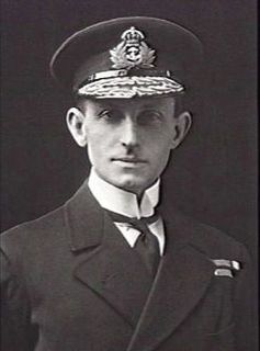
John Saumarez Dumaresq Australian admiral

Rear Admiral John Saumarez Dumaresq was an officer in the Royal Navy. He served during the First World War but is most remembered as an inventor, for development of the device named after him, the Dumaresq, which helped users calculate the rate at which the range to an enemy ship was changing over time. He was the first Australian born officer to command the Australian Fleet.

Technology

Related Research Articles

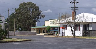
Armidale, New South Wales City in New South Wales, Australia

Armidale is a city in the Northern Tablelands, New South Wales, Australia. Armidale had a population of 24,351 as at June 2017. It is the administrative centre for the Northern Tablelands region. It is approximately halfway between Sydney and Brisbane at the junction of the New England Highway and Waterfall Way. Armidale traditional owners are Anaiwan people. Many Gumbaynggirr people have settled in Armidale since colonisation.

Glenelg may refer to

Lyndhurst, New South Wales Town in New South Wales, Australia

Lyndhurst is a small village in New South Wales, Australia in Blayney Shire. It is 4 kilometres west of Mandurama or about 269 km west of Sydney and 63 km south-west of Bathurst just off the Mid-Western Highway New South Wales. Once serving as the major centre for basic goods and needs to the nearby Junction Reefs goldfields. At the 2011 census, Lyndhurst had a population of 219 people.

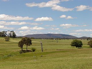
Mount Duval (New South Wales) mountain in Australia

Mount Duval, a large forested mountain of the New England Range, part of the Great Dividing Range, is located on the Northern Tablelands in the New England region of New South Wales, Australia.

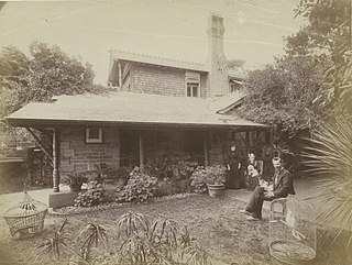
John Horbury Hunt Australian architect

John Horbury Hunt was a Canadian-born architect who worked in Sydney, Australia and rural New South Wales from 1863.

Electoral district of Northern Tablelands state electoral district of New South Wales, Australia

Northern Tablelands is an electoral district of the Legislative Assembly in the Australian state of New South Wales. It is currently held by Adam Marshall representing the National Party, following a by-election triggered by the resignation of independent member Richard Torbay. The electorate currently includes Uralla Shire, Armidale Regional Council, Glen Innes Severn, Inverell Shire, Gwydir Shire and Moree Plains Shire.

Ben Lomond, New South Wales Town in New South Wales, Australia

Ben Lomond is a village on the Northern Tablelands in the New England region of New South Wales, Australia. The village is situated 6 km off the New England Highway between Armidale and Glen Innes. It was located in the Guyra Shire local government area until that council was amalgamated into the Armidale Regional Council on 12 May 2016, with parts of the surrounding district in Glen Innes Severn Shire and Inverell Shire. It is primarily a farming area, with most of the residents involved in sheep, cattle and grain farming.

Walcha Shire Local government area in New South Wales, Australia

Walcha Shire is a local government area located in the New England region of New South Wales, Australia. The Shire is situated adjacent to the junction of the Oxley Highway and Thunderbolts Way and is 20 kilometres (12 mi) east of the Main North railway line passing through Walcha Road.

Uralla Shire Local government area in New South Wales, Australia

Uralla Shire is a local government area located in the New England region of New South Wales, Australia. The New England Highway passes through the Shire.

Guyra Shire Local government area in New South Wales, Australia

Guyra Shire is the name of a former local government area located in the New England region of New South Wales, Australia. The shire was abolished on 12 May 2016, where the council, together with the Armidale Dumaresq Shire, was subsumed into the Armidale Regional Council with immediate effect.

Mole River (New South Wales) river in New South Wales, Australia

The Mole River, a watercourse that is one of the Border Rivers and part of the Macintyre catchment within the Murray–Darling basin, is located in the Northern Tablelands region of New South Wales, Australia.

Armidale, New South Wales is a city in Australia.

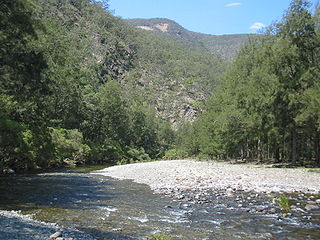
Chandler River (New South Wales) river

Chandler River, a perennial stream of the Macleay River catchment, is located in the Northern Tablelands district of New South Wales, Australia.

Lionel Gilbert historian

Lionel Arthur Gilbert OAM was an Australian historian, author, curator, lecturer, and biographer, specializing in applied, natural, and local history. Born in Burwood, New South Wales, he studied at Sydney Teachers College and, beginning in 1946, worked as a teacher and later a headmaster in state schools in various locations around New South Wales until 1961. In 1963 Gilbert graduated from the University of New England with a Bachelor of Arts in History. That same year, he was appointed a lecturer and curator at the Armidale Teachers' College Museum of Education, in which capacity he served until his retirement in 1984, overseeing several expansions of the museum and establishment of a historical research centre.

The Commissioners Waters, a watercourse that is part of the Macleay River catchment, is located in the Northern Tablelands region of New South Wales, Australia.

William John Dumaresq was an English-born Australian politician.

Armidale Regional Council Local government area in New South Wales, Australia

The Armidale Regional Council is a local government area in the New England and Northern Tablelands regions of New South Wales, Australia. This area was formed in 2016 from the merger of the Armidale Dumaresq Shire with the surrounding Guyra Shire.

Dumaresq railway station

The Dumaresq railway station is an heritage-listed former railway station located at 537 Dumaresq Road, Dumaresq, in the Armidale Regional Council local government area, New South Wales, Australia. The property is owned by RailCorp, an agency of the Government of New South Wales. It was added to the New South Wales State Heritage Register on 2 April 1999.