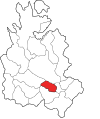
Cerro Punta is a city and corregimiento in Tierras Altas District, Chiriquí Province, Panama. Cerro Punta is located in Panama's western highlands at an altitude is 6,500 feet, just south of the Continental Divide. Many of the inhabitants of the village and the surrounding areas are indigenous Native Americans. The climate, like the rest of Panama, is tropical with a short dry season and rainy season that extends about 9 – 10 months of the year. Night time temperatures are often cool due to Cerro Punta's relatively high elevation. During the 1970s much of the land was used for cultivating strawberries; households also maintained small mixed-vegetable gardens. The village can be reached by traveling north from the Pan-American highway.

Chiriquí Grande is a corregimiento in Chiriquí Grande District, Bocas del Toro Province, Panama. It is the seat of Chiriquí Grande District. It has a land area of 58.8 square kilometres (22.7 sq mi) and had a population of 3,014 as of 2010, giving it a population density of 51.2 inhabitants per square kilometre (133/sq mi). Its population as of 1990 was 7,637; its population as of 2000 was 2,069. The town is located on the southern shore of Chiriquí Lagoon and its port serves as the northern terminus of the Trans-Panama pipeline.

El Copé is a corregimiento in Olá District, Coclé Province, Panama. La MICA Biological Station is located nearby. It has a land area of 76.7 square kilometres (29.6 sq mi) and had a population of 1,425 as of 2010, giving it a population density of 18.6 inhabitants per square kilometre (48/sq mi). Its population as of 1990 was 1,081; its population as of 2000 was 1,263.

El Roble is a corregimiento in Aguadulce District, Coclé Province, Panama. It has a land area of 218.8 square kilometres (84.5 sq mi) and had a population of 8,369 as of 2010, giving it a population density of 38.2 inhabitants per square kilometre (99/sq mi). Its population as of 1990 was 7,097; its population as of 2000 was 7,997.

El Empalme is a town and corregimiento in the Changuinola District of Bocas del Toro Province of Panama. It has a land area of 79.5 square kilometres (30.7 sq mi) and had a population of 18,653 as of 2010, giving it a population density of 234.7 inhabitants per square kilometre (608/sq mi). It was created by Law 40 of April 30, 2003.
Palo Grande is a corregimiento in Alanje District, Chiriquí Province, Panama. It has a land area of 41 square kilometres (16 sq mi) and had a population of 578 as of 2010, giving it a population density of 14.1 inhabitants per square kilometre (37/sq mi). Its population as of 1990 was 563; its population as of 2000 was 563.
Potrero de Caña is a corregimiento in Tolé District, Chiriquí Province, Panama. It has a land area of 20.1 square kilometres (7.8 sq mi) and had a population of 337 as of 2010, giving it a population density of 16.8 inhabitants per square kilometre (44/sq mi). Its population as of 1990 was 1,751; its population as of 2000 was 458.
El Potrero is a corregimiento in La Pintada District, Coclé Province, Panama. It has a land area of 73.9 square kilometres (28.5 sq mi) and had a population of 3,165 as of 2010, giving it a population density of 42.8 inhabitants per square kilometre (111/sq mi). Its population as of 1990 was 2,672; its population as of 2000 was 2,815.
El Coco is a corregimiento in Penonomé District, Coclé Province, Panama with a population of 5,605 as of 2010. Its population as of 1990 was 3,558; its population as of 2000 was 4,592.
El Bebedero is a corregimiento in Tonosí District, Los Santos Province, Panama with a population of 1,332 as of 2010. Its population as of 1990 was 1,227; its population as of 2000 was 1,389.
Cirí Grande is a corregimiento in Capira District, Panamá Oeste Province, Panama with a population of 3,635 as of 2010. Its population as of 1990 was 4,138; its population as of 2000 was 3,079.
El Líbano is a corregimiento in Chame District, Panamá Oeste Province, Panama with a population of 200 as of 2010. Its population as of 1990 was 177; its population as of 2000 was 191.
El Llano is a corregimiento in Chepo District, Panamá Province, Panama with a population of 2,819 as of 2010. Its population as of 1990 was 12,393; its population as of 2000 was 2,839.
El Cocla is a corregimiento in Calobre District, Veraguas Province, Panama with a population of 608 as of 2010. Its population as of 1990 was 608; its population as of 2000 was 597.
El Potrero is a corregimiento in Calobre District, Veraguas Province, Panama with a population of 635 as of 2010. Its population as of 1990 was 687; its population as of 2000 was 650.
La Laguna is a corregimiento in Calobre District, Veraguas Province, Panama with a population of 774 as of 2010. Its population as of 1990 was 1,033; its population as of 2000 was 881.
El Aromillo is a corregimiento in Cañazas District, Veraguas Province, Panama with a population of 1,359 as of 2010. It was created by Law 43 of August 5, 2002.
Cerro de Casa is a corregimiento in Las Palmas District, Veraguas Province, Panama with a population of 2,343 as of 2010. Its population as of 1990 was 2,465; its population as of 2000 was 2,225.
El Prado is a corregimiento in Las Palmas District, Veraguas Province, Panama with a population of 1,074 as of 2010. Its population as of 1990 was 4,971; its population as of 2000 was 1,103.
Río Grande is a corregimiento in Soná District, Veraguas Province, Panama with a population of 3,674 as of 2010. Its population as of 1990 was 3,305; its population as of 2000 was 3,317.


