Espanola, Florida

Last updated

Espanola is an unincorporated community in Flagler County, Florida, United States. It is located at the intersection of Old Brick Road, County Road 13, and County Road 205. It is part of the Deltona–Daytona Beach–Ormond Beach, FL metropolitan statistical area.

Unincorporated area Region of land not governed by own local government

In law, an unincorporated area is a region of land that is not governed by a local municipal corporation; similarly an unincorporated community is a settlement that is not governed by its own local municipal corporation, but rather is administered as part of larger administrative divisions, such as a township, parish, borough, county, city, canton, state, province or country. Occasionally, municipalities dissolve or disincorporate, which may happen if they become fiscally insolvent, and services become the responsibility of a higher administration. Widespread unincorporated communities and areas are a distinguishing feature of the United States and Canada. In most other countries of the world, there are either no unincorporated areas at all, or these are very rare; typically remote, outlying, sparsely populated or uninhabited areas.

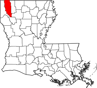
Flagler County, Florida County in the United States

Flagler County is a county on the east coast of the U.S. state of Florida. As of the 2010 census, the population was 95,696. Its county seat is Bunnell. Created in 1917 from portions of Saint Johns and Volusia Counties, it was named for Henry Morrison Flagler, who built the Florida East Coast Railway.
Florida State of the United States of America

Florida is the southernmost contiguous state in the United States. The state is bordered to the west by the Gulf of Mexico, to the northwest by Alabama, to the north by Georgia, to the east by the Atlantic Ocean, and to the south by the Straits of Florida. Florida is the 22nd-most extensive, the 3rd-most populous, and the 8th-most densely populated of the U.S. states. Jacksonville is the most populous municipality in the state and the largest city by area in the contiguous United States. The Miami metropolitan area is Florida's most populous urban area. Tallahassee is the state's capital.

Geography

Espanola is located at 29°30′25″N81°18′35″W / 29.50694°N 81.30972°W / 29.50694; -81.30972 Coordinates: 29°30′25″N81°18′35″W / 29.50694°N 81.30972°W / 29.50694; -81.30972 . [1]

Geographic coordinate system Coordinate system

A geographic coordinate system is a coordinate system that enables every location on Earth to be specified by a set of numbers, letters or symbols. The coordinates are often chosen such that one of the numbers represents a vertical position and two or three of the numbers represent a horizontal position; alternatively, a geographic position may be expressed in a combined three-dimensional Cartesian vector. A common choice of coordinates is latitude, longitude and elevation. To specify a location on a plane requires a map projection.

Related Research Articles

Rutledge, Alabama Town in Alabama, United States

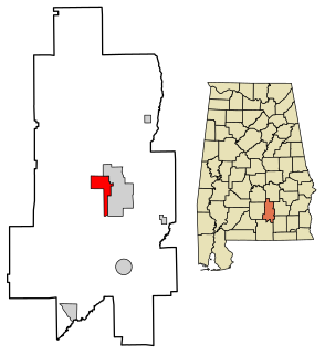
Rutledge is a town in Crenshaw County, Alabama, United States. As of the 2010 census, the population of the town was 467.

Golden Beach, Florida Town in Florida

Golden Beach is a town located in the northeast corner of Miami-Dade County, Florida, between the Intracoastal Waterway and Atlantic Ocean. As of the 2010 census, the town had a total population of 919.

Vilano Beach, Florida Census-designated place in Florida, United States

Vilano Beach is an unincorporated community in St. Johns County, Florida, United States. It is listed as the Villano Beach) census-designated place (CDP) by the U.S. Census Bureau. The population was 2,678 at the 2010 census.

DeLand Southwest, Florida CDP in Florida, United States

DeLand Southwest is an unincorporated census-designated place located in Volusia County, Florida, United States. The population was 1,052 at the 2010 census.

Dock Junction, Georgia CDP in Georgia, United States

Dock Junction is a census-designated place (CDP) in Glynn County, Georgia, United States. It is part of the 'Brunswick, Georgia Metropolitan Statistical Area'. The population was 7,721 at the 2010 census. Its original name was Arco until the seventies, the name deriving from the Atlantic Refining Company.

Meansville, Georgia City in Georgia, United States

Meansville is a city in Pike County, Georgia, United States. The population was 192 at the 2000 census.

Deerfield, Missouri Village in Missouri, United States

Deerfield is a village in Vernon County, Missouri, United States. The population was 81 at the 2010 census.

Rhodhiss, North Carolina Town in North Carolina, United States

Rhodhiss is a town in Caldwell and Burke counties in the U.S. state of North Carolina. The population was 1,070 at the 2010 census, up from 366 at the 2000 census. It is part of the Hickory–Lenoir–Morganton Metropolitan Statistical Area.

Plum Grove is an unincorporated community in Lowndes County, Mississippi.

Huletts Landing, New York hamlet in New York, United States

Huletts Landing is a hamlet in the town of Dresden in northern Washington County, New York, United States. A lakeside community on the eastern shore of Lake George in the Adirondack Mountains, Huletts Landing is located entirely within the Adirondack Park. There is only one roadway access to the hamlet, County Route 6 and its suffixed routes, which head north-south. Huletts Landing is geographically located at 43°38′21″N73°30′25″W and has approximately two centuries of written history.

Nye was a town two miles north of Laredo in southwestern Webb County, Texas, United States. It was named after Thomas C. Nye, a local planter who introduced Bermuda onions into the community in 1898. The area has been eventually absorbed by neighboring Laredo.

Clear Creek Township, Monroe County, Indiana Township in Indiana, United States

Clear Creek Township is one of eleven townships in Monroe County, Indiana, United States. As of the 2010 census, its population was 5,000 and it contained 2,674 housing units.

Lancaster, Huntington County, Indiana Unincorporated community in Indiana, United States

Lancaster is an unincorporated community in Lancaster Township, Huntington County, Indiana.

Pacific House, California Unincorporated community in California, United States

Pacific House is a small unincorporated community in El Dorado County, California, United States. It lies along Highway 50 and is next to the town of Pacific, California. The ZIP code is 95726. The community is inside area code 530.

Cody's Corner is an unincorporated community in Flagler County, Florida, United States. It is located at the intersection of Dupont Road and State Road 11 southwest of Bunnell. The community is part of the Deltona–Daytona Beach–Ormond Beach, FL metropolitan statistical area.

Nook is a hamlet in Juniata County, Pennsylvania, United States. Nook is located in Beale Township, along Pennsylvania Route 35, with a zip code of 17058. Mennonites and other persons of Pennsylvania Dutch descent inhabit the small settlement.

Auburn, North Dakota Census-designated place & unincorporated community in North Dakota, United States

Auburn is a census-designated place and unincorporated community in Walsh County, North Dakota, United States. Its population was 48 as of the 2010 census.

Atkins, Louisiana human settlement in United States of America

Atkins is an unincorporated community in Bossier Parish, Louisiana, United States. Atkins is located at 32°18′35″N93°30′54″W.

Columbia is an unincorporated community in Franklin Township, Tuscarawas County, Ohio, United States. It is located near Strasburg, Parral, and Dover. Despite being in Franklin Township, Columbia uses Dover's Zip Code, 44622. It has the "Columbia Skateland" roller rink and the "Columbia Woodlands" getaway park.

References